 ultimate-guide
Advanced Sensor Technology for Infrastructure Inspection
Table of Contents
- Why Advanced Sensor Technology Matters for Infrastructure Inspection
- LiDAR for Infrastructure Inspection: Precision Mapping and 3D Data
- Thermal Imaging for Infrastructure Inspection: Detecting Hidden Issues
- Bridge Inspection Drone: Autonomous Aerial Assessment of Critical Assets
- Structural Health Monitoring Sensors: Real-Time Asset Condition Tracking
- Sensor Fusion and Data Integration in Modern Inspection Workflows
- Selecting the Right Sensor Technology for Your Infrastructure Assets
- Frequently Asked Questions
Last Updated: October 6, 2026
Why Advanced Sensor Technology Matters for Infrastructure Inspection
Advanced sensor technology for infrastructure inspection has transformed how teams assess bridges, buildings, pipelines, and critical assets. Where traditional visual inspections relied on human judgment and physical access, modern sensors deliver precision data that catches problems before they become failures. The right sensing approach reduces risk, cuts costs, and extends asset life.
Aging infrastructure demands faster, safer assessment. Manual inspections are slow, expensive, and dangerous, missing subsurface issues, hidden corrosion, and structural stress that only specialized sensors reveal. Advanced sensor technology for infrastructure inspection collects data human eyes cannot detect.
No single technology does everything: LiDAR excels at 3D mapping but struggles with certain materials, thermal imaging reveals temperature anomalies but requires interpretation, and radar penetrates obstacles but offers lower resolution. The most effective workflows combine modalities through sensor fusion to build a complete picture of asset condition.
This guide covers the sensor technologies transforming infrastructure inspection, how they work, where they excel, and how to select the right approach for your assets.
LiDAR for Infrastructure Inspection: Precision Mapping and 3D Data
LiDAR (Light Detection and Ranging) generates precise 3D point clouds by measuring how long laser pulses take to reflect off surfaces. It delivers millimeter-level accuracy over large areas, critical for detecting settlement, deformation, and surface degradation that threatens structural integrity.
A drone-mounted LiDAR system can map a bridge deck or building facade in minutes, producing millions of data points that reveal cracks, spalling, and geometric changes invisible to the naked eye. These point clouds become baseline records; future scans expose subtle shifts over time.
LiDAR works in daylight and darkness, through light rain, and across varied surface textures, making it reliable for scheduled inspections on fixed timelines. For structural health monitoring sensors integrated into ongoing asset surveillance, it provides consistent, repeatable measurements.
LiDAR struggles with highly reflective surfaces (water, polished metal) and transparent materials (glass, clear coatings), and dense vegetation scatters returns. The equipment is expensive and point-cloud processing requires specialized software. For small, localized inspections, simpler sensors deliver adequate results at lower cost.
Thermal Imaging for Infrastructure Inspection: Detecting Hidden Issues
Thermal imaging captures infrared radiation, revealing temperature patterns that indicate material condition, electrical faults, moisture intrusion, and thermal bridging, detecting problems visual inspection and conventional sensors miss entirely.
Water infiltration shows up as cold spots on masonry and concrete, since moisture absorbs heat differently than dry material. Corroded electrical connections generate excess heat under load. Missing insulation creates thermal anomalies, and delamination traps heat differently than sound material. Each threatens asset safety yet is invisible in standard photography.
Thermal imaging for infrastructure inspection works best during temperature swings, early morning or late afternoon, when contrast between problem areas and surrounding material peaks. A professional thermal camera with trained interpretation catches issues early, when remediation costs far less than emergency repair.
The catch: temperature differences alone don't diagnose problems. You need domain knowledge about how materials behave, what normal thermal patterns look like, and which anomalies signal defects versus benign variations. Without that expertise, thermal data becomes noise, which is why professional teams combine it with other modalities and structural knowledge.
Bridge Inspection Drone: Autonomous Aerial Assessment of Critical Assets
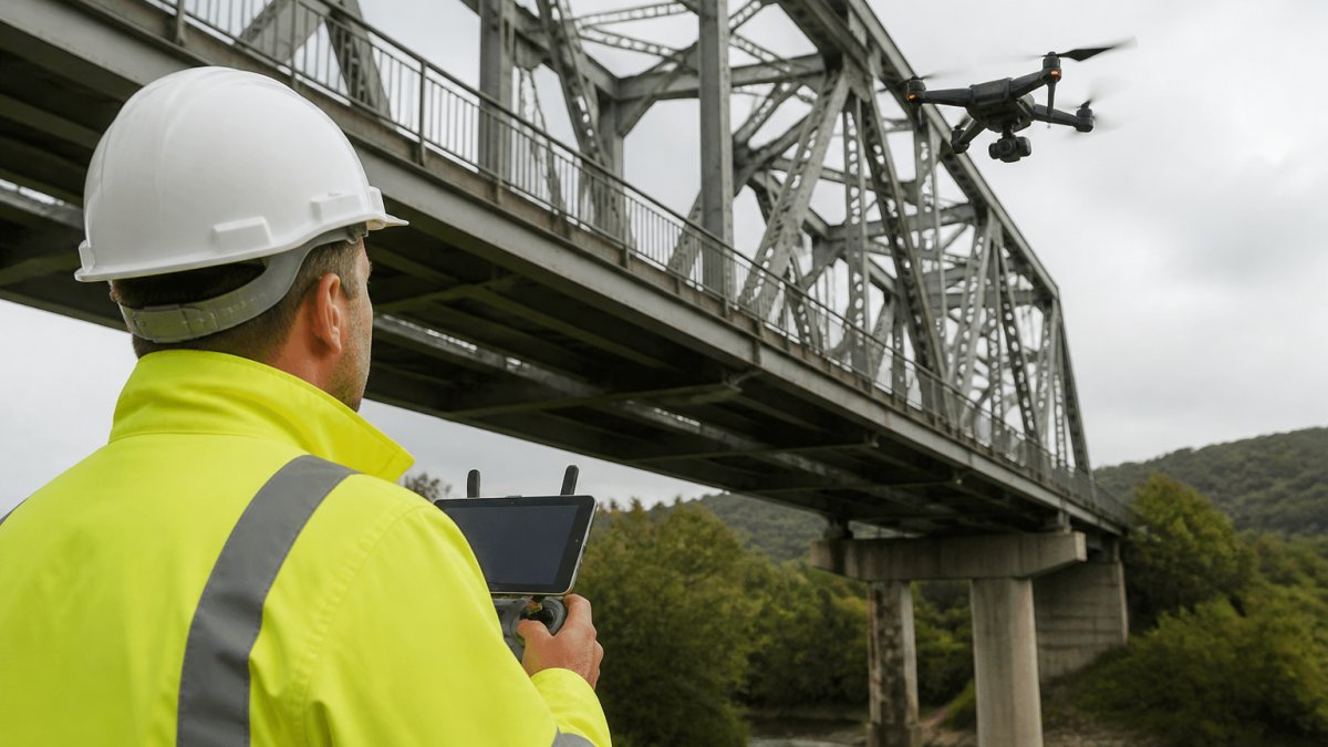
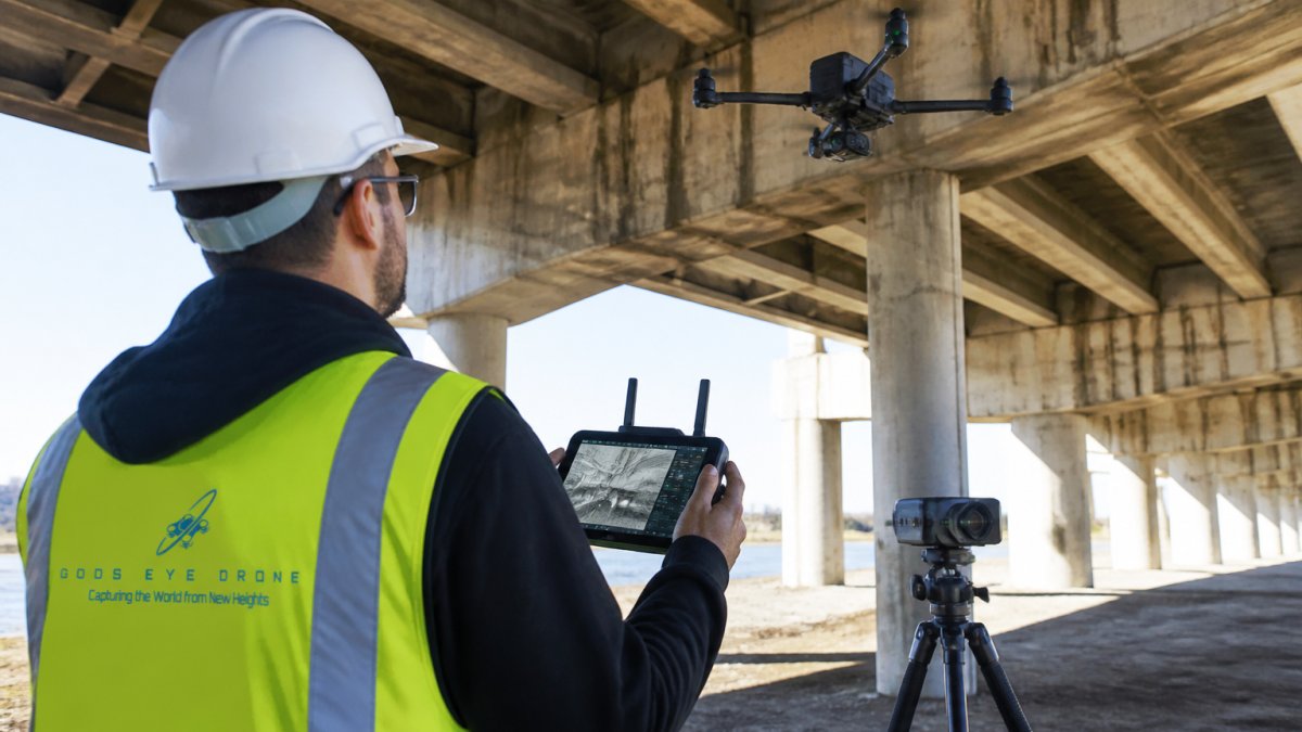
Drones with advanced sensor suites have revolutionized bridge inspection by eliminating traffic closures, expensive access equipment, and personnel working at height. A bridge inspection drone reaches every surface, undersides, expansion joints, cable anchorages, while crews stay safe on the ground.
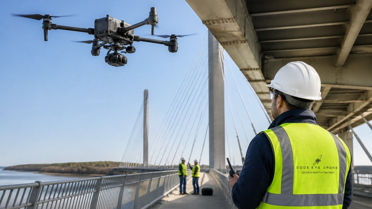
Modern bridge inspection drones carry high-resolution visual cameras for crack mapping, LiDAR for dimensional accuracy, thermal cameras for moisture detection, and sometimes ground-penetrating radar for subsurface assessment. This sensor fusion means a single flight captures data that would take weeks traditionally, while autonomous navigation on programmed routes ensures consistent, repeatable baselines.
Traditional bridge inspections require lane closures, traffic control, equipment rental, and crews under time pressure. Drone-based assessment eliminates most of these costs while improving data quality and safety: inspectors review imagery and sensor data from an office, and engineers get complete 3D models and thermal maps instead of written reports and sketches.
Regulatory acceptance has accelerated, with transportation departments increasingly recognizing drone inspection as equivalent or superior for condition assessment. The data is more complete, the timeline faster, and the safety profile better, giving owners better information, faster decisions, and lower risk.
Structural Health Monitoring Sensors: Real-Time Asset Condition Tracking
Structural health monitoring sensors embedded or mounted on bridges, buildings, and critical assets provide continuous condition data rather than periodic snapshots. They track stress, vibration, temperature, humidity, and deformation over weeks, months, or years, revealing how assets respond to environmental loading and identifying degradation trends before failure.
Wireless sensor networks transmit data to a central system where machine learning detects anomalies: vibration changes might indicate loose bolts or developing cracks, temperature and humidity trends reveal moisture intrusion, and stress measurements show load distribution. This enables predictive maintenance, scheduling repairs as problems emerge rather than after failures.
The advantage is profound: fewer catastrophic failures, longer asset life, and data-driven maintenance budgets. Instead of inspecting on a fixed schedule regardless of condition, you inspect when sensors indicate problems, shifting management from reactive to predictive.
Challenges include sensor deployment logistics, wireless reliability in complex structures, data management at scale, and expertise to interpret continuous data streams. Initial costs are significant, but for critical assets where failure carries high consequence, major bridges, tall buildings, dams, the return on investment justifies the expense.
Sensor Fusion and Data Integration in Modern Inspection Workflows
The most effective inspection programs combine multiple sensor modalities through sensor fusion, integrating and cross-validating data from different technologies for a more complete assessment than any single sensor provides. Fusion only pays off when you understand what each modality contributes and where each fails. The comparison below is the framework most teams use to decide which sensors to fly together.
| Modality | Typical accuracy | Effective range | Resolution | Operating conditions | Key limitations | Best-fit assets |
|---|---|---|---|---|---|---|
| LiDAR | Millimeter to low-centimeter point spacing | Tens of meters per scan pass | Dense 3D point clouds | Daylight or dark; light rain; struggles with fog | Reflective and transparent surfaces scatter returns; dense vegetation degrades data | Bridges, facades, tunnels, topographic mapping |
| Radar / millimeter-wave | Centimeter-scale displacement and void detection | Penetrates shallow surfaces; meters of standoff | Lower than LiDAR; coarse geometry | Works through dust, smoke, some moisture | Lower resolution; interpretation requires expertise | Concrete decks, pavement layers, subsurface voids |
| Thermal / infrared | Detects temperature differentials, not dimensions | Line-of-sight, tens of meters | Moderate spatial resolution | Best during temperature swings (early morning, late afternoon) | Needs skilled interpretation; limited by low thermal contrast | Building envelopes, electrical systems, moisture intrusion, delamination |
| High-resolution visual | Sub-millimeter crack width at close range | Depends on standoff and lens | Very high 2D detail | Requires adequate lighting | No depth or subsurface data; occlusion from vegetation | Crack mapping, spalling, surface defects on any asset |
| Ground-penetrating radar | Centimeter-scale depth to rebar and voids | Up to roughly a meter in concrete, deeper in dry soil | Moderate | Dry surfaces preferred; moisture attenuates signal | Slower coverage; needs trained operators | Concrete structures, pavement, utility locating |
A practical workflow: a drone flight collects high-resolution visual imagery and LiDAR point clouds of a building facade. Visual data identifies cracks and spalling, LiDAR confirms dimensions and reveals subtle deformation, a thermal pass detects moisture behind the facade, and ground-penetrating radar shows subsurface voids and delamination. Software combines these into a unified 3D model with color-coded condition zones, letting engineers make maintenance decisions with high confidence.
Sensor fusion requires compatible data formats, synchronized timing, and software that overlays different data types. It's more complex than running individual sensors, but the payoff is reliability: when multiple independent sensors confirm a problem, confidence increases dramatically, and when they disagree, it signals further investigation is needed.
Data integration also enables machine learning. Algorithms trained on sensor readings paired with known outcomes recognize patterns experts might miss, predicting failures more accurately over time. Model quality depends on labeled ground truth, so teams that document confirmed defects during manual follow-up get far more from their fusion pipeline.
Selecting the Right Sensor Technology for Your Infrastructure Assets
Choosing sensor technology means matching inspection goals to sensor capabilities, considering asset type, environmental constraints, and budget. There is no universal best choice; the fastest way to narrow the field is to start from the asset, not the sensor.
Bridges. Dominant failure modes are fatigue cracking, steel corrosion, concrete delamination, and bearing or expansion joint degradation.
Roads and pavements. Surface distress, rutting, and subsurface voids drive sensor choice. Ground-penetrating radar is the workhorse for layer thickness and void detection, paired with high-resolution visual or LiDAR for surface profile and crack mapping.
Pipelines. External corrosion, coating damage, and third-party encroachment are the primary concerns. Visual and thermal sensors on drones or crawlers handle above-ground segments.
Buildings and facades. Water intrusion, spalling, and envelope failure recur. Thermal imaging paired with high-resolution visual imagery is standard, with LiDAR added when facade geometry or deformation matters.
Tunnels. Limited access and lighting make drone and robotic platforms essential. LiDAR for geometry and deformation, high-resolution visual for crack and spall mapping, and thermal for moisture and lining delamination form the core set.
Utilities and substations. Electrical faults, corrosion, and thermal overload drive selection. Infrared thermal imaging is the primary tool for energized equipment, with visual and sometimes ultraviolet imaging for corona and arcing detection. Continuous monitoring sensors are increasingly deployed at high-value substations.
Start with your inspection objective. Geometry and deformation mapping suggests LiDAR; moisture detection points to thermal imaging; electrical issues require infrared analysis; continuous monitoring demands embedded sensors and wireless networks; multiple objectives suggest sensor fusion.
Environmental constraints shape feasibility: LiDAR performs poorly in heavy rain or dense fog, thermal imaging requires temperature differentials, wireless networks need reliable signal paths through structural material, and drone operations depend on airspace regulations and weather minimums.
Budget encompasses equipment, training, data processing, and expertise. A high-end thermal camera costs less than a LiDAR system, but both cost more than standard photography. Drone operations require certification and insurance, and fusion platforms demand software licenses and skilled personnel.
Federal Highway Administration bridge inspection program guidance
Frequently Asked Questions
How does thermal imaging help with infrastructure inspections?
Thermal imaging detects temperature variations that indicate structural problems, moisture intrusion, electrical faults, or material degradation invisible to the naked eye. For bridges, buildings, and utility infrastructure, thermal cameras reveal heat loss patterns, corrosion hotspots, and equipment failures before they become critical. This non-destructive assessment reduces inspection time and identifies maintenance needs with precision.
When should inspectors use LiDAR instead of visual imaging?
LiDAR excels when you need precise 3D measurements, operate in low-light conditions, or require millimeter-level accuracy for structural analysis. Unlike visual imaging, LiDAR penetrates vegetation, captures dense point clouds for volumetric calculations, and works in darkness or fog. Use LiDAR for bridge clearance verification, slope stability assessment, and detailed condition mapping where dimensional accuracy is critical.
What sensors can detect structural damage?
Multiple sensor types detect different damage signatures: thermal imaging reveals moisture and material degradation, ultrasonic sensors measure concrete thickness and detect voids, radar penetrates surfaces to find subsurface corrosion, and visual high-resolution imaging captures cracks and spalling. Structural health monitoring sensors use accelerometers and strain gauges for real-time movement and stress detection. Combining these modalities provides comprehensive damage assessment.
How are drones used to inspect infrastructure?
Drones equipped with advanced sensor suites, LiDAR, thermal cameras, high-resolution imaging, and radar, access hard-to-reach infrastructure safely and cost-effectively. They perform autonomous flight paths for consistent coverage, collect data in real-time, and generate 3D models and thermal maps for analysis. Drones eliminate manual climbing, reduce inspection duration, and enable frequent monitoring of bridges, power lines, roofs, and cellular towers without service interruptions.