 listicle
Drone Data Processing Software for Infrastructure Inspection
Table of Contents
- Why Drone Data Processing Software Matters for Infrastructure
- Drone Photogrammetry Software for Infrastructure: The Foundation
- Top Drone Data Processing Platforms for Infrastructure Teams
- Pix4Dmapper: Professional Photogrammetry Standard
- DroneDeploy: Cloud-Based Automation and Collaboration
- Agisoft Metashape Professional: Granular Control and Flexibility
- RealityCapture: Fast Processing for Large Datasets
- Bentley ContextCapture: Enterprise Reality Modeling
- SkyeBrowse: Videogrammetry for Speed
- Drone Data Analysis Best Practices for Infrastructure Inspection
- Drone Inspection Reporting Tools and Workflows
- ROI and Cost-Benefit Analysis for Small Teams
- Hardware-Software Compatibility and Real-World Deployment
- Frequently Asked Questions
Last Updated: August 26, 2026
Why Drone Data Processing Software Matters for Infrastructure
Infrastructure managers face a critical challenge: inspecting assets efficiently without sending crews into hazardous conditions. Drone data processing software transforms raw aerial imagery into actionable intelligence, 3D models, thermal anomaly maps, and compliance-ready reports. The difference between a successful inspection program and a failed one often comes down to how well you process the data your drone captures.
At Gods Eye Drone, we provide high-quality aerial photography, videography, and specialized inspection services. The teams that win aren't the ones with the newest drones, they're the ones with solid workflows: automated flight planning, high-quality data capture, and processing software that turns hours of footage into deliverables in minutes instead of days. A bridge inspection that misses a critical defect is a liability. A thermal survey that fails to identify a failing component can lead to downtime or worse. The software you choose determines whether you catch what matters and whether you can prove you did.
Drone Photogrammetry Software for Infrastructure: The Foundation
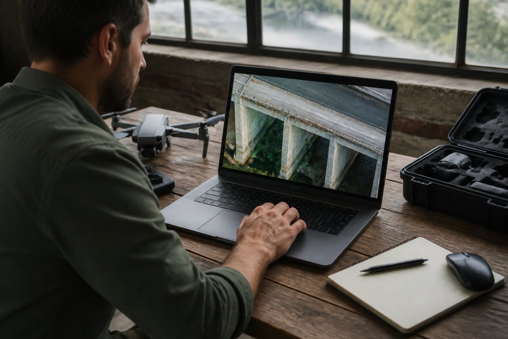
Photogrammetry reconstructs 3D geometry from overlapping still images. Your drone captures hundreds or thousands of photos from different angles, and photogrammetry software stitches them into a unified 3D model, orthomosaic map, or point cloud. For most infrastructure inspection tasks, photogrammetry delivers the detail you need at a fraction of the cost of LiDAR.
Photogrammetry vs. LiDAR Processing
Photogrammetry captures color and texture alongside geometry, making it ideal for visual defect detection. You can see surface cracks, corrosion, and paint deterioration in the resulting model. LiDAR measures pure distance and excels in dense vegetation or shadows, but ignores color entirely. For bridge inspections, building facades, or roof assessments, photogrammetry typically wins because you need to SEE the problem. LiDAR hardware costs $50,000 to $150,000 for drone-mounted systems (faa.gov). For infrastructure teams on tight budgets, start with photogrammetry and invest in LiDAR only if you've identified specific use cases where it solves a problem your current workflow can't handle.
3D Modeling and Digital Twin Generation
A digital twin is a virtual replica of a real-world asset accurate enough to measure, analyze, and track changes over time. The best infrastructure teams fly the same asset quarterly or annually, processing each survey into a 3D model, and comparing models over time. Cracks grow. Corrosion spreads. Settlements shift. When you have a historical record of 3D models, you can quantify degradation and predict maintenance needs before failure occurs.
This requires processing software that exports in standard formats: LAZ point clouds, OBJ or FBX meshes, GeoTIFF orthomosaics. Gods Eye Drone integrates drone capture with processing workflows that deliver these formats, enabling teams to build asset libraries and track condition over time.
Top Drone Data Processing Platforms for Infrastructure Teams
Your choice depends on your team size, budget, hardware compatibility, and whether you prioritize speed, accuracy, or integration with existing systems.
Pix4Dmapper: Professional Photogrammetry Standard
Pix4Dmapper is the industry standard for professional photogrammetry. It processes images into 2D orthomosaics, 3D point clouds, and textured meshes with survey-grade accuracy when you use ground control points properly.
Pix4Dmapper subscriptions run roughly $3,990 per year (pix4d.com). The learning curve is steep, and desktop processing requires a powerful workstation (16GB+ RAM, modern GPU). Cloud processing adds additional expense.
Best for: Professional surveyors, GIS teams, and organizations that need high-accuracy 2D maps and 3D models and have the budget and expertise to maintain the software.
DroneDeploy: Cloud-Based Automation and Collaboration
DroneDeploy automates workflows: plan flights in the app, fly with a DJI drone, and the platform automatically uploads and processes imagery in the cloud. Results appear as 2D maps and 3D models within hours. The interface is intuitive, and collaboration features let multiple team members view, annotate, and share results from anywhere.
DroneDeploy is built for DJI drones. Processing times vary without SLA guarantees, and per-seat pricing adds up quickly for larger teams. Individual plans start at $329 per seat per month when billed annually, or $4,188 per year.
Best for: Construction firms and agriculture operations that fly DJI drones regularly and need fast, collaborative cloud workflows.
Agisoft Metashape Professional: Granular Control and Flexibility
Agisoft Metashape Professional is a perpetual-license desktop software ($3,370 - $3,499 one-time purchase) that gives you complete control over the photogrammetry pipeline. It runs on Windows, Mac, or Linux and handles any drone or camera system. The Python scripting interface lets advanced users automate workflows and batch-process multiple projects.
There's no cloud option and no integrated collaboration platform. You process locally and manage files yourself.
Best for: GIS professionals, surveyors, and organizations that process high volumes of imagery and prefer perpetual licenses over subscriptions.
RealityCapture: Fast Processing for Large Datasets
RealityCapture specializes in speed, generating high-detail triangle meshes faster than most competitors. The software is free for individuals and small businesses (under $1 million annual revenue) and costs $1,250 per seat annually for larger organizations.
RealityCapture is primarily a mesh-generation tool. If you need precise orthomosaics or point clouds, other software may be better suited.
Best for: Individuals, hobbyists, small businesses, and larger organizations that need fast 3D mesh generation from large datasets.
Bentley ContextCapture: Enterprise Reality Modeling
Bentley ContextCapture is purpose-built for large-scale infrastructure projects, city-scale 3D models, and highway corridors. It automates aerotriangulation and generates clean, detailed reality meshes from massive aerial photography datasets. The software integrates deeply with Bentley's ecosystem and the iTwin cloud platform.
Licensing typically runs $3,200 to $6,500 for a 12-month subscription license, with additional cloud infrastructure costs. For small teams, this can be prohibitive.
Best for: Departments of Transportation, large engineering firms, and organizations already embedded in the Bentley ecosystem.
SkyeBrowse: Videogrammetry for Speed
SkyeBrowse converts video into 3D models using patented videogrammetry. A 90-second video clip becomes a processed 3D model in minutes. You can capture video from any camera, drones, smartphones, or 360 cameras. Accuracy varies by tier (0.1 inches to 2-6 inches), and the software isn't designed for survey-grade precision work.
SkyeBrowse offers a freemium plan, a pay-per-model option starting at $3 per model, and subscription plans. The Lite plan starts at $59 per month when billed month-to-month, or $468 per year when billed annually. For enterprise or public-sector clients, pricing is customized.
Best for: Public safety, emergency response, construction site documentation, and operational teams that prioritize speed over survey-grade accuracy.
Drone Data Analysis Best Practices for Infrastructure Inspection
Processing software is only one part of the workflow. How you capture data, manage accuracy, detect anomalies, and secure information determines whether your inspections deliver real value.
Flight Planning and Data Capture Quality
The quality of your final model depends entirely on the quality of your input imagery. Professional flight planning uses automated mission software that calculates optimal altitude, speed, and overlap based on your desired ground resolution. The goal is 70-80% forward overlap and 50-60% side overlap, standard for photogrammetry (peer-reviewed research).
Timing matters too. Fly during golden hour (early morning or late afternoon) to avoid harsh shadows. Wind is your enemy, even light wind causes camera shake. Fly when winds are under 10 mph. For thermal imaging, plan flights during calm conditions when air movement doesn't artificially cool surfaces.
Ground Control Points and Accuracy Benchmarks
A ground control point (GCP) is a marked location on the ground with known GPS coordinates. When you include GCPs in your photogrammetry processing, the software anchors the 3D model to real-world coordinates. Without GCPs, your model is geometrically accurate but geographically floating.
For infrastructure inspection, GCPs are essential if you're building a digital twin or comparing models over time. With 4-6 well-distributed GCPs and survey-grade GPS, you can achieve centimeter-level accuracy. Without GCPs, accuracy drops to meters. For visual defect detection, meter-level accuracy is fine. For structural measurements or settlement monitoring, centimeter-level accuracy is required.
Thermal Imaging and Anomaly Detection
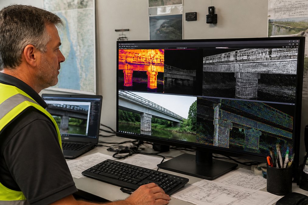
Thermal imaging captures infrared radiation, revealing temperature variations invisible to the human eye. For infrastructure, thermal imaging identifies electrical faults, water infiltration, missing insulation, and equipment degradation. Modern processing software overlays thermal data onto 3D models, creating a georeferenced thermal map.
Thermal accuracy depends on emissivity, ambient temperature, and camera calibration. Shiny surfaces are difficult to measure accurately. Matte surfaces are easier. For equipment monitoring, anomalies are usually 5-20 degrees above ambient, so detection is straightforward.
Data Security and Cybersecurity Protocols
Infrastructure inspection data is sensitive. Establish clear protocols: encrypted storage, access controls, audit trails. Verify cloud processing platforms' security certifications (SOC 2, ISO 27001). For sensitive government or critical infrastructure projects, on-premises processing may be required. Define data retention periods and deletion procedures, and comply with relevant regulations.
Drone Inspection Reporting Tools and Workflows
Raw 3D models and thermal maps need to be converted into compliance-ready documentation.
Post-Processing Automation vs. Manual Review
Post-processing automation uses AI and machine learning to detect defects automatically. Crack detection algorithms identify fractures in concrete. Corrosion detection flags rust and deterioration. For teams processing dozens of inspections monthly, automation saves significant time.
A responsible workflow combines automation with human review. Run automated detection, then have an experienced inspector review flagged items. For critical infrastructure (bridges, dams, power generation), manual review by qualified engineers is standard practice. For routine asset monitoring, automation alone may be sufficient.
GIS Integration and CAD Export
Infrastructure teams often manage assets through GIS systems (ArcGIS, QGIS) or CAD platforms (AutoCAD, Civil 3D). Ensure your processing software exports in standard formats: GeoTIFF orthomosaics, LAZ point clouds, SHP shapefiles, DWG CAD files. Gods Eye Drone delivers processed data in formats compatible with standard GIS and CAD workflows, enabling teams to integrate drone intelligence into existing asset management systems.
Compliance Reporting and Documentation
Infrastructure inspections often require formal documentation for compliance, insurance, or regulatory purposes. Professional reporting tools generate these documents automatically, with timestamps, GPS coordinates, thermal data, and annotated imagery. Standardized reporting formats make it easy to share findings with stakeholders and ensure accountability.
ROI and Cost-Benefit Analysis for Small Teams
A traditional bridge inspection requires traffic control, equipment rentals, and specialized personnel, often $10,000 to $50,000 per inspection. A drone inspection costs a fraction of that and produces more detailed data. Pricing depends on quantity, dates, and delivery. For current prices or a quote, please visit our website. For a team doing 10 inspections annually, drone services can offer significant value.
The ROI isn't just financial. It's safety, reducing crew exposure to hazardous conditions. It's speed, completing inspections in hours instead of days. It's documentation, building a permanent record of asset condition for future reference.
Hardware-Software Compatibility and Real-World Deployment
Not all processing software works with all drones. DJI drones are ubiquitous and compatible with most platforms. Enterprise drones (Freefly, Auterion) require specialized software. Before investing in processing software, verify it supports your drone platform.
Consider your team's technical capacity too. Cloud-based platforms require minimal IT overhead. Desktop software requires workstation management and maintenance. For small teams with limited IT resources, cloud platforms reduce friction. Gods Eye Drone operates certified platforms with proven compatibility, ensuring seamless integration from capture to processing.
Choosing the right drone data processing software for infrastructure inspection means matching your workflow to your team's capabilities and budget. Cloud platforms prioritize speed and collaboration. Desktop software offers control and flexibility. Specialized tools excel at specific use cases.
At Gods Eye Drone, we pair professional-grade drone capture with processing workflows that deliver the intelligence your infrastructure management program needs. Our certified pilots, state-of-the-art FLIR equipment, and integration with industry-standard processing platforms ensure that your inspection data becomes actionable intelligence. Whether you're managing bridges, electrical systems, or critical assets, we're equipped to deliver precise aerial inspections with the documentation and accuracy your projects require. Book Now to discuss your inspection needs.
=== FAQ ANSWERS (audit these too, same rules) ===
[1] Q: What is the best drone data processing software for infrastructure inspection? A: The best choice depends on your team's needs. Pix4Dmapper offers industry-standard photogrammetry accuracy for surveyors and GIS specialists. DroneDeploy provides cloud-based automation ideal for teams managing recurring inspections. Agisoft Metashape Professional suits organizations needing granular control over processing parameters. For speed, SkyeBrowse converts video into 3D models in minutes. Bentley ContextCapture excels at enterprise-scale digital twin generation. Evaluate based on your accuracy requirements, hardware capacity, team size, and integration needs with existing CAD or GIS workflows.
[2] Q: How does drone data processing software improve infrastructure inspection accuracy? A: Drone data processing software transforms raw aerial imagery into georeferenced 3D models, orthomosaics, and point clouds with measurable precision. Ground control points (GCPs) establish survey-grade accuracy, typically within inches when properly deployed. Automated photogrammetry eliminates manual measurement errors and creates repeatable baselines for tracking structural changes over time. Thermal imaging integration detects anomalies invisible to standard cameras. The software's ability to process hundreds of images consistently produces more reliable data than manual inspection alone, reducing inspector bias and enabling quantified comparisons across inspection cycles.
[3] Q: Should I use cloud-based or desktop-based drone processing software? A: Cloud-based platforms like DroneDeploy eliminate local hardware investment, enable team collaboration, and provide automatic backups. Processing times vary, but data stays secure in the cloud. Desktop software like Agisoft Metashape and RealityCapture gives you full control, faster local processing on powerful machines, and no dependency on internet connectivity. For infrastructure teams with strict data security requirements, desktop processing may be preferable. For distributed teams needing rapid turnaround and minimal hardware setup, cloud platforms offer efficiency. Many organizations use both: cloud for standard workflows, desktop for sensitive or highly complex projects requiring granular control.
[4] Q: What features should I prioritize when choosing drone inspection reporting tools? A: Prioritize tools that automate report generation, integrate with your existing GIS or CAD software, and support compliance documentation requirements specific to your industry. Look for geotagging and metadata management to maintain spatial accuracy. Post-processing automation saves time on routine inspections; manual review options are essential for anomaly detection and thermal analysis. Cloud storage with unlimited data retention can be a valuable feature. Integration with platforms like Procore or Autodesk can streamline construction workflows. For search and rescue or emergency response, real-time analytics and rapid export capabilities are critical. Verify the software supports your drone hardware and sensor types, including thermal imaging if needed.
Frequently Asked Questions
Q: What is the best drone data processing software for infrastructure inspection?
A: The best choice depends on your team's needs. Pix4Dmapper offers industry-standard photogrammetry accuracy for surveyors and GIS specialists. DroneDeploy provides cloud-based automation ideal for teams managing recurring inspections. Agisoft Metashape Professional suits organizations needing granular control over processing parameters. For speed, SkyeBrowse converts video into 3D models in minutes. Bentley ContextCapture excels at enterprise-scale digital twin generation. Evaluate based on your accuracy requirements, hardware capacity, team size, and integration needs with existing CAD or GIS workflows.
Q: How does drone data processing software improve infrastructure inspection accuracy?
A: Drone data processing software transforms raw aerial imagery into georeferenced 3D models, orthomosaics, and point clouds with measurable precision. Ground control points (GCPs) establish survey-grade accuracy, typically within inches when properly deployed. Automated photogrammetry eliminates manual measurement errors and creates repeatable baselines for tracking structural changes over time. Thermal imaging integration detects anomalies invisible to standard cameras. The software's ability to process hundreds of images consistently produces more reliable data than manual inspection alone, reducing inspector bias and enabling quantified comparisons across inspection cycles.
Q: Should I use cloud-based or desktop-based drone processing software?
A: Cloud-based platforms like DroneDeploy eliminate local hardware investment, enable team collaboration, and provide automatic backups. Processing times vary, but data stays secure in the cloud. Desktop software like Agisoft Metashape and RealityCapture gives you full control, faster local processing on powerful machines, and no dependency on internet connectivity. For infrastructure teams with strict data security requirements, desktop processing may be preferable. For distributed teams needing rapid turnaround and minimal hardware setup, cloud platforms offer efficiency. Many organizations use both: cloud for standard workflows, desktop for sensitive or highly complex projects requiring granular control.
Q: What features should I prioritize when choosing drone inspection reporting tools?
A: Prioritize tools that automate report generation, integrate with your existing GIS or CAD software, and support compliance documentation requirements specific to your industry. Look for geotagging and metadata management to maintain spatial accuracy. Post-processing automation saves time on routine inspections; manual review options are essential for anomaly detection and thermal analysis. Cloud storage with unlimited data retention can be a valuable feature. Integration with platforms like Procore or Autodesk can streamline construction workflows. For search and rescue or emergency response, real-time analytics and rapid export capabilities are critical. Verify the software supports your drone hardware and sensor types, including thermal imaging if needed.
This article was written using GrandRanker