 ultimate-guide
LiDAR Sensor Integration for Environmental Monitoring
Table of Contents
- What LiDAR Sensor Integration Means for Environmental Monitoring
- LiDAR Drone Mapping for Environmental Assessment
- LiDAR and Multispectral Sensor Fusion
- LiDAR Point Cloud Analysis Techniques
- Atmospheric Monitoring and Remote Sensing Applications
- Hardware Selection and Integration Criteria
- Regulatory and Ethical Considerations
- Frequently Asked Questions
Last Updated: September 29, 2026
What LiDAR Sensor Integration Means for Environmental Monitoring
LiDAR sensor integration for environmental monitoring represents a fundamental shift in how we collect and analyze geospatial data about landscapes, ecosystems, and atmospheric conditions. At Gods Eye Drone, we utilize state-of-the-art technology to help environmental professionals, conservation teams, and infrastructure managers capture precise 3D information.
The core principle is straightforward: LiDAR emits laser pulses and measures the time it takes for them to reflect back from objects on the ground. This creates a point cloud, a massive dataset of individual 3D coordinates that reveals terrain, vegetation structure, and built features with remarkable accuracy. When properly integrated with other sensors and data sources, LiDAR becomes a powerful tool for environmental assessment, ecosystem mapping, and long-term monitoring of landscape changes.
What makes LiDAR sensor integration particularly valuable is its ability to penetrate vegetation. Unlike passive optical sensors, LiDAR can measure ground elevation beneath dense forest canopy, detect subtle topographic variations, and quantify vegetation height and biomass. This capability transforms how environmental professionals approach everything from wetland dynamics assessment to coastal erosion monitoring.
LiDAR Drone Mapping for Environmental Assessment
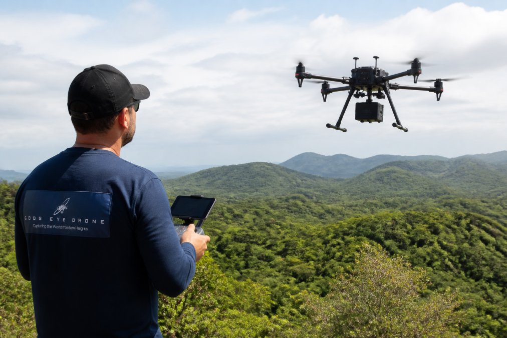
Drone-mounted LiDAR systems have democratized access to high-resolution geospatial data. A single flight can capture millions of data points across hundreds of acres, generating detailed digital representations of complex terrain in hours rather than days.
How Point Cloud Data Reveals Terrain and Vegetation Structure
A point cloud is fundamentally a collection of individual 3D measurements, each tagged with X, Y, and Z coordinates. When you have millions of these points captured from a single flight, they create a three-dimensional map of everything the laser struck, ground, trees, buildings, power lines, and water surfaces.
The real power emerges when you classify these points. Environmental analysts separate ground returns from vegetation returns, isolate individual tree crowns, measure canopy height, and calculate biomass estimates. This classification process requires careful attention to altitude, pulse intensity, and return timing. A skilled analyst can determine that a point represents the forest floor versus the top of a 120-foot oak, and that distinction is critical for conservation planning.
Terrain analysis becomes far more sophisticated with LiDAR data. Traditional elevation maps from older surveys often miss local variations, small valleys, ridge lines, and drainage patterns that matter enormously for hydrology and ecosystem function. LiDAR captures these features with spatial resolution often better than one meter, enabling detailed topographic surveying that supports everything from flood modeling to wildlife habitat assessment.
Applications in Ecosystem Mapping and Wetland Dynamics
Wetlands present a classic use case for LiDAR sensor integration. These ecosystems are difficult to access on foot, water levels fluctuate seasonally, and vegetation changes rapidly. Repeated LiDAR surveys over months or years reveal how wetland dynamics unfold, where water levels rise and fall, which areas support dense vegetation growth, and how the landscape responds to drought or heavy precipitation.
Environmental conservation teams use this data to track restoration progress, monitor invasive species encroachment, and understand how wetland structure supports wildlife. When you can measure vegetation height and density across an entire wetland in a single flight, you gain insights that would require months of ground surveys and sampling.
Coastal environments benefit similarly. LiDAR reveals beach profiles, dune structure, and vegetation patterns along shorelines. Repeated surveys document coastal erosion, identify areas vulnerable to storm surge, and track how human interventions like seawalls or dune restoration projects affect the broader coastal system. This temporal monitoring capability, the ability to fly the same area repeatedly and measure change, transforms how coastal managers approach environmental stewardship.
LiDAR and Multispectral Sensor Fusion
The most powerful environmental monitoring approaches combine LiDAR with multispectral imaging. LiDAR provides 3D structure; multispectral sensors capture spectral signatures that reveal vegetation health, water quality, and surface composition.
Why Combining Data Sources Improves Accuracy
Multispectral imaging captures reflected light across multiple wavelength bands, visible light, near-infrared, and sometimes shortwave infrared. These bands reveal information LiDAR cannot: vegetation vigor (through normalized difference vegetation index calculations), soil moisture patterns, and water quality indicators.
When you fuse these datasets, you answer more complete questions. LiDAR tells you there is a dense stand of trees; multispectral data tells you whether those trees are healthy or stressed. LiDAR reveals that a wetland has standing water; multispectral data indicates algae blooms or sediment load. This data fusion approach requires careful georeferencing, aligning both datasets to a common coordinate system, but the result is environmental intelligence that neither dataset alone could provide.
The integration also improves classification accuracy. Machine learning models trained on combined LiDAR and multispectral data achieve higher accuracy in land cover classification, vegetation type identification, and change detection than models relying on either dataset independently. This is particularly valuable when monitoring complex ecosystems with mixed vegetation types or when tracking subtle environmental changes over time.
LiDAR Point Cloud Analysis Techniques
Raw point cloud data is enormous, often gigabytes per flight, and requires systematic processing to become actionable environmental intelligence.
Georeferencing and 3D Modeling Workflows
The first step after data collection is georeferencing: aligning the point cloud to a known coordinate system. This requires precise positioning data from the drone's GPS and inertial measurement unit, combined with ground control points if maximum accuracy is required. Professional environmental monitoring often demands vertical accuracy within 10-15 centimeters, which requires careful attention to these georeferencing steps.
Once georeferenced, analysts apply classification algorithms that assign each point to a category, ground, low vegetation, high vegetation, building, or other features. This classification is where domain expertise becomes critical. An algorithm might flag all tall returns as "tree canopy," but a skilled analyst recognizes that some returns represent utility poles, dead snags, or measurement artifacts that should be handled differently.
Processing Data for Topographic Surveying and Biomass Estimation
Topographic surveying with LiDAR produces digital elevation models (DEMs) and digital surface models (DSMs). A DEM represents ground elevation; a DSM includes all surface features. The difference between them, the canopy height model, reveals vegetation structure. This is the foundation for biomass estimation: taller, denser vegetation generally contains more carbon and provides better habitat structure.
Biomass estimation models use LiDAR-derived metrics like canopy height, canopy density, and crown area, combined with field measurements from sample plots, to estimate total above-ground biomass across large areas. This capability is essential for carbon accounting, forestry management, and understanding ecosystem carbon storage. Environmental professionals use these estimates to track how land management practices affect carbon sequestration and to prioritize conservation areas based on their ecological value.
Atmospheric Monitoring and Remote Sensing Applications
Beyond ground-based environmental assessment, LiDAR excels at measuring atmospheric conditions through remote sensing techniques.
Using DIAL Technology for Air Quality Assessment
Differential absorption lidar (DIAL) is a specialized LiDAR application that measures atmospheric gases by comparing laser returns at two closely spaced wavelengths, one strongly absorbed by a target gas and one weakly absorbed. The difference in signal strength reveals gas concentration. This technique can measure ozone, nitrogen dioxide, sulfur dioxide, and other air pollutants with high spatial and temporal resolution.
DIAL systems mounted on aircraft or integrated with ground-based systems provide air quality data that complements traditional monitoring networks. They reveal pollution plumes from industrial sources, track how air quality varies with altitude, and measure how pollutant distribution changes throughout the day.
Hardware Selection and Integration Criteria
Choosing the right LiDAR system for environmental monitoring requires understanding trade-offs between competing specifications and practical constraints.
Payload Integration and Spatial Resolution Trade-offs
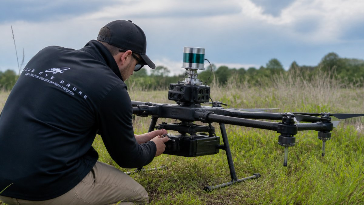
LiDAR sensors vary widely in weight, power consumption, scan rate, and measurement range. A lightweight system might weigh 500 grams and consume minimal power, but it may have lower pulse repetition rates and shorter range than heavier professional systems. For drone-based monitoring, weight directly affects flight time and operational cost, a lighter system means longer flights and lower per-acre costs.
Autonomous Navigation and Real-World Deployment
Modern environmental monitoring increasingly relies on autonomous flight planning. Rather than manually flying each survey line, operators define survey boundaries and desired point density, and the drone automatically plans an efficient flight path. This standardization improves data quality and repeatability, successive surveys follow identical paths, enabling precise change detection.
Regulatory and Ethical Considerations
Environmental monitoring with LiDAR raises important regulatory and ethical questions that practitioners must navigate carefully.
Frequently Asked Questions
How does LiDAR sensor integration improve environmental monitoring accuracy?
LiDAR sensor integration captures precise 3D geospatial data through point cloud technology, revealing terrain and vegetation structure with centimeter-level accuracy. When integrated with drone platforms, LiDAR enables temporal monitoring across large areas, allowing environmental professionals to track changes in ecosystems, measure canopy height, and estimate biomass. Unlike traditional photographic methods, LiDAR penetrates vegetation and operates effectively in various atmospheric conditions, making it ideal for mapping wetland dynamics, coastal erosion, and complex terrain that would be difficult to assess from ground-based surveys alone.
What types of environmental data can be captured through LiDAR integration?
LiDAR captures multiple data types: high-resolution point clouds for 3D terrain analysis, vegetation structure measurements for ecosystem mapping, atmospheric conditions through differential absorption lidar (DIAL), and temporal datasets for monitoring change over time. When fused with multispectral imaging, LiDAR provides both structural and spectral data, enabling applications like precision agriculture. This data fusion approach reveals information unavailable from either sensor alone, supporting comprehensive environmental assessment across diverse landscapes.
Can LiDAR and multispectral sensor fusion be deployed on drone platforms?
Yes. Modern drone platforms support payload integration of both LiDAR and multispectral sensors through careful weight and power management. Sensor fusion combines LiDAR's 3D structural data with multispectral imaging's spectral information, enabling orthomosaic generation, vegetation classification, and biomass estimation in a single flight. This integrated approach reduces operational costs compared to separate missions and improves data accuracy through georeferencing both datasets to a common coordinate system. Autonomous navigation systems allow these platforms to follow programmed flight paths while collecting synchronized data.
What are the main challenges in LiDAR point cloud analysis for environmental monitoring?
Key challenges include processing large point cloud datasets, removing noise and atmospheric artifacts, accurate georeferencing to ensure spatial alignment, and interpreting complex vegetation structures. Data processing workflows require specialized software and computational resources, particularly for real-time or near-real-time applications. Classification of point clouds to distinguish ground, vegetation, and other features demands careful algorithm selection. Environmental professionals often benefit from working with experienced data processing partners who understand the specific requirements of ecosystem mapping, topographic surveying, and conservation applications.