 comparison
VSI Aerial vs Extreme Aerial: Drone Comparison Guide
Table of Contents
- VSI Aerial vs Extreme Aerial: Service Overview and Key Differences
- FAA Part 107 Certified Drone Pilots: Compliance and Credentials
- Industrial Drone Inspection Services: Technical Capabilities
- Aerial Photography Drone Cost: Direct Cost-Benefit Analysis
- Drone Videography Services Comparison: Real Estate and Commercial Applications
- Workflow Integration and Project Management: Which Provider Scales Better
- VSI Aerial vs Extreme Aerial: Verdict and Recommendation Framework
- Frequently Asked Questions
VSI Aerial vs Extreme Aerial: Drone Comparison Guide
Last Updated: July 27, 2026
When evaluating professional drone services, understanding how VSI Aerial and Extreme Aerial compare becomes essential for informed decision-making. Both operate in the commercial drone market but differ significantly in operational scope, technical capabilities, and service specialization. Below, we examine the specific strengths and limitations of each provider to help you choose the right partner for aerial photography, inspection, or data collection needs.
VSI Aerial vs Extreme Aerial: Service Overview and Key Differences
VSI Aerial focuses on high-volume commercial operations emphasizing real estate photography and construction documentation. Extreme Aerial positions itself as a full-service provider offering specialized inspection services, including thermal imaging and infrastructure assessment. VSI Aerial operates a larger fleet optimized for speed and consistency, while Extreme Aerial emphasizes specialized equipment and advanced sensor payloads.
A real estate agent needing 20 property listings per month faces different constraints than a utility company conducting quarterly infrastructure inspections. The provider you select should align with your project frequency, complexity, and timeline requirements.
What Each Provider Specializes In
VSI Aerial has built its reputation on high-volume aerial photography for real estate marketing. Their workflow emphasizes rapid turnaround, most residential listings receive edited footage within 24-48 hours through standardized flight paths and template-based editing. They operate multiple teams across their service region, allowing simultaneous coverage of multiple properties.
Extreme Aerial specializes in industrial applications including thermal imaging for building envelope assessment, roof condition evaluation, and infrastructure inspection for utilities and municipalities. This specialization requires pilots with deeper technical training in thermal data interpretation and geospatial analysis. Their equipment includes thermal cameras, multispectral sensors, and software for processing complex datasets into actionable intelligence.
Scale of Operations and Fleet Capabilities
VSI Aerial maintains a larger operational footprint with multiple quadcopter platforms, primarily DJI-based systems optimized for consumer and prosumer-level applications. This scale creates efficiency through batch editing and consistent quality standards. However, scale also means less customization; their standard packages fit most projects but may not accommodate unusual requirements.
Extreme Aerial operates a smaller, more specialized fleet focused on equipment capability rather than unit volume. Their aircraft carry advanced sensor packages, thermal cameras, LiDAR, multispectral sensors, that cost significantly more than standard RGB imaging systems. A single Extreme Aerial flight might collect thermal, visual, and geospatial data simultaneously, whereas VSI Aerial would require separate missions for different data types.
If you need 50 properties photographed in a month, VSI Aerial's volume approach delivers better economics. If you need a single thermal assessment of a 200-unit apartment complex, Extreme Aerial's specialized equipment provides superior data quality and analysis depth.
FAA Part 107 Certified Drone Pilots: Compliance and Credentials
Both providers employ FAA Part 107 certified drone pilots, which is a baseline requirement for commercial operations in the United States. However, certification alone doesn't distinguish between providers, the depth of pilot training, experience with specific aircraft, and familiarity with specialized equipment varies considerably.
Certification Requirements and Safety Compliance
FAA Part 107 certification requires passing a written exam covering airspace rules, weather interpretation, emergency procedures, and operational limitations. The certification is valid for two years, after which pilots must renew through recurrent testing.
What the certification doesn't capture is hands-on experience. A pilot with 500 flight hours brings different capability than one with 50 hours, even if both hold current Part 107 credentials. VSI Aerial's high-volume model typically produces pilots with extensive flight time through dozens of similar missions monthly. Extreme Aerial's pilots develop deeper expertise in complex scenarios: flying in challenging weather, interpreting sensor data in real-time, and managing specialized equipment under demanding conditions.
According to FAA regulations on commercial drone operations, all commercial pilots must maintain visual line-of-sight, operate during daylight hours, and maintain altitude below 400 feet except in specific circumstances. Both providers operate within these constraints, but their application differs based on mission complexity.
Insurance and Liability Coverage Comparison
Professional operators carry general liability insurance covering bodily injury and property damage claims. VSI Aerial's high-volume real estate focus means their insurance reflects lower per-mission risk, resulting in competitive pricing. Extreme Aerial's specialized work, thermal assessment of high-rise buildings, utility infrastructure inspection, industrial facility documentation, carries higher liability exposure and typically includes higher coverage limits.
For critical infrastructure work or liability-sensitive applications, Extreme Aerial's deeper insurance structure provides better protection. For routine real estate photography, VSI Aerial's standard coverage typically suffices.
Industrial Drone Inspection Services: Technical Capabilities
The technical capabilities gap between these providers becomes most apparent in specialized inspection work, where equipment, pilot training, and data processing infrastructure matter most.
Thermal Imaging and Specialized Sensor Payloads
VSI Aerial offers basic thermal imaging through consumer-grade thermal cameras integrated into some aircraft. These systems provide visual thermal data identifying temperature variations across building facades or roof surfaces, adequate for identifying general problem areas but lacking precision for detailed engineering analysis.
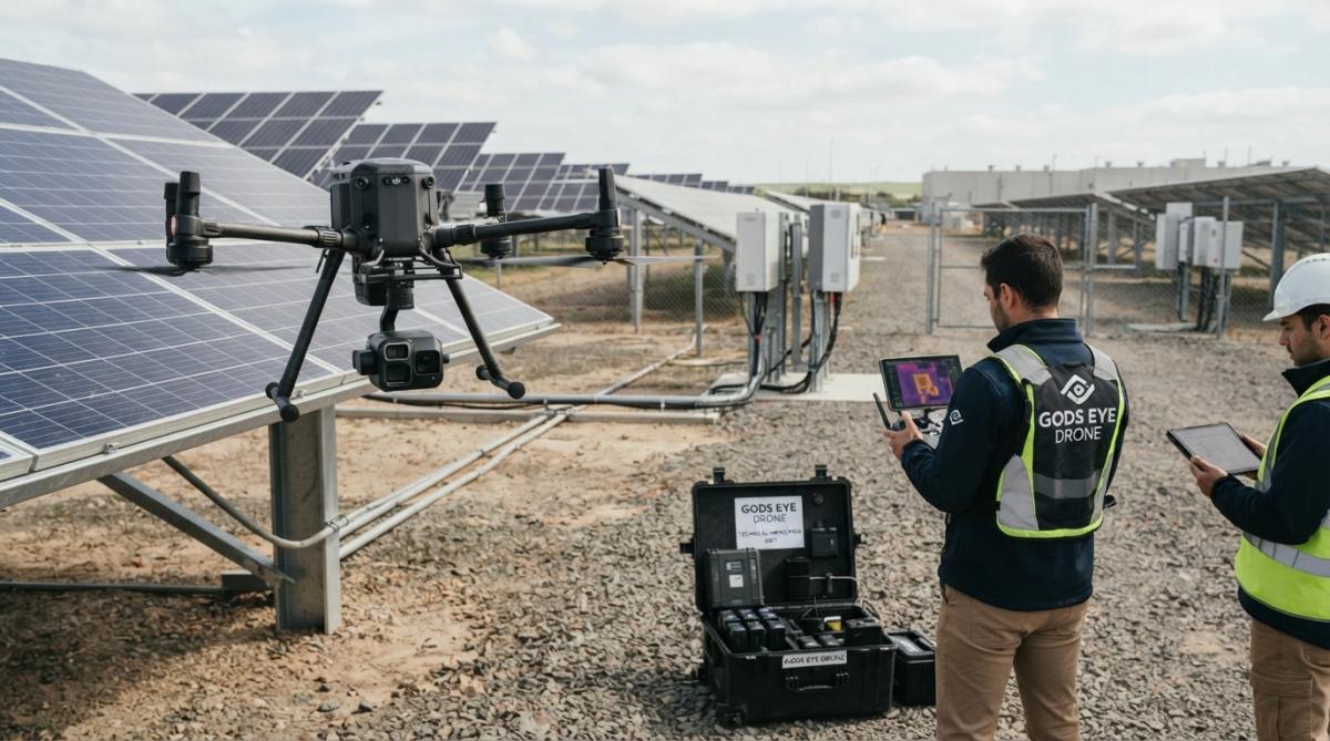
Extreme Aerial operates professional-grade thermal imaging systems with higher resolution sensors and radiometric capabilities. Their equipment can measure actual temperatures, not just relative variations, which is essential for building envelope assessment, electrical equipment diagnostics, and industrial process monitoring. A building manager investigating roof leaks needs consumer thermal imaging to see which areas retain moisture. An engineer evaluating an electrical substation's heat signature needs radiometric accuracy to determine if equipment operates within design parameters, only professional thermal systems provide this reliability.
Data Collection and Geospatial Analysis
VSI Aerial delivers edited video and still photography optimized for marketing purposes. Post-processing focuses on color correction, framing, and presentation quality.
Extreme Aerial collects raw data and processes it into actionable intelligence. Their flights generate point clouds, orthomosaics, thermal datasets, and geospatial analysis products that integrate into engineering workflows, GIS systems, and facility management platforms. The data they deliver answers specific questions: Is this roof degrading? Are these electrical connections overheating? What's the precise elevation change across this site?
For construction monitoring, VSI Aerial documents site progress weekly. For structural assessment or detailed site surveying, Extreme Aerial's geospatial capabilities provide the precision engineering requires.
Aerial Photography Drone Cost: Direct Cost-Benefit Analysis
Pricing for drone services varies dramatically based on scope, complexity, and deliverable type.
Pricing Models and Turnaround Time
VSI Aerial typically operates on per-property or per-hour pricing for real estate work. A single residential property costs between $150-300 for standard aerial photography with 2-4 edited video clips and 20-30 still images. This pricing reflects their high-volume model processing dozens of properties monthly using standardized workflows. Turnaround is rapid: 24-48 hours from flight to delivery.
Extreme Aerial's pricing reflects specialized work and custom deliverables. A thermal inspection of a commercial building might range from $800-2,500 depending on building size, thermal complexity, and analysis depth. Turnaround extends to 5-10 business days because data processing requires interpretation and report generation.
The cost difference reflects fundamentally different services. VSI Aerial sells speed and consistency at scale. Extreme Aerial sells expertise and specialized capability.
Value Proposition: What You Get for Your Investment
With VSI Aerial, you're investing in marketing presentation. Their deliverables make properties more appealing to buyers, which research suggests increases inquiry rates and reduces time-on-market.
With Extreme Aerial, you're investing in information that reduces uncertainty. Thermal imaging reveals building envelope problems before they become expensive repairs. Infrastructure inspection data informs maintenance prioritization. Geospatial analysis supports engineering decisions.
Drone Videography Services Comparison: Real Estate and Commercial Applications
Both providers offer drone videography, but their approaches and quality outputs differ significantly based on their operational focus.
Real Estate Marketing Footage Quality and Delivery
VSI Aerial specializes in real estate videography optimized for MLS listings and marketing websites. Their footage emphasizes property features through establishing shots, aerial transitions showing lot size and neighborhood context, and property-specific details. Video editing includes color grading, music selection, and pacing designed for quick consumption, with most deliverables running 60-120 seconds.
Extreme Aerial approaches videography as one component of comprehensive documentation. If filming a construction site, the video captures progress while documenting specific conditions relevant to project management or quality assurance. The editing prioritizes clarity and information over marketing appeal.
For real estate agents, VSI Aerial's marketing-focused approach delivers exactly what you need. For construction firms or facility managers, Extreme Aerial's documentation-focused approach provides better project records.
Construction Monitoring and Site Documentation
Construction monitoring requires consistent, comparable imagery over time from the same vantage points with consistent lighting and camera settings. VSI Aerial excels at this through standardized flight protocols. Weekly site documentation at the same time of day creates a visual record clearly showing progress.
Extreme Aerial adds analytical capability to construction monitoring. Beyond visual documentation, they generate orthomosaics showing precise site layouts, measure progress against design specifications, and create geospatial records that integrate with project management systems.
For residential construction, VSI Aerial's consistent visual documentation suffices. For commercial or infrastructure projects, Extreme Aerial's comprehensive geospatial documentation provides the precision that engineering and project management require.
Workflow Integration and Project Management: Which Provider Scales Better
How each provider integrates into your operational workflow significantly impacts the actual value you receive.
Booking, Communication, and Deliverable Timelines
VSI Aerial operates a simplified booking system optimized for high volume. Most real estate agents can schedule flights online, select their property from a map, and receive deliverables within 48 hours. Communication is efficient but minimal, optimized for speed rather than customization.
Extreme Aerial requires more direct communication. Project scope, specific deliverables, analysis requirements, and timeline constraints need discussion before work begins. This consultative approach ensures they understand your requirements and can scope work appropriately.
For high-frequency, routine work, VSI Aerial's automation scales better. For complex or specialized projects, Extreme Aerial's consultative approach prevents misalignment.
Raw Footage Processing and Post-Production Support
VSI Aerial handles all post-production internally, delivering fully edited, ready-to-use deliverables. Modifications, different music, adjusted pacing, or additional clips require revision requests.
Extreme Aerial provides raw data and processed deliverables depending on your requirements. If you need the raw thermal dataset for your own analysis, they can provide it. If you need a detailed engineering report interpreting the thermal data, they provide that instead.
For real estate agents, VSI Aerial's complete post-production service is convenient. For technical teams, Extreme Aerial's flexibility to deliver raw data or custom analysis products is more valuable.
| Aspect | VSI Aerial | Extreme Aerial | Winner for Your Use Case |
|---|---|---|---|
| Booking Speed | Automated, same-day | Consultative, 2-3 days | VSI for routine work |
| Turnaround | 24-48 hours | 5-10 business days | VSI for urgency |
| Post-Production | Fully edited | Raw data or custom reports | Extreme for analysis |
| Scalability | Excellent for volume | Better for complexity | VSI for 20+ monthly projects |
| Customization | Limited | Extensive | Extreme for unique needs |
VSI Aerial vs Extreme Aerial: Verdict and Recommendation Framework
Choosing between these providers requires honest assessment of your actual needs. Both are competent operators, but they serve different use cases.
Best Use Cases for Each Provider
Choose VSI Aerial if:
- You need routine aerial photography for real estate marketing
- You have 10+ monthly projects requiring consistent, fast turnaround
- Your primary need is visual presentation, not technical analysis
- Budget constraints favor the lower-cost option
- You prefer automated booking and minimal communication overhead
Choose Extreme Aerial if:
- You need specialized inspection services: thermal imaging, roof assessment, infrastructure evaluation
- Your projects require technical analysis and detailed reporting
- You need geospatial data for engineering or GIS applications
- You're willing to invest in higher-quality deliverables for mission-critical work
- Your projects are complex enough to benefit from pilot expertise in specialized equipment
How to Choose Based on Your Project Requirements
Start with this diagnostic: What problem are you solving? If you're solving a marketing problem, how do I make this property more appealing to buyers?, VSI Aerial is the right choice. If you're solving an information problem, what's the condition of this roof, is this equipment overheating, how has this site changed since last month?, Extreme Aerial is the right choice.
Next, assess your volume and budget. If you're a real estate agent with 15 monthly listings, VSI Aerial's per-property pricing and fast turnaround make economic sense. If you're a municipality conducting quarterly infrastructure assessments, Extreme Aerial's specialized capability justifies their higher per-project cost.
Finally, evaluate integration requirements. If you need finished marketing materials ready to upload, VSI Aerial delivers that. If you need raw data or custom analysis products that integrate into your technical workflows, Extreme Aerial provides that flexibility.
At Gods Eye Drone, we understand that the best drone service provider solves your specific problem efficiently. Whether you need high-volume real estate photography or specialized industrial inspection, the key is matching provider capability to your actual requirements rather than paying for capability you don't need or settling for capability that falls short.
Choosing the right drone service provider directly impacts your project outcomes and operational efficiency. If you're conducting routine real estate photography, VSI Aerial's speed and consistency deliver excellent value. If you need technical analysis, specialized equipment, or complex geospatial data, Extreme Aerial's expertise and equipment provide the precision your projects require. Gods Eye Drone combines high-volume capability with specialized inspection services, advanced FLIR thermal equipment, and FAA-certified pilots who understand both marketing applications and technical analysis requirements. Get started with Gods Eye Drone and gain the aerial intelligence and professional documentation your projects demand.
Frequently Asked Questions
Are VSI Aerial and Extreme Aerial both FAA Part 107 certified?
Both providers operate professional drone services and should maintain FAA Part 107 certification for their pilots, as this is mandatory for commercial drone operations in the United States. When evaluating either provider, always request proof of current certification and ask about their pilots' experience levels. Insurance coverage and liability limits also vary, confirm these details before booking, especially for critical infrastructure or high-value projects.
What's the typical turnaround time for aerial photography drone projects?
Turnaround depends on project scope, weather conditions, and post-production requirements. Most professional providers deliver raw or edited footage within 5-10 business days. However, rush jobs or complex editing may extend timelines. Ask your provider upfront about job turnaround time and whether weather delays affect your final delivery date or cost.
How much does aerial photography drone cost compare between VSI Aerial and Extreme Aerial?
Pricing varies significantly based on project scope, flight duration, imagery resolution, and deliverable format. Rather than comparing list prices, focus on value: what imagery resolution, editing, and data delivery you receive. Request detailed quotes from both providers that itemize costs for flight time, post-production, and any specialized services like thermal imaging or geospatial analysis.
Which provider is better for industrial drone inspection services?
Industrial inspections require thermal imaging, high-resolution cameras, and geospatial data collection. Compare each provider's sensor payloads, flight efficiency, and experience with your specific infrastructure type. Ask about their track record with similar projects and whether they can deliver orthomosaic or point cloud data for detailed analysis.
What should I do if weather cancels my scheduled drone videography services?
Professional providers have weather policies, some reschedule at no charge, others may charge a partial fee. Before booking, clarify the cancellation and rescheduling policy. Ask whether you pay if the pilot arrives but conditions are unsafe to fly, and how far in advance the provider will notify you of weather-related delays.
This article was written using GrandRanker