 listicle
Is Drone Photography Worth It for Selling a House?
Table of Contents
- Does Drone Photography Help Sell Homes Faster?
- Key Benefits of Aerial Photography for Home Listings
- Real Estate Drone Photography Pricing and ROI
- FAA Part 107 Requirements for Real Estate
- Property Types Where Drones Make the Biggest Impact
- Drone Photography vs. Traditional Real Estate Marketing
- Integration with 3D Virtual Tours and Digital Marketing
- Conclusion
- Frequently Asked Questions
Last Updated: August 31, 2026
Does Drone Photography Help Sell Homes Faster?
The real question isn't whether drone photography looks impressive, it does. It's whether it actually moves homes faster and attracts the right buyers. The answer depends on your property type, market position, and competitive landscape.
Aerial photography has become standard in competitive markets, but not all homes benefit equally. A modest suburban ranch and a sprawling estate have entirely different needs. The key is understanding when drone imagery creates genuine competitive advantage versus when it's just added expense.
At Gods Eye Drone, we've worked with real estate agents across multiple property types. The data is clear: drone photography matters most for homes where traditional ground-level photography can't tell the full story. If your listing has distinctive features, acreage, a pool, or architectural detail, aerial perspective changes how buyers perceive value. For standard suburban properties in dense neighborhoods, the ROI calculation shifts.
Key Benefits of Aerial Photography for Home Listings
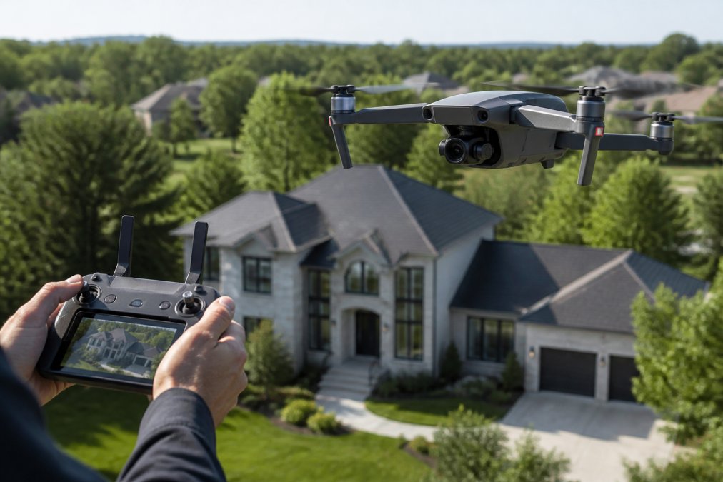
Aerial photography solves a specific problem: buyers can't see what they need to see from street level. Traditional photography shows the front of a house. Drone imagery shows the entire property in context.
Showcasing Property Boundaries and Neighborhood Context
Buyers need to understand what they're purchasing. For properties with acreage, distinctive setbacks, or significant land features, drone photography is essential communication. A five-acre property looks like a five-acre property when you can see the entire perimeter. Without aerial perspective, buyers rely on listing descriptions they often don't read carefully.
Neighborhood context matters too. Showing proximity to parks, schools, or commercial areas from above creates confidence in the location decision. This is particularly valuable in markets where location premium is high.
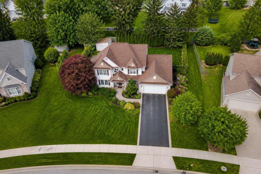
Attracting Qualified Buyers with Visual Storytelling
Qualified buyers respond to comprehensive visual presentation. When a listing includes multiple perspectives, including aerial shots, it signals serious marketing and attracts buyers ready to move forward, not casual browsers.
Cinematic drone video performs particularly well. A 60-90 second video showing the property's exterior, grounds, and surroundings creates narrative and emotional connection. Listing velocity correlates with comprehensive visual presentation. Homes with aerial photography and video tend to receive offers faster than comparable homes with traditional photography alone.
Real Estate Drone Photography Pricing and ROI
Understanding the cost-benefit of drone photography requires honest accounting. The service has a cost, and the question is whether that cost produces measurable return through faster sales, higher offers, or reduced time-on-market.
Professional vs. DIY Cost Comparison
Professional drone services like Gods Eye Drone include not just photography, but color correction, editing, and integration into your listing presentation. They handle FAA compliance and insurance.
DIY drone photography appeals to budget-conscious agents but carries hidden costs. A consumer drone requires training and practice to operate safely. Time spent learning equipment and editing footage is time not spent on other business activities. Inconsistent quality can actually hurt a listing's perceived value.
For most real estate professionals, professional drone services deliver better ROI.
When Drone Photography Delivers Maximum Value
Drone photography delivers maximum value for properties where it reveals something important that ground-level photography misses: large estates with distinctive grounds, waterfront properties where water access is a key selling point, homes with architectural features best understood from above, and properties in scenic locations where neighborhood context adds value.
Drone photography delivers minimal value for standard suburban homes in dense neighborhoods where every property looks similar from above. The money spent on professional drone imagery might be better invested in staging or professional ground-level photography.
Drone photography is a tool for specific situations, not a universal requirement. Using it where it matters creates competitive advantage.
FAA Part 107 Requirements for Real Estate
Operating a drone for commercial real estate photography is regulated by the Federal Aviation Administration under Part 107 of Title 14 of the Code of Federal Regulations. Understanding these requirements is essential because violations create legal and financial liability.
Core Part 107 Operating Requirements
Any person flying a drone for commercial purposes must hold an FAA Part 107 Remote Pilot Certificate (faa.gov). This requires passing the FAA Part 107 knowledge test, being at least 16 years old, passing a TSA background check, and maintaining the certificate through recurrent training every 24 months (faa.gov).
Once certified, Part 107 pilots must comply with specific operational rules:
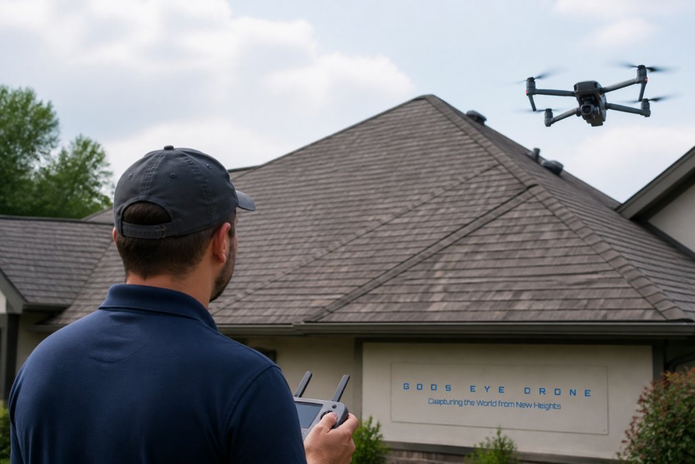
- Visual line of sight: The pilot must maintain direct, unaided visual contact with the aircraft at all times.
- Altitude restrictions: Drones cannot fly higher than 400 feet above ground level (faa.gov).
- Airspace compliance: Flights in controlled airspace require prior authorization from air traffic control.
- Daylight-only operations: Flights must occur during civil twilight.
- No flights over people or moving vehicles: Drones cannot fly directly over people not involved in the operation.
- Maximum speed: Drones cannot exceed 100 mph horizontal speed.
- Remote identification: All drones must broadcast remote identification information via radio or internet.
Airspace Restrictions for Real Estate Photography
Before any drone flight, the pilot must check airspace restrictions using the FAA's B4UFLY mobile app or online airspace map. Class B, C, D airspace around airports requires explicit authorization. Temporary flight restrictions can appear with little notice. Drone flights are prohibited in most national parks and many wildlife areas.
Liability and Enforcement
The FAA has significantly increased enforcement of Part 107 violations. Penalties include civil penalties up to $27,500, criminal penalties up to $250,000 in fines and imprisonment, and aircraft seizure. Liability extends beyond the pilot, property owners or real estate agents who knowingly hire uncertified operators may share liability.
Verifying Pilot Credentials
When hiring a drone service, verify credentials by requesting the Part 107 certificate, confirming commercial drone liability insurance, asking the pilot to confirm airspace checks, and requesting a written agreement specifying deliverables and compliance responsibilities.
DIY Operators and Legal Risk
A homeowner or real estate agent flying a consumer drone without Part 107 certification violates federal aviation regulations, even over private property. Violations can result in FAA enforcement action, fines, civil liability, insurance denial, and listing complications. The safest approach is hiring a certified professional with commercial insurance.
Property Types Where Drones Make the Biggest Impact
Luxury Homes and Large Estates
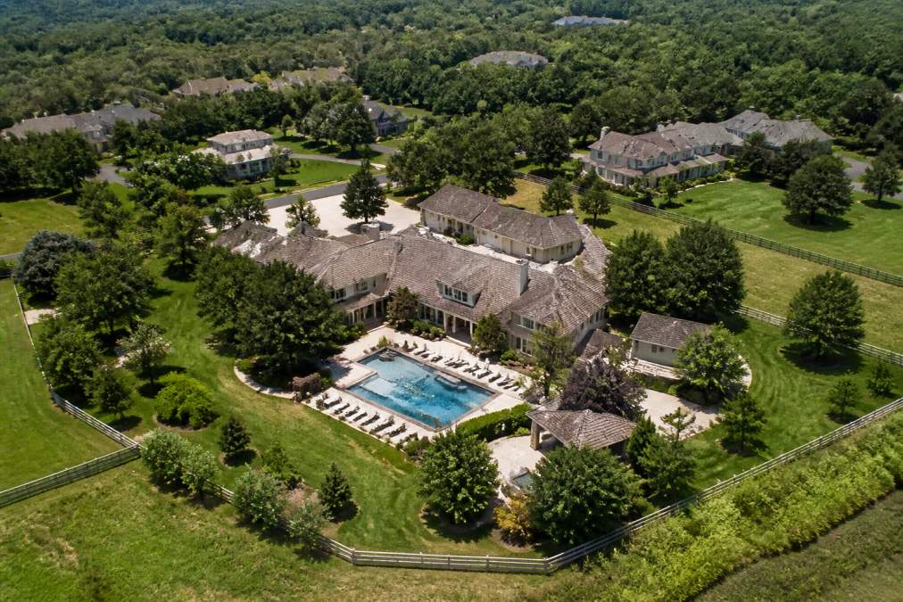
Luxury properties and large estates represent the strongest ROI case for drone photography. These properties have distinctive features, architectural detail, mature landscaping, acreage, and pools. Aerial perspective reveals the full scope of what buyers are purchasing.
For luxury estates, professional drone photography and video are expected marketing elements. Buyers at this price point expect comprehensive visual presentation. Better visual presentation attracts more qualified buyers, generates more offers, and typically results in higher sale prices.
Properties Where Drones Fall Short
Standard suburban homes in dense neighborhoods often don't benefit meaningfully from drone photography. When every property looks similar from above, aerial perspective doesn't differentiate. Ground-level features, condition, staging, and curb appeal matter more.
Urban townhomes and condos in high-rise areas may face airspace restrictions or neighborhood rules. Properties with minimal acreage and no distinctive features are poor candidates for drone photography.
Drone Photography vs. Traditional Real Estate Marketing
Traditional real estate marketing, ground-level photography, virtual tours, descriptions, remains the foundation of property listings. Drone photography is an addition to this foundation, not a replacement.
A well-marketed property includes professional ground-level photography, staging, virtual tour capability, and drone imagery where it adds value. Each element serves a purpose. For most properties, traditional photography is sufficient to attract qualified buyers. For properties where aerial perspective reveals important information, adding drone photography increases listing engagement and reduces time-on-market.
The decision should be based on what the property actually needs to communicate, not on what's trendy.
Integration with 3D Virtual Tours and Digital Marketing
Modern real estate marketing combines multiple visual formats. 3D virtual tours, 360-degree photography, drone video, and traditional photography each serve different purposes in the buyer journey.
Drone photography integrates well with 3D virtual tours. A virtual tour showing interior layout, combined with drone footage showing exterior and grounds, creates comprehensive visual presentation. Cinematic drone video performs particularly well on social media and listing platforms, generating more engagement than static images.
Integration with digital marketing means using drone imagery across multiple platforms: the MLS listing, the agent's website, social media, and email marketing. Gods Eye Drone provides not just aerial photography and videography, but integration support, delivering content optimized for different platforms.
Conclusion
Is drone photography worth it for selling a house? For large estates, luxury properties, waterfront homes, and properties with distinctive grounds or architectural features, professional drone photography delivers clear ROI. It communicates information that ground-level photography cannot and attracts qualified buyers.
For standard suburban homes where aerial perspective doesn't reveal anything meaningful, drone photography is added cost without corresponding benefit. The marketing budget is better spent elsewhere.
The decision should be based on honest assessment of whether your property's distinctive features are best understood from above. When you're ready to evaluate whether aerial photography is right for your property, Book Now with Gods Eye Drone. Our certified pilots will assess your property's specific characteristics and recommend whether drone photography will meaningfully improve your listing presentation. We handle FAA compliance, insurance, and professional editing, delivering market-ready content that communicates your property's true value.
Frequently Asked Questions
Q: Does drone photography actually help homes sell faster?
A: Drone photography increases listing engagement by showcasing property scale, landscape, and neighborhood context that ground-level photos cannot capture. Homes with aerial imagery attract qualified buyers more quickly because the visual storytelling demonstrates the full scope of the property. However, the impact depends on the property type, luxury homes and estates see the most dramatic effect on listing velocity, while smaller urban properties may see modest gains. The competitive advantage matters most in markets with high saturation where visual differentiation drives buyer interest.
Q: What are the FAA Part 107 requirements for real estate drone photography?
A: The FAA Part 107 regulations require that anyone flying a drone commercially must hold a Remote Pilot Certificate. This means your drone operator must pass the FAA knowledge test and maintain certification. Part 107 also mandates that flights stay below 400 feet, maintain visual line of sight, avoid flying over people or moving vehicles, and follow local airspace restrictions. Professional drone services handle these compliance requirements, but it's critical to verify your provider carries proper insurance and maintains current Part 107 certification. Non-compliance can result in significant fines.
Q: Is drone photography worth the cost for smaller homes or lower-priced properties?
A: For homes under $300,000 or smaller urban properties, drone photography may not justify the cost relative to the listing price. The ROI is strongest on properties where aerial perspective adds meaningful value, estates with acreage, waterfront homes, or properties with significant landscape features. Smaller homes in dense neighborhoods often benefit more from ground-level photography, 3D virtual tours, and detailed interior shots. Consider drone photography an investment when the property's unique features (pool, acreage, architectural design) warrant the additional marketing expense and when the listing price supports the cost.
Q: Should I hire a professional drone photographer or shoot aerial photos myself?
A: Professional drone photographers bring FAA Part 107 certification, insurance, liability coverage, and post-production expertise that DIY attempts cannot match. A certified pilot ensures compliance, reduces legal risk, and delivers high-resolution, professionally edited imagery optimized for real estate marketing. If you own a drone and want to experiment, you must obtain Part 107 certification before any commercial use. However, the cost and time investment in certification, equipment maintenance, and editing typically make professional services more cost-effective than in-house operations, especially for agents managing multiple listings monthly.
Q: How long does it take to receive final drone photography deliverables?
A: Professional drone services typically deliver final edited images and videos within 3-7 business days after the shoot, depending on the scope and editing requirements. Some providers offer rush turnaround for an additional fee. The timeline depends on weather conditions (which may require rescheduling), the number of shots requested, and the complexity of post-production editing. For agents on tight listing timelines, confirm turnaround expectations before booking and discuss rush options if your market demands quick deployment of marketing collateral.
This article was written using GrandRanker