 comparison
Drone vs Satellite Imagery for Crop Health: Full Comparison
Table of Contents
- Drone vs Satellite Imagery for Crop Health: The Key Differences
- Satellite vs Drone Data: Pros and Cons for Farm Management
- Multispectral Drone Mapping for Agriculture: What It Captures
- NDVI vs NDRE for Crop Health: Which Index Should You Use?
- Benefits of Drone Mapping for Small Farms and Large Operations
- Hybrid Workflows: Combining Satellite Scouting with Drone Follow-Up
- Cost, Scalability, and ROI: Choosing the Right Tool for Your Fields
- Conclusion: Making the Call Between Drones and Satellites
- Frequently Asked Questions
Last Updated: September 5, 2026
Choosing between drone and satellite imagery for crop health depends on field size, growth stages, and how quickly you need answers. It comes down to a trade-off: centimeter-level detail on your schedule versus broad, frequent coverage with no pilot or hardware. At Gods Eye Drone, we have spent years deploying multispectral sensors over working farms, and the honest answer is that most operations benefit from both, but for different jobs.
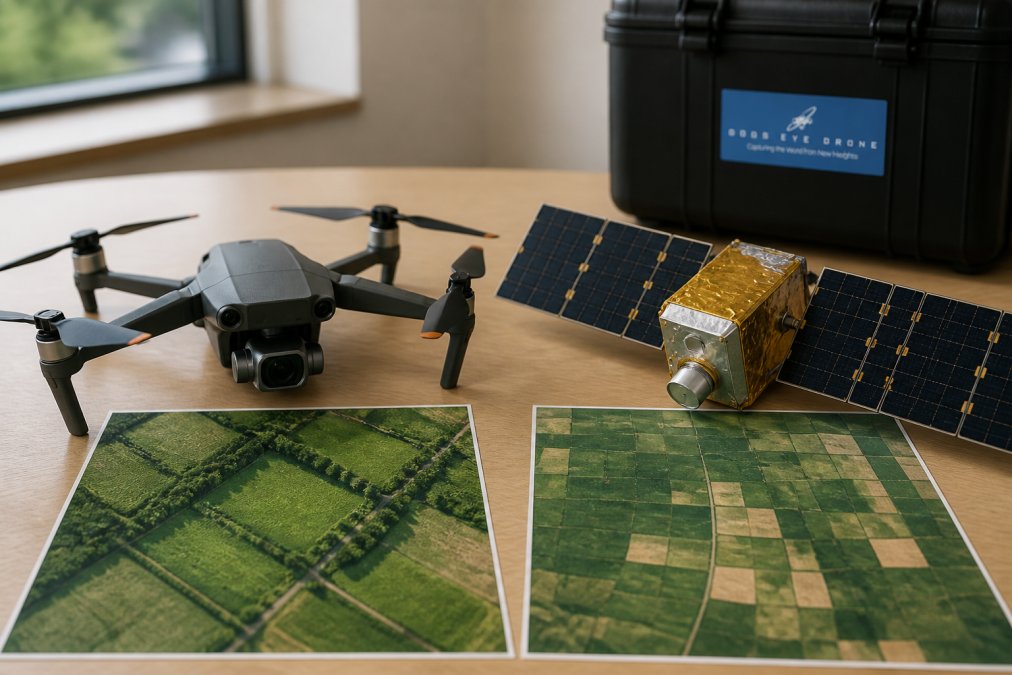
The core distinction is simple. Satellite imagery captures multispectral data from orbit, trading fine detail for wide, frequent coverage. Drone imagery captures the same spectral bands from meters above the canopy, delivering far finer detail on demand.
Drone vs Satellite Imagery for Crop Health: The Key Differences
The key differences lie in spatial resolution, temporal resolution, and operational control. Drones capture imagery at a ground sampling distance measured in centimeters, while most free or moderate-cost satellites measure in meters. That gap determines whether you can spot a single diseased plant or only a stressed patch the size of a tractor.
Spatial Resolution and Ground Sampling Distance
Spatial resolution, expressed as ground sampling distance, defines the smallest object you can reliably detect. A drone flying at low altitude can produce pixel sizes of 1 to 5 centimeters, distinguishing individual plants, irrigation failures, or early pest infestation patterns (faa.gov). Satellite imagery typically ranges from 3 to 10 meters per pixel, which is excellent for whole-field variability but blind to within-row problems.
Temporal Resolution and Revisit Frequency
Temporal resolution is where satellites win outright. A satellite constellation can revisit the same field every 1 to 5 days, giving a consistent time series without touching equipment (nasa.gov). Drones fly only when you schedule them, making revisit rate a function of labor, weather, and battery capacity. However, that control cuts both ways: a drone flies through cloud cover, while optical satellites are often blocked by it for days.
Satellite vs Drone Data: Pros and Cons for Farm Management
Satellite data excels at scalability and historical baselines, while drone data wins on precision and timeliness. Understanding the pros and cons of each prevents the common mistake of buying the wrong tool for your acreage.
Strengths and Limitations of Satellite Imagery
The primary strength of satellite imagery is its efficiency over large operations. Platforms like EOSDA Crop Monitoring calculate NDVI, NDRE, and MSAVI indices across thousands of acres and pair them with historical weather data, eliminating manual flight operations. The trade-off is lower spatial resolution, which can miss localized patchiness, and dependence on clear skies.
Strengths and Limitations of Drone Imagery
Drone imagery delivers superior spatial resolution for identifying localized problems such as nutrient deficiency, pest infestation, or irrigation failures. A multispectral drone like the DJI Mavic 3 Multispectral integrates an RGB sensor with four spectral bands and an RTK module for centimeter-level positioning, operating independently of cloud cover. The limitations are real: it requires a skilled pilot, significant hardware investment, and flight planning time that scales with acreage.
Multispectral Drone Mapping for Agriculture: What It Captures
Multispectral drone mapping captures reflected light across spectral bands invisible to the human eye, translating canopy health into actionable maps. The data is stitched into an orthomosaic that georeferences every pixel, from which you can generate a normalized difference vegetation index map highlighting biomass and vigor, or a more advanced index that detects nitrogen status before visual symptoms appear.
The real value of multispectral drone mapping lies in detecting stress early. By the time nitrogen deficiency or pest damage is visible, yield loss has often already occurred. Drone imagery captures the early spectral signature, giving you a window to intervene while the crop can still recover.
NDVI vs NDRE for Crop Health: Which Index Should You Use?
NDVI vs NDRE is not a question of which is better, but which matches the growth stage you are monitoring. NDVI measures the contrast between near-infrared and red reflectance, and is the industry standard for assessing overall biomass and canopy health (usgs.gov). NDRE uses the red-edge band that penetrates deeper into the leaf, making it more sensitive to chlorophyll and nitrogen status in dense, mature canopies.
For practical field use, the decision is straightforward. Early in the season, when canopies are thin, NDVI is reliable and widely supported. Later, when the canopy closes and NDVI saturates, NDRE provides better differentiation of nitrogen status. Many agronomists run both indices from the same flight.
| Index | Best Growth Stage | Primary Use | Limitation |
|---|---|---|---|
| NDVI | Early to mid-season | Biomass and vigor mapping | Saturates in dense canopies |
| NDRE | Mid to late season | Nitrogen status detection | Requires red-edge band sensor |
Benefits of Drone Mapping for Small Farms and Large Operations
The benefits of drone mapping for small farms are immediate, while large operations see value mainly through targeted deployment. For a farm under 500 acres, a drone replaces hours of walking fields. One pilot can cover 200 to 400 acres in a single morning, producing maps that pinpoint problem zones with precision that satellite data cannot match. This makes drone mapping a strong fit for high-value crops, orchards, and vegetable operations.
Large operations face a different math. Covering thousands of acres by drone requires multiple batteries, days, and significant pilot time, driving up costs quickly. For these operations, drone mapping is best used to investigate anomalies that satellite imagery flags.
Hybrid Workflows: Combining Satellite Scouting with Drone Follow-Up
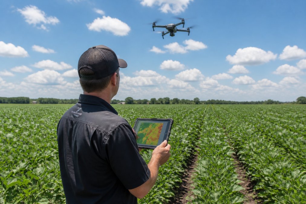
The most effective crop monitoring strategy in 2026 is a hybrid workflow using satellite imagery for broad, frequent scouting and drones for targeted, high-resolution follow-up. Satellite data tracks canopy health across growth stages, flagging zones that deviate from the expected curve. The drone then flies only those flagged zones, capturing the spatial resolution needed to diagnose the cause and prescribe a variable rate application.
This workflow also solves the cloud cover problem. When satellite imagery is blocked, the drone can still fly. When skies clear, the satellite resumes its cadence, and drone data can calibrate the satellite imagery, improving accuracy of both datasets.
Cost, Scalability, and ROI: Choosing the Right Tool for Your Fields
Cost and scalability are the deciding factors between drones and satellites, and the right choice depends on acreage, crop value, and labor availability. Satellite platforms operate on a subscription model that scales predictably with acreage, making them the clear choice for thousands of acres. Drone imagery requires a significant upfront investment in hardware, such as the DJI Mavic 3 Multispectral at a list price of $3,999, plus ongoing pilot labor and software processing costs. That fixed cost is justified when the imagery prevents input waste or catches a problem early on high-value acres.
A Concrete ROI Calculation Framework
To move beyond generalities, use this framework to determine whether a drone deployment is justified. The core question is: Does the value of the preventable yield loss or input savings exceed the fully loaded cost of the drone flight?
Step 1: Calculate the fully loaded cost per acre for a drone flight.
This includes hardware depreciation, battery replacement, pilot labor, and software processing. For a typical setup:
- Hardware depreciation: A $5,000 drone with a 3-year lifespan and 100 flights per year equals $16.67 per flight.
- Pilot labor: At $25/hour, a 2-hour sortie covering 100 acres equals $50 per flight, or $0.50 per acre.
- Software processing: Analytics platforms typically cost $50-$150 per month, adding $5-$15 per flight for 10 flights per month.
- Total fixed cost per flight: Approximately $70-$80, or $0.70-$0.80 per acre for a 100-acre sortie.
Step 2: Estimate the value of the decision the imagery enables.
Consider a nitrogen deficiency scenario. If a drone flight identifies a 5-acre zone that is underperforming, and a variable-rate application corrects it, the value is the yield difference. At $4.50 per bushel for corn and a 20-bushel-per-acre loss avoided on 5 acres, the prevented loss is $450. Subtract the $80 flight cost, and the net ROI is $370 for a single flight.
Step 3: Compare against satellite subscription costs.
Satellite platforms like EOSDA Crop Monitoring or Planet offer subscriptions ranging from $1-$3 per acre per year. For a 1,000-acre farm, that is $1,000-$3,000 annually. The drone flight above costs $80 per sortie; 10 flights per season is $800, comparable to the satellite subscription but with far higher resolution. In practice, satellites flag the zone, but the drone diagnoses the cause.
Step 4: Factor in the cost of being wrong.
The hidden cost is the value of a missed problem. If a satellite misses a 2-acre pest infestation that a drone would have caught, and it spreads, the yield loss can dwarf any subscription savings. For high-value crops like almonds or wine grapes, where per-acre revenue can exceed $5,000, a single missed event justifies a drone program.
Scalability Thresholds: When to Switch Tools
A common pattern among precision agriculture consultants is a scalability threshold based on acreage and crop value:
- Under 500 acres: Drone-only workflows are often sufficient, especially for high-value specialty crops.
- 500-2,500 acres: A hybrid workflow is most cost-effective. Use satellite for weekly screening and drones for targeted follow-up.
- Over 2,500 acres: Satellite becomes the primary tool for baseline monitoring. Drones are reserved for specific investigations, such as irrigation failures or pest outbreaks.
The Real Cost of Regulatory Compliance
One cost factor most comparisons omit is regulatory compliance. Flying a drone commercially requires an FAA Part 107 Remote Pilot Certificate, costing about $175 for the exam with recurrent training every 24 months. This means training an employee or hiring a contract pilot, who typically charges $75-$150 per hour, potentially doubling the labor cost of a sortie. Satellite imagery has no equivalent regulatory burden.
This regulatory overhead is why many farms under 500 acres still choose satellite-only monitoring. The fixed cost of certification is hard to justify when a satellite subscription costs less than one contract flight. However, for operations that already employ a pilot for other tasks, the marginal cost of adding crop health flights is negligible.
A Decision Matrix for Your Operation
To make the final call, ask these four questions:
- What is the per-acre value of the crop? High-value crops justify drone-level detail. Commodity crops may not.
- How large is the operation? Under 500 acres, drones are practical. Over 2,500 acres, satellite is the baseline.
- How quickly do you need answers? If you need same-day diagnosis, drones win. If a 3-5 day lag is acceptable, satellite suffices.
- Do you have a certified pilot on staff? If not, factor in training costs or contract pilot rates.
Conclusion: Making the Call Between Drones and Satellites
The drone vs satellite imagery decision comes down to matching the technology to the question you are asking and the size of your operation. For broad, frequent, low-cost monitoring across large acreage, satellite imagery is the right foundation. For precise, on-demand diagnosis of specific problems, drone imagery is unmatched. The operations that get the most value treat them as complementary tools in a single workflow.
The Operational Decision Framework
Before you invest in either technology, work through this practical checklist:
- Define the agronomic question. Are you tracking overall field vigor week-to-week, or diagnosing a specific stress pattern? The former points to satellite; the latter points to drone.
- Assess your regulatory posture. If you choose drone, confirm you or your contractor holds a current FAA Part 107 Remote Pilot Certificate. Factor the $175 exam fee and 24-month recurrent training into your budget.
- Calculate the fully loaded cost per acre. Use the ROI framework above and compare against a satellite subscription at $1-$3 per acre per year.
- Plan for cloud cover. If your critical growth stages fall in a region with frequent cloud cover, a drone provides a weather-independent backup.
- Start with a hybrid workflow. Begin with satellite imagery to establish a baseline and flag anomalies. Deploy the drone only to those flagged zones.
The Regulatory Reality Most Articles Ignore
One of the most overlooked operational barriers is the regulatory burden. Drone operations require more than a pilot certificate. You must also comply with airspace restrictions, visual line-of-sight requirements, and, in some cases, obtain a Part 107 waiver for operations beyond visual line of sight (BVLOS). The FAA has been slow to grant BVLOS waivers for agriculture, meaning most flights are limited to fields within visual range of the pilot. For a farm with scattered parcels, this is a significant constraint. Satellite imagery has no such limitation.
This regulatory asymmetry is why many large operations use satellite as their primary tool and reserve drones for specific, small-scale investigations where the pilot can stand at the field edge. It is not a technology limitation; it is an operational one.
The Future: Sensor Fusion and Automated Workflows
The direction of precision agriculture is sensor fusion. Farm management platforms are increasingly integrating satellite and drone data into a single interface, where satellite imagery triggers alerts and drone flights are automatically scheduled for flagged zones. Some platforms offer API integrations that allow drone flight planning software to pull satellite-derived management zones and generate flight paths automatically.
For most operations, the practical path is to start with satellite monitoring, learn to interpret vegetation indices like NDVI and NDRE, and then add a drone once you have identified the specific questions that satellite resolution cannot answer. This staged approach avoids buying a $4,000 drone and discovering you lack the pilot time or regulatory clearance to use it.
If you are ready to put this into practice, Gods Eye Drone provides certified pilots and state-of-the-art multispectral and FLIR equipment to capture the aerial intelligence your fields need. Whether you require detailed crop health mapping, irrigation analysis, or support planning your first hybrid monitoring workflow, our team is equipped to deliver precise results. Book a consultation to discuss your acreage, your crop, and the agronomic questions you need answered.
Frequently Asked Questions
What is the primary resolution difference between drone and satellite imagery?
The main difference is spatial resolution, measured as ground sampling distance. Drones can capture imagery at centimeter-level pixel sizes, identifying small problem areas or individual plants. Satellites typically offer pixel sizes from 3 to 10 meters. While newer commercial satellites are improving, drone imagery remains the standard for detecting localized patchiness, nutrient deficiency, or pest infestation early.
Is drone imagery more cost-effective than satellite data for small farms?
For small farms, drone mapping often delivers better value. Satellite subscriptions scale by acreage and can carry recurring costs that are hard to justify on smaller operations. Drone hardware is a one-time investment, and many software platforms automate flight planning and NDVI processing. The benefits of drone mapping for small farms include on-demand access, higher detail, and no cloud cover delays, which makes the per-acre cost competitive for fields under a few thousand acres.
How does cloud cover impact satellite versus drone crop monitoring?
Cloud cover is a major limitation for satellite-based remote sensing. Optical satellites cannot see through clouds, which can delay critical data collection during key crop growth stages. Drones operate below the cloud ceiling, so you can capture multispectral imagery on demand even when satellite passes are blocked. This makes drones more reliable for time-sensitive decisions like variable rate application or spotting pest infestation before it spreads.
Can drones and satellites be used together for better crop insights?
Yes, and this hybrid workflow is becoming standard practice. Use satellite imagery for weekly, field-wide screening to spot broad trends and anomalies across thousands of acres. When a satellite index like NDVI flags a problem zone, deploy a drone for high-resolution scouting of that specific area. This combines the scalability of satellites with the precise, actionable detail of multispectral drone mapping for agriculture.
What specific crop health metrics can drones capture that satellites miss?
Drones capture centimeter-level detail that satellites cannot. This includes stand count analysis, early weed patch detection, and precise plant height measurement. With multispectral sensors, drones detect subtle differences in canopy health that a 10-meter satellite pixel might average out. Drones also generate detailed orthomosaics and 3D topographic maps, which support drainage planning and yield mapping in ways that coarser satellite data cannot match.
Choosing between these technologies does not have to be a one-time, all-in decision. Start with satellite scouting to understand your field variability, then bring in a drone service for the zones that need a closer look. Gods Eye Drone pairs certified pilots with the latest multispectral sensors to give you centimeter-level detail exactly when and where you need it. Get started with Gods Eye Drone and see the difference that on-demand aerial intelligence makes for your crop health decisions.
This article was written using GrandRanker
Frequently Asked Questions
Q: What is the primary resolution difference between drone and satellite imagery?
A: The main difference is spatial resolution, measured as ground sampling distance. Drones can capture imagery at centimeter-level pixel sizes, identifying small problem areas or individual plants. Satellites typically offer pixel sizes from 3 to 10 meters. While newer commercial satellites are improving, drone imagery remains the standard for detecting localized patchiness, nutrient deficiency, or pest infestation early.
Q: Is drone imagery more cost-effective than satellite data for small farms?
A: For small farms, drone mapping often delivers better value. Satellite subscriptions scale by acreage and can carry recurring costs that are hard to justify on smaller operations. Drone hardware is a one-time investment, and many software platforms automate flight planning and NDVI processing. The benefits of drone mapping for small farms include on-demand access, higher detail, and no cloud cover delays, which makes the per-acre cost competitive for fields under a few thousand acres.
Q: How does cloud cover impact satellite versus drone crop monitoring?
A: Cloud cover is a major limitation for satellite-based remote sensing. Optical satellites cannot see through clouds, which can delay critical data collection during key crop growth stages. Drones operate below the cloud ceiling, so you can capture multispectral imagery on demand even when satellite passes are blocked. This makes drones more reliable for time-sensitive decisions like variable rate application or spotting pest infestation before it spreads.
Q: Can drones and satellites be used together for better crop insights?
A: Yes, and this hybrid workflow is becoming standard practice. Use satellite imagery for weekly, field-wide screening to spot broad trends and anomalies across thousands of acres. When a satellite index like NDVI flags a problem zone, deploy a drone for high-resolution scouting of that specific area. This combines the scalability of satellites with the precise, actionable detail of multispectral drone mapping for agriculture.
Q: What specific crop health metrics can drones capture that satellites miss?
A: Drones capture centimeter-level detail that satellites cannot. This includes stand count analysis, early weed patch detection, and precise plant height measurement. With multispectral sensors, drones detect subtle differences in canopy health that a 10-meter satellite pixel might average out. Drones also generate detailed orthomosaics and 3D topographic maps, which support drainage planning and yield mapping in ways that coarser satellite data cannot match.