 ultimate-guide
Drone Site Monitoring for Project Managers: A Practical Guide
Table of Contents
- Why Drone Site Monitoring Matters for Project Managers
- Real-Time Progress Tracking and Project Milestones
- Drones in Construction: Automated Data Collection and Flight Scheduling
- Drone Safety Inspection Construction: Risk Mitigation and Compliance
- Drone Data Analysis Construction: Earthwork and Volumetric Measurements
- 3D Modeling with Drones Construction: High-Resolution Mapping and BIM Integration
- Change Management and ROI: Making the Case to Your Team
- Data Security, Post-Processing Workflows, and Stakeholder Communication
- Frequently Asked Questions
Last Updated: July 31, 2026
Why Drone Site Monitoring Matters for Project Managers
Drone site monitoring has become essential for modern construction projects. Teams using aerial monitoring reduce schedule delays by catching issues weeks earlier than traditional ground-based inspections. Project managers oversee dozens of daily decisions, but often with incomplete or outdated site information. Drone monitoring compresses the feedback loop dramatically, a single flight captures georeferenced imagery covering hundreds of acres, creating a permanent visual record stakeholders can review from the office. Teams using aerial documentation report faster issue resolution, fewer disputes, and measurable improvements in stakeholder confidence.
The real value isn't the technology itself, but the decision speed it enables. When you can see exactly where earthwork stands, where materials are staged, and whether safety protocols are being followed, you stop guessing and start acting on facts.
Below, we'll walk through how to integrate drone monitoring into your project workflow, from real-time progress tracking to earthwork analysis, risk mitigation, and stakeholder communication.
Real-Time Progress Tracking and Project Milestones
The foundation of drone site monitoring is comparing where you are against where you planned to be. Real-time progress tracking eliminates waiting for monthly reports or relying on superintendent estimates.
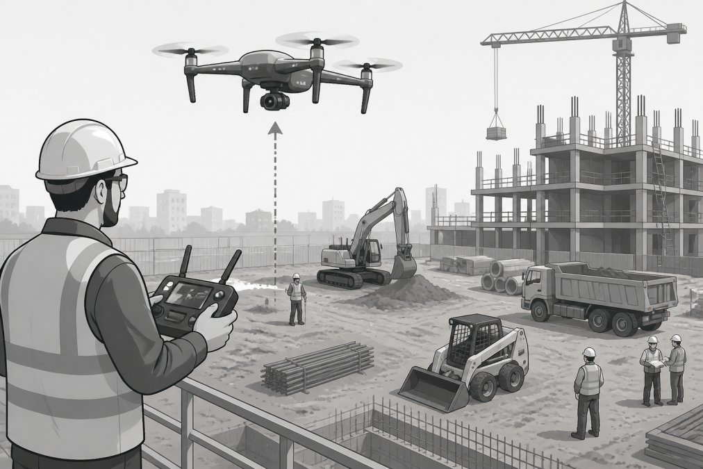
A weekly or bi-weekly drone flight captures orthomosaic imagery, a geometrically corrected, seamless mosaic of the entire site. Overlay this against your baseline plan, and you have a visual record of whether earthwork is on schedule, foundations are poured on time, and material stockpiles are positioned correctly. No guessing.
Many teams fly on the same day each week, creating a consistent visual timeline that makes trends obvious. If concrete work is slipping by five days per week, you'll see it clearly after three consecutive flights, allowing you to intervene before the slip becomes a crisis.
Project milestones become verifiable events rather than self-reported dates. When your contract says "foundation complete by June 15," you now have aerial proof. This reduces disputes and creates accountability.
Drones in Construction: Automated Data Collection and Flight Scheduling
Drones work best when data collection is systematic. Automated flight scheduling eliminates ad hoc flights that create gaps in your timeline. Define a flight plan once, the area to cover, altitude, and camera settings, and the system repeats it on schedule. Consistent flight patterns mean orthomosaics are directly comparable, letting you spot real changes versus artifacts of different flight conditions.
Remote sensing technology in drones has advanced significantly, with high-resolution sensors capturing centimeter-level accuracy. Flight automation reduces pilot error; once programmed, the drone executes the same flight every time with consistent overlap and coverage.
Data processing happens in the cloud for most modern systems. Raw imagery is uploaded and processed into orthomosaics, point clouds, and volumetric measurements without manual intervention. Your project manager can review results the same day the flight happens.
Integration with your project management software is essential. Drone data should feed directly into scheduling tools, budget tracking, and stakeholder dashboards. This eliminates manual data entry and keeps everyone working from the same source of truth.
Drone Safety Inspection Construction: Risk Mitigation and Compliance
Safety inspection using drones serves dual purposes: documenting hazards before they cause incidents and creating compliance records that satisfy regulatory requirements.
Traditional safety inspections are reactive. Supervisors walk the site and report issues, but have limited visibility into high areas and confined spaces. Drones reach these areas safely and document conditions in detail. Thermal cameras detect unsafe electrical conditions; high-resolution cameras spot fall hazards, unsecured materials, or improper scaffolding from angles ground-based inspectors can't reach.
OSHA requires documentation of safety conditions and corrective actions. Drone footage creates an objective, date-stamped record. When an inspector asks how you know a condition was corrected, you show aerial before-and-after imagery, demonstrating due diligence.
Thermal imaging identifies heat loss in building envelopes, electrical overheating, and moisture infiltration. For construction, thermal imaging verifies weatherproofing completion before final inspections and catches mechanical issues before they become failures.
Establish a regular cadence, monthly or quarterly drone safety inspections create a consistent record that regulators recognize as genuine due diligence.
Drone Data Analysis Construction: Earthwork and Volumetric Measurements
Earthwork analysis directly impacts your budget. Volume calculations for cut-and-fill operations, material stockpiles, and excavation depth are expensive to measure manually. Drones generate precise measurements from imagery alone.
A drone flight captures overlapping imagery processed into a point cloud, millions of 3D coordinate points representing the site's surface. From this, you calculate volumes with centimeter-level accuracy. A stockpile estimated at 500 cubic yards might actually be 487. That difference compounds across dozens of material deliveries.
Accuracy protects your budget and creates accountability with suppliers and subcontractors. Volumetric measurements also track progress, if your earthwork schedule calls for 10,000 cubic yards per month, drone flights verify whether that target is met.
Point cloud data feeds into 3D modeling software, overlaying drone-derived data against your design model to show exactly where site conditions deviate from the plan.
3D Modeling with Drones Construction: High-Resolution Mapping and BIM Integration
High-resolution mapping from drones creates the foundation for digital twins, virtual replicas of your site for planning, analysis, and stakeholder communication.
Orthomosaics and point clouds are processed into digital surface models (DSM) representing elevation of every point on the site, and digital elevation models (DEM) showing underlying terrain. Building information modeling (BIM) integration overlays your design model against drone-derived point clouds to identify conflicts before they become problems. Is a utility line actually where the design said it would be? Is the building pad elevation correct? These questions are answered by comparing design models against drone data.
Geospatial data from drone flights is georeferenced, every point has precise latitude, longitude, and elevation. This allows seamless integration with GIS systems, civil design software, and project management platforms.
Cloud-based processing eliminates the need for significant computational power in your office. Upload raw files and processing happens in the cloud; results are typically available within 24 hours.
BIM software integration keeps your 3D model current. As the site evolves, new drone flights update the as-built model, creating a living record of the project.
Change Management and ROI: Making the Case to Your Team
Most drone implementations fail not because the technology doesn't work, but because teams don't use it effectively. Resistance comes from unfamiliarity with new data types and workflows built over decades.
Change management starts with education. Your team needs to understand what drone data shows and how to interpret it. A misaligned orthomosaic is usually a processing artifact, not a real site problem. If your team doesn't understand these nuances, they'll dismiss the data as unreliable.
The ROI conversation is concrete. Pricing for drone monitoring depends on factors like site size and processing requirements. The benefit is catching problems early, a schedule slip caught in month two has far lower cost than discovering it in month six.
Leadership commitment is essential. If your project manager actively uses drone data in project meetings and decision-making, the team learns quickly that this is how the project operates. Start with low-stakes use cases like progress documentation before expanding to decision-critical applications.
Data Security, Post-Processing Workflows, and Stakeholder Communication
Drone data is valuable and sensitive. Site imagery can reveal security vulnerabilities and operational details competitors might exploit. Data security is essential.
Start with access control. Limit drone imagery viewing to your project team, the client, and key consultants. Use role-based access in your project management platform. Cloud storage requires encryption both in transit and at rest; verify your provider meets relevant security certifications.
Post-processing workflows are where drone data often gets stuck. Raw imagery is useless without processing. Establish a standard schedule: fly Tuesday, process Wednesday, review Thursday, make decisions Friday. This rhythm ensures data is processed while still relevant.
Stakeholder communication is where drone data shines. Instead of describing site conditions in text, show them. Weekly progress reports with drone imagery are more compelling than written descriptions. Add annotations showing where work is happening, where problems exist, and what's planned next. Many project managers create a simple dashboard that updates weekly: drone imagery, key metrics (percentage complete, delays, budget status), and upcoming milestones. This transparency builds trust and reduces status calls and email updates.
Drone site monitoring transforms how teams make decisions and communicate progress. Gods Eye Drone provides certified pilots, state-of-the-art equipment, and processing support that keeps data flowing into your decision-making cycle. The result is faster issue resolution, better stakeholder confidence, and measurable improvements in schedule and budget adherence. Book Now to discuss how drone monitoring can improve your next project.
Frequently Asked Questions
How does drone site monitoring help project managers make better decisions?
Drone site monitoring provides project managers with geospatial data, orthomosaics, and point cloud imagery that enable data-driven decision making. Real-time progress tracking through high-resolution aerial imagery allows you to verify schedule adherence, identify delays early, and allocate resources more efficiently. Visual documentation from unmanned aerial vehicles captures site conditions that would otherwise require time-consuming ground inspections, reducing project delays and improving operational efficiency.
What regulations apply to drone use for construction site monitoring in the United States?
In the US, construction drone operations fall under FAA Part 107 regulations. Operators must be certified remote pilots, maintain visual line of sight, stay below 400 feet altitude, and avoid flying over people. Commercial drone services require a Part 107 certificate, and operators must follow local airspace restrictions. Many construction sites also have additional safety protocols. Working with certified drone service providers ensures compliance with all federal and local requirements for your project.
How long does it take to process drone data into usable project deliverables?
Processing time depends on project scope and data volume. Basic orthomosaics and progress photos can be delivered within 24-48 hours. Complex deliverables like 3D models, point clouds, and volumetric calculations typically require 3-7 business days for cloud-based processing and post-processing workflow completion. Factors affecting timeline include flight duration, number of images, processing software capabilities, and deliverable complexity. Discuss turnaround expectations with your drone service provider when booking, especially for time-sensitive project milestones.
What's the difference between drone site monitoring and traditional construction monitoring methods?
Traditional site monitoring relies on ground inspections, manual measurements, and 2D documentation, methods that are time-consuming, labor-intensive, and prone to human error. Drone site monitoring captures high-resolution aerial imagery, automated data collection, and geospatial analysis that provide comprehensive site documentation in a fraction of the time. Drones enable 3D modeling, precise volumetric measurements, and digital twins that traditional methods cannot achieve. This results in better cost and budget adherence, faster decision-making, and improved safety through remote inspection of hazardous areas.
This article was written using GrandRanker