 listicle
Drone Services for Property Developers: A Kansas Guide
Table of Contents
- Why Drone Services Matter for Property Developers
- Quick Comparison: Top Drone Service Providers
- Gods Eye Drone: Full-Service Aerial Solutions
- Specialized Providers: Mapping, Inspections, and LiDAR
- Construction-Focused Providers and Budget Options
- Understanding Construction Site Aerial Mapping Costs
- FAA Part 107 Drone Regulations for Commercial Operations
- Drone Progress Reporting for Developers: Implementation and ROI
- Frequently Asked Questions
Last Updated: August 14, 2026
Why Drone Services Matter for Property Developers
Aerial imagery has transformed how developers approach site planning, project monitoring, and stakeholder communication. What used to require expensive helicopters or ground-based surveys now happens with precision and speed using commercial drones. For property developers in Kansas, this shift directly impacts timeline, cost, and decision-making accuracy.
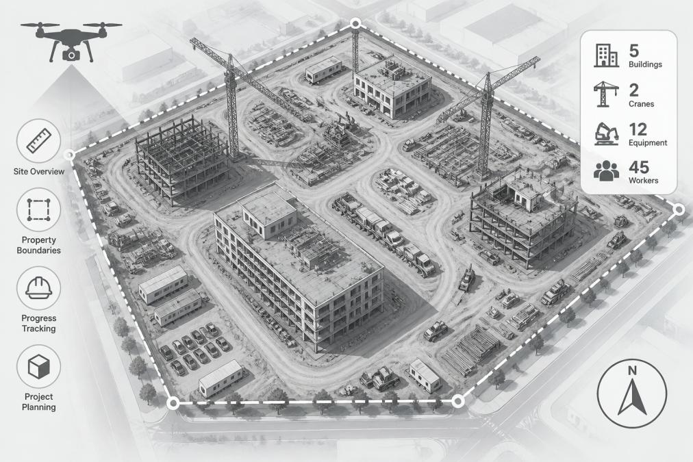
Drone services capture geospatial data that informs every phase of development: site selection, environmental assessment, progress tracking, and regulatory compliance. Gods Eye Drone and other specialized providers in Kansas deliver this through high-resolution photography, thermal imaging, LiDAR mapping, and 3D modeling.
Consider a practical example: a developer evaluating a 40-acre parcel for mixed-use development. Traditional surveying takes weeks and costs significantly more. Drone-based topographic mapping with LiDAR delivers elevation models, volumetric analysis, and vegetation mapping in days, flowing directly into CAD and GIS systems. Construction teams then use ongoing aerial monitoring to track progress against schedule, document conditions for insurance and regulatory compliance, and identify logistical issues before they become costly problems.
FAA Part 107 certification has standardized commercial operations, making it easier for developers to work with qualified providers. Property developers who integrate drone services into their workflows report better stakeholder alignment, faster decision cycles, and measurable improvements in project outcomes.
Quick Comparison: Top Drone Service Providers
| Provider | Specialization | Key Services | Best For |
|---|---|---|---|
| Gods Eye Drone | Full-service aerial solutions | Photography, videography, thermal imaging, inspections | Comprehensive projects needing one trusted partner |
| Skye Link | Advanced mapping and LiDAR | Thermal imaging, LiDAR surveys, facade inspections | Large-scale development and infrastructure assessment |
| Drone Services of Kansas City | Construction-focused mapping | Orthomosaics, 3D modeling, progress tracking, LiDAR | Active construction sites needing regular monitoring |
| The Future 3D | High-precision 3D data | LiDAR surveying, virtual tours, drone inspections | Projects requiring survey-grade accuracy and visualization |
| Have Drone Will Travel | Construction documentation | Orthomosaic mapping, photogrammetry, progress tracking | Developers prioritizing visual documentation and CAD integration |
| Kansas City Land Surveying | Topographic and survey data | LiDAR mapping, ALTA surveys, DTM surfaces | Land developers needing certified survey-grade deliverables |
| Dronegenuity | Statewide network services | Orthomosaics, 3D modeling, aerial surveys | Multi-site projects across Kansas needing consistent quality |
| LinearEye | Cost-effective packages | Basic site surveys, construction documentation | Developers on budget looking for transparent pricing |
| Horizon Drone Services | Photogrammetry and 3D modeling | 2D orthomosaics, 3D job site models, progress tracking | Contractors and developers focused on visual project management |
Gods Eye Drone: Full-Service Aerial Solutions
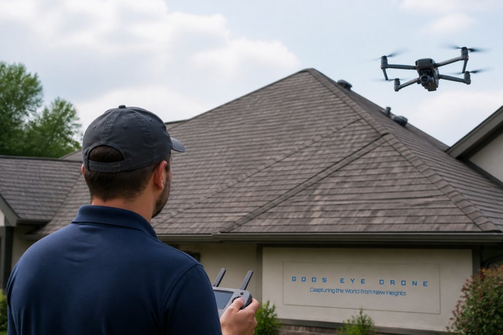
Gods Eye Drone is a veteran-owned operation delivering comprehensive aerial solutions for property developers across the region. The company combines high-resolution photography and videography with specialized thermal imaging using advanced FLIR equipment. Thermal data reveals issues invisible to standard cameras: roof leaks, electrical hot spots, HVAC performance, and moisture intrusion in building envelopes.
For property developers, the practical advantage is integration. A single certified pilot can capture standard aerial photography for marketing and documentation, then pivot to thermal inspection for due diligence on existing structures. That consolidation reduces coordination overhead and ensures consistent data quality across project phases.
FAA Part 107 certification signals operational discipline. Developers working with certified operations avoid regulatory complications, insurance disputes, and footage that doesn't meet professional standards.
Specialized Providers: Mapping, Inspections, and LiDAR
Skye Link: Advanced Thermal and LiDAR Services
Skye Link operates across Kansas with a focus on advanced geospatial technologies. LiDAR (Light Detection and Ranging) delivers point cloud data that creates precise elevation models and 3D representations. For property developers, this translates to accurate volumetric calculations for grading, drainage planning, and site logistics. Thermal imaging identifies energy efficiency issues, moisture problems, and structural anomalies that affect property valuation and development cost.
Skye Link's end-to-end service model, from data collection through processing and reporting, removes the burden of managing multiple vendors. Facade inspections matter for adaptive reuse projects where understanding building condition drives renovation budgets and timelines.
Drone Services of Kansas City: Construction-Focused Mapping
Drone Services of Kansas City specializes in orthomosaic mapping, 3D site modeling, and progress documentation. RTK (Real-Time Kinematic) orthomosaics deliver georeferenced aerial images accurate enough for CAD overlay, enabling developers to measure distances and calculate areas with confidence.
The company's stockpile and volume calculation service addresses a specific pain point: inventory tracking on active sites. Developers managing material deliveries or excavation get accurate volume data without manual surveying. Construction progress documentation provides consistent visual records for schedule tracking, insurance claims, and stakeholder reporting.
Interior LiDAR scanning using Planix R1 technology extends the service into buildings. Developers evaluating existing structures for renovation get detailed spatial data without traditional floor plans, accelerating due diligence.
The Future 3D: High-Precision 3D Scanning and Virtual Tours
The Future 3D uses professional-grade equipment like Trimble and NavVis systems to deliver survey-grade accuracy. LiDAR surveys generate point clouds dense enough for detailed analysis and 3D modeling. Immersive 3D virtual tours enable developers to showcase property conditions to investors and lenders without site visits, accelerating decision-making.
Drone inspections with thermal imaging and HD video assess roof condition, facade integrity, and infrastructure. For developers managing property portfolios, this inspection capability reduces reliance on traditional methods and accelerates triage decisions.
Kansas City Land Surveying: LiDAR and Topographic Data
Kansas City Land Surveying brings traditional surveying expertise into the drone era. LiDAR mapping services deliver topographic surveys, ALTA (American Land Title Association) aerial survey images, and DTM (Digital Terrain Model) surfaces with photographic backdrops. This combination delivers both the precision of survey-grade data and the visual context of orthorectified imagery.
For land developers evaluating large parcels with significant topographic variation, this service eliminates the time and cost of traditional ground surveys while delivering superior data density.
Construction-Focused Providers and Budget Options
Have Drone Will Travel: Orthomosaic Mapping and Progress Tracking
Have Drone Will Travel targets the construction workflow directly. Orthomosaic mapping and photogrammetry deliver visual documentation for progress tracking and stakeholder communication. The company's use of DroneDeploy platform enables overlay of orthomosaics on base maps, making progress comparison intuitive.
For active construction sites, this service provides consistent, timestamped visual records that track site evolution. Developers use these records for schedule verification, insurance documentation, and stakeholder reporting. 3D models enable visualization of completed work and identification of spatial conflicts before they become costly rework.
Dronegenuity: Statewide Network and 3D Modeling
Dronegenuity operates a statewide network of FAA Part 107 certified pilots, enabling consistent service across Kansas regardless of project location. For developers managing multiple sites, this network approach simplifies vendor management and ensures faster turnaround times.
The company's strengths include high-resolution aerial photography, orthomosaics, and 3D modeling. Dronegenuity processes data into interactive 3D models and analysis-ready datasets, reducing internal resource requirements.
LinearEye: Transparent Pricing and Certified Pilots
LinearEye distinguishes itself through transparent, package-based pricing. The company's FAA Part 107 certification and secure file delivery address compliance and data security concerns. LinearEye doesn't offer advanced LiDAR or thermal imaging, making it suitable for routine documentation rather than complex projects.
Horizon Drone Services: Photogrammetry and Job Site Models
Horizon Drone Services focuses on practical tools for project management: photogrammetry, 2D orthomosaics, and 3D job site models. 3D job site models enable visualization of progress and identification of logistical issues without site visits. The safety implications matter too: identifying hazards through 3D models reduces on-site risk.
Understanding Construction Site Aerial Mapping Costs
Drone services pricing varies based on project scope, site size, and deliverable complexity. A basic site survey costs substantially less than survey-grade LiDAR mapping or thermal inspection. Site size matters: larger properties require more flight time and processing time. Deliverable complexity also drives cost: standard photography costs less than LiDAR surveys, which cost less than integrated thermal analysis.
The ROI calculation matters more than absolute cost. A developer investing in detailed site analysis during planning phases reduces costly surprises during construction. Accurate volumetric data eliminates material waste. Progress documentation prevents schedule disputes. Thermal inspections catch building defects before they become expensive problems.
For developers managing tight budgets, starting with basic orthomosaic mapping and upgrading to LiDAR or thermal services as projects progress allows cost control while maintaining data continuity.
FAA Part 107 Drone Regulations for Commercial Operations
Commercial drone operations in the United States fall under FAA Part 107 regulations. Certified remote pilots must pass a knowledge test covering regulations, airspace, weather, and safety. Flights must occur during daylight hours, within visual line of sight, below 400 feet altitude, and away from people and property.
For property developers, the key implication is simple: work with FAA Part 107 certified pilots. This certification ensures the provider understands regulations, carries appropriate insurance, and operates within legal boundaries. Developers should verify that providers carry appropriate liability insurance and understand airspace restrictions in their area.
Drone Progress Reporting for Developers: Implementation and ROI
Drone progress reporting transforms how developers track construction timelines and communicate status to stakeholders. Implementation requires clear workflows, consistent scheduling, and effective data management.

The basic workflow involves regular drone flights, typically weekly or bi-weekly, capturing consistent imagery from the same locations and altitudes. This consistency enables comparison between flights, revealing progress and identifying delays. Orthomosaics overlay on site plans, showing work completion status. 3D models enable visualization of spatial relationships and conflict identification.
Implementation starts with defining flight parameters: altitudes, camera angles, coverage areas, and scheduling. Consistency matters because it enables meaningful comparison over time. Data management requires organization: establish naming conventions, folder structures, and archiving procedures to prevent data loss.
The ROI case centers on three benefits. First, visual documentation reduces schedule disputes through timestamped imagery. Second, early issue identification saves costs by addressing logistical problems before they cascade. Third, stakeholder confidence improves through visual reporting, accelerating approvals and decision-making.
Drone services have become essential infrastructure for property developers managing complex projects. The providers listed above represent different specializations and price points, but they share commitment to delivering accurate aerial data that improves planning, reduces risk, and accelerates decision-making. Gods Eye Drone stands out as the full-service option, combining standard aerial photography with advanced thermal inspection and specialized capabilities. For developers needing comprehensive aerial intelligence across project phases, Gods Eye Drone's veteran-owned operation and certified pilots deliver the reliability and precision that complex development demands. Book a consultation with Gods Eye Drone to discuss how drone services can accelerate your next project.
Frequently Asked Questions
What makes drone services valuable for property developers compared to traditional surveying methods?
Drone services capture high-resolution aerial imagery and geospatial data in a fraction of the time traditional ground surveys require. For property developers, this means faster site analysis, accurate topographic mapping, and 3D models that inform project planning. Drones can cover large areas quickly, produce orthomosaic images for precise measurements, and generate point clouds for volumetric analysis. The data supports CAD/BIM integration, reduces project timelines, and improves decision-making with real-time site intelligence.
What does FAA Part 107 drone regulations mean for hiring a commercial drone service?
FAA Part 107 certification ensures a drone operator is licensed and trained to fly commercially. When you hire a drone service, verify the pilot holds a Part 107 remote pilot certificate, maintains proper insurance, and follows airspace restrictions. Licensed operators understand regulatory compliance, flight restrictions near airports, and safety protocols. Hiring a Part 107-certified service protects your project from liability and ensures the data collected meets professional standards and legal requirements.
How does drone progress reporting help construction site management and timelines?
Regular drone progress reporting provides visual documentation of construction milestones, allowing project managers to track work completion, identify delays, and communicate status to stakeholders. Consistent aerial imagery creates a detailed record of project phases, supports quality control, and flags potential issues before they escalate. Many drone services integrate data into project management software, enabling automated reporting and comparison of planned versus actual progress. This transparency reduces miscommunication, improves scheduling accuracy, and helps keep projects on budget.
What is the typical cost range for drone services, and how is pricing structured?
Drone service pricing depends on project scope, site size, complexity, and deliverables. Basic site surveys and aerial photography typically start lower, while advanced services like LiDAR mapping, 3D modeling, and thermal imaging cost more. Most providers quote based on specific project needs rather than fixed rates. Contact individual service providers directly for accurate estimates, as costs vary significantly based on whether you need simple photography, orthomosaic mapping, construction progress tracking, or specialized inspections.
Can drone services integrate with BIM and CAD software for construction projects?
Yes, many drone services produce data compatible with BIM and CAD workflows. Orthomosaic maps, 3D point clouds, and photogrammetry outputs can be imported into design software for site planning and project coordination. Services like Drone Services of Kansas City and The Future 3D specifically support CAD/GIS integration, allowing developers to overlay drone data with design plans. This integration improves accuracy, reduces rework, and enables better collaboration between design and field teams.
This article was written using GrandRanker