 ultimate-guide
Drone Crop Monitoring for Kansas Farms: A 2026 Guide
Table of Contents
- Why Drone Crop Monitoring Matters for Kansas Farmers
- How Multispectral Imaging for Agriculture Works
- Key Applications: From Disease Detection to Precision Spraying
- FAA Part 107 Agricultural Drone Requirements
- Cost of Drone Crop Monitoring Services and ROI
- Selecting and Implementing Drone Monitoring on Your Farm
- Common Mistakes to Avoid When Starting Drone Monitoring
- Conclusion
- Frequently Asked Questions
Last Updated: August 20, 2026
Why Drone Crop Monitoring Matters for Kansas Farmers
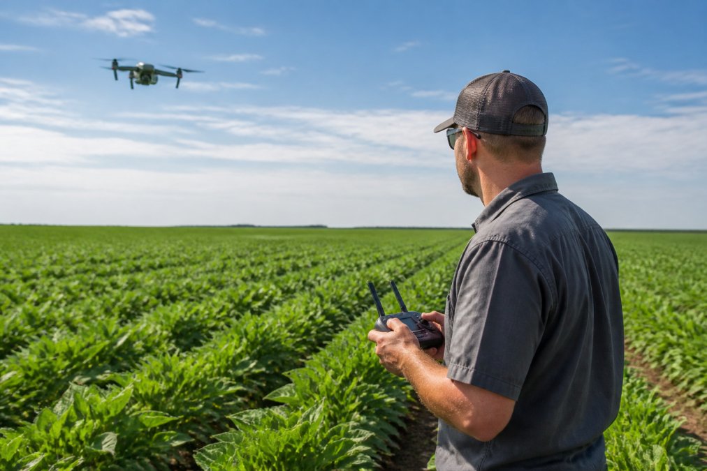
Drone crop monitoring transforms how farmers make decisions about their fields. At Gods Eye Drone, we work with agricultural managers across the region who've discovered that aerial intelligence changes everything, from spotting disease before it spreads to optimizing irrigation patterns across thousands of acres.
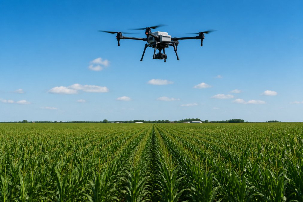
The core value is simple: what you can't see, you can't manage. Ground-level scouting catches problems in small patches. Drone crop monitoring reveals patterns across entire fields, showing which zones are thriving and which are struggling. That visibility translates directly into better yields, lower input costs, and faster response times when problems emerge.
Kansas farming faces specific challenges that make aerial monitoring particularly valuable: heat stress, variable soil conditions, irrigation inconsistency, and rapid disease progression all benefit from frequent, detailed field assessment. Traditional scouting requires hours walking fields; UAV-based monitoring delivers the same intelligence in minutes, with data you can compare week to week.
How Multispectral Imaging for Agriculture Works
Multispectral imaging captures light wavelengths the human eye cannot see, revealing crop health patterns invisible from the ground. A standard camera records red, green, and blue light. Multispectral sensors add infrared and near-infrared bands, which plants reflect differently depending on their health status, water stress, and nutrient levels.
The most common metric is NDVI (Normalized Difference Vegetation Index), which compares how much near-infrared light a plant reflects versus red light. Healthy, vigorous plants reflect far more near-infrared light. This ratio produces a map where green zones show strong plant vigor and red or brown zones flag stress or poor growth.
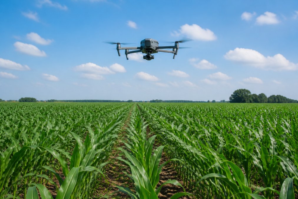
In practice, you fly the drone over your field on a consistent schedule, weekly or biweekly during the growing season. The multispectral sensor collects raw image data. Software processes those images into NDVI maps, which highlight problem zones instantly. A field that looks uniform from the road suddenly reveals stressed patches, irrigation dead zones, soil compaction areas, or early disease infection that you can address before yield loss occurs.
The time-series aspect matters as much as individual images. One NDVI map shows where problems exist. A series of maps over weeks shows whether conditions are improving or deteriorating, revealing whether your management response is working.
Key Applications: From Disease Detection to Precision Spraying
Drone crop monitoring delivers value across multiple use cases. The same flight data serves different purposes depending on your priorities and challenges.
Crop Health Assessment and Early Disease Detection
Early detection of crop disease is one of the highest-value applications of multispectral imaging. Diseases like gray leaf spot, southern leaf blight, and fusarium head blight show up in NDVI maps before visible symptoms appear across large areas. Infected plants reflect light differently than healthy ones, creating detectable patterns in the data.
A farmer using routine drone monitoring can spot disease pressure in specific field zones days or weeks before walking the field would reveal it. That early warning window is critical. Fungicide applications are most effective when disease pressure is low. Waiting until visible symptoms spread means the disease has already colonized more plants, reducing treatment effectiveness and increasing input costs. Rather than spraying an entire field, you spray the zones where disease pressure is highest, reducing chemical use and costs.
Irrigation Optimization and Soil Compaction Monitoring
Irrigation efficiency directly impacts yield and input costs. Thermal imaging and NDVI data reveal which zones receive adequate water and which ones are water-stressed. Drip irrigation lines that clog or pivot systems with nozzle problems create dry patches that show clearly in multispectral data.
Soil compaction reduces water infiltration and root development. Compacted zones show up as stressed, underperforming areas in NDVI maps. Once identified, you can plan targeted remediation, subsoiling, cover crops, or adjusted traffic patterns.
Variable Rate Application and Drift Reduction
Variable rate application (VRA) uses zone-specific data to apply inputs, fertilizer, fungicide, herbicide, at rates matched to field conditions. Instead of applying the same rate across the entire field, you apply more in high-yielding zones and less in low-performing areas, improving efficiency and reducing environmental impact.
Drones can apply inputs with precision and minimal drift compared to ground equipment, particularly in sensitive areas near water bodies or adjacent properties.
FAA Part 107 Agricultural Drone Requirements
Operating a drone for agricultural purposes requires FAA Part 107 certification for the pilot. This is a federal requirement with no exceptions for agricultural use. The Remote Pilot Certificate in the Small UAS category is the legal foundation for commercial drone operations, including crop monitoring.
To obtain Part 107 certification, a pilot must pass the Remote Pilot Knowledge Test, which covers airspace regulations, weather, emergency procedures, and operational limitations. Certification is valid for two years, after which a recurrent examination is required.
Part 107 operations have specific constraints relevant to agricultural work. Flights must remain within visual line of sight of the pilot. Operations are limited to daylight hours or twilight periods under specific lighting conditions. Maximum altitude is 400 feet above ground level. The drone cannot fly over people who are not directly participating in the operation. Maximum airspeed is 100 miles per hour.
For drone crop monitoring on your farm, you have two paths: hire a certified pilot from a company like Gods Eye Drone, or train your own staff to become certified. Many larger operations choose to certify internal staff, which provides operational flexibility and reduces per-flight costs. Smaller operations typically contract with certified service providers.
Agricultural operations can request waivers from certain Part 107 restrictions if they can demonstrate safe operations under alternative procedures. Some farmers have obtained waivers for operations beyond visual line of sight (BVLOS) or for flights over people in certain circumstances.
Cost of Drone Crop Monitoring Services and ROI
The cost structure for drone crop monitoring depends on whether you operate your own equipment or hire a service provider. Equipment costs include the drone itself, sensors, batteries, and software licenses. Service costs include pilot time, flight planning, data processing, and reporting.
For farmers contracting with service providers, pricing typically ranges from per-acre fees for single flights to seasonal packages covering regular monitoring throughout the growing season. Seasonal contracts provide the most consistent data for decision-making. Return on investment appears through reduced input costs from targeted applications, improved yields from early disease detection and irrigation optimization, and lower water use. A common scenario is a farmer who identifies and corrects irrigation problems, saving water and improving yields in underperforming zones. Those gains often offset monitoring costs within a single season.
Gods Eye Drone helps agricultural clients build a clear ROI picture by identifying specific opportunities in their fields and tracking results over time.
Selecting and Implementing Drone Monitoring on Your Farm
Moving from interest to active implementation requires several decisions: which hardware and software to use, how to integrate drone data with your existing farm management systems, and how to execute the rollout without disrupting operations.
Drone Hardware and Software Selection
Multispectral drone systems range from affordable entry-level platforms to advanced systems with higher accuracy and processing power. Key selection criteria include sensor type, spatial resolution, flight time, and software ecosystem. A drone that captures five spectral bands provides more information than a three-band system, but requires more processing power and storage.
Software matters as much as hardware. The drone itself is just the data collection tool. Processing software converts raw images into NDVI maps, disease detection alerts, and irrigation analysis. Choose systems that fit your workflow and existing tools.
For many farmers, hiring a certified service provider like Gods Eye Drone eliminates hardware selection complexity. The service provider owns the equipment, maintains it, handles all regulatory compliance, and delivers processed data directly to you.
Data Integration with Farm Management Software
Raw NDVI maps are useful, but real power emerges when you integrate drone data with your other farm management information. Combining drone-derived field zones with yield maps from previous years, soil test results, and irrigation records creates a complete picture of field performance.
Most modern farm management platforms support data import from external sources. You can upload NDVI maps, define management zones, and overlay them with historical data. Some platforms offer automated integration with drone service providers, so data flows directly without manual steps.
Step-by-Step Implementation Roadmap
A successful rollout follows a structured path: start with a pilot approach on a subset of your operation, establish baseline data, execute monitoring flights, analyze results, and make management decisions based on findings.
| Phase | Timeline | Key Actions |
|---|---|---|
| Planning | Week 1-2 | Define monitoring goals, select service provider or equipment, schedule first flights |
| Baseline | Week 3-4 | Conduct initial flights across target fields, establish NDVI baseline, identify problem zones |
| Monitoring | Weeks 5-16 | Execute regular flights (weekly or biweekly), track changes over time, document management responses |
| Analysis | Weeks 17-18 | Compare drone-derived insights with yield data, calculate ROI, plan next-season adjustments |
| Scaling | Season 2+ | Expand monitoring to additional fields, refine data integration, optimize application strategies |
Start with one or two fields rather than your entire operation. This approach lets you understand the workflow, validate the value proposition, and train your team without overwhelming complexity.
Common Mistakes to Avoid When Starting Drone Monitoring
Several pitfalls trip up farmers new to drone crop monitoring.
Expecting instant answers from single flights. One NDVI map shows where problems exist but not why. Time-series data reveals whether stress is improving or worsening and whether your management response is working. Commit to regular monitoring throughout the season.
Treating drone data as a substitute for ground truth. Aerial imagery is powerful, but it's not infallible. NDVI maps flag stress zones, but confirming what's causing the stress requires walking the field. Drone data points you toward problems; ground scouting confirms diagnoses.
Ignoring data integration. Drone data sitting in isolation creates friction. Integrate that data into your farm management system so it's visible alongside your other field information.
Overcomplicating the first season. Start simple. Establish NDVI monitoring on a few fields, learn the workflow, and see how the data informs decisions. Advanced analysis can come later.
Underestimating the time required for data analysis. Raw drone imagery requires processing. Someone on your team needs to review maps, identify problem zones, confirm findings on the ground, and decide what action to take. Budget time for this workflow.
Conclusion
Drone crop monitoring for Kansas farms delivers measurable value through early disease detection, irrigation optimization, and targeted input application. The technology is mature, regulations are clear, and service providers like Gods Eye Drone have the expertise to execute flights, process data, and deliver actionable insights.
The path forward starts with defining your specific monitoring goals, then selecting the right approach for your operation. Whether you contract with a certified service provider or invest in equipment and pilot training, the key is committing to regular, season-long monitoring that builds a time-series dataset you can analyze and act on.
Begin with a pilot program on one or two fields. Establish baseline NDVI data early in the season, execute regular flights, integrate findings with your farm management system, and track whether drone-informed decisions improve outcomes. Once you've validated the approach and seen results, scaling to additional fields becomes straightforward.
Ready to add precision to your crop management? The FAA's Part 107 regulations page outlines the regulatory framework, and Gods Eye Drone's team can guide you through equipment selection, data integration, and implementation planning. Contact Gods Eye Drone to discuss your specific monitoring needs and get started with a consultation.
Frequently Asked Questions
How does drone crop monitoring actually improve crop yields?
Drone crop monitoring detects crop stress, disease, and irrigation issues weeks before they're visible to the naked eye. Early detection enables faster intervention, adjusting irrigation, applying targeted fertilizer, or treating disease hotspots, reducing losses and optimizing inputs. Time-series imagery from repeated flights shows how crops respond to management changes, creating data-driven insights that directly improve yield outcomes.
What is multispectral imaging for agriculture and why does it matter?
Multispectral imaging captures data across multiple light wavelengths, visible and near-infrared, revealing plant health metrics invisible to standard cameras. NDVI (Normalized Difference Vegetation Index) values calculated from multispectral data quantify crop vigor and identify stressed areas. This precision enables variable rate application of water, fertilizer, and pesticides, reducing waste and boosting efficiency compared to uniform field application.
What FAA Part 107 agricultural drone requirements apply to my farm operations?
FAA Part 107 requires a Remote Pilot Certificate for any commercial drone operation, including agricultural crop monitoring. Pilots must pass a knowledge test, maintain visual line of sight, fly below 400 feet AGL, and avoid manned aircraft. Flights over non-participating persons require waivers. Agricultural operations typically qualify for routine approvals; certified operators like Gods Eye Drone handle compliance, freeing farmers to focus on field data.
What is the typical cost of drone crop monitoring services and what ROI should I expect?
Cost depends on field size, flight frequency, imagery type, and whether you hire a service or purchase equipment. Pricing varies widely based on your specific needs and operational scope. Contact Gods Eye Drone for a custom quote tailored to your acreage and monitoring goals. ROI typically appears within one season through reduced input waste, earlier disease detection, and optimized irrigation, particularly on larger operations where precision gains compound.
This article was written using GrandRanker