 ultimate-guide
Drone Construction Monitoring Pricing: 2026 Guide
Table of Contents
- What Drives Drone Construction Monitoring Pricing
- Hourly vs. Per-Project Rate Structures for Construction Monitoring
- Understanding the Cost of Drone Construction Progress Report Delivery
- How Often Should You Schedule Construction Site Inspection Drone Visits
- Calculating ROI of Drone Construction Monitoring for Your Project
- Insurance, Licensing, and Hidden Costs in Drone Services
- Choosing the Right Drone Service Provider for Your Budget
- Conclusion
- Frequently Asked Questions
Last Updated: September 1, 2026
What Drives Drone Construction Monitoring Pricing
Drone construction monitoring pricing isn't a simple per-flight fee. The costs depend on multiple overlapping factors that construction managers need to understand before booking services. At Gods Eye Drone, we've helped project managers navigate these variables to build accurate budgets for aerial site oversight.
The core drivers of drone construction monitoring pricing include the scope of the site, flight frequency, data processing requirements, equipment specifications, and regulatory compliance. A straightforward site survey might cost substantially less than ongoing progress monitoring with 3D modeling and volumetric analysis. The difference comes down to deliverables, mobilization distance, and the complexity of data processing after the flight.
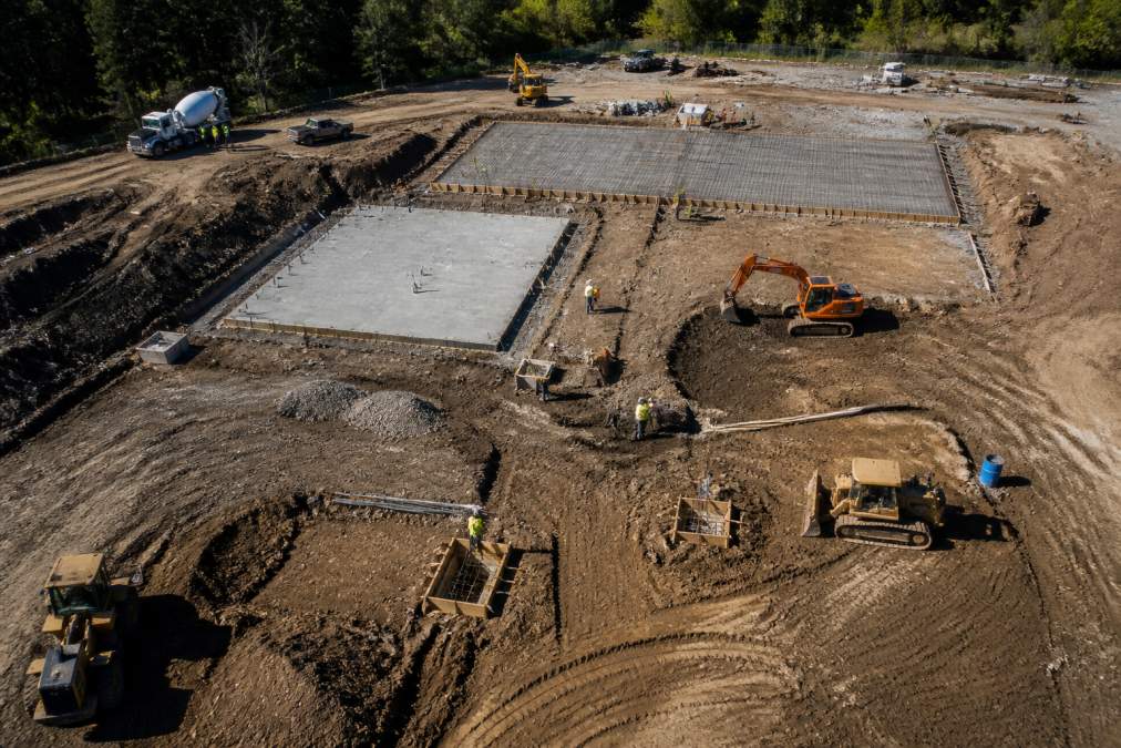
Equipment costs factor heavily into pricing. Advanced platforms equipped with high-resolution cameras, thermal imaging (FLIR), and multispectral sensors command higher rates than basic visual documentation. A certified remote pilot operating state-of-the-art technology invests significantly in hardware maintenance, software subscriptions for flight planning and data processing, and compliance with Part 107 regulations.
Turnaround time also affects cost. Rush processing of orthomosaic imagery and 3D models costs more than standard delivery windows. If your project needs deliverables within 24 hours rather than five business days, expect to pay a premium for expedited data processing and cloud storage acceleration.
Insurance and liability coverage represent real overhead that responsible operators pass through to clients. Professional drone services carry comprehensive general liability and errors & omissions insurance, which protects both the operator and the client. This safety net adds to the service cost but reflects genuine risk management.
Hourly vs. Per-Project Rate Structures for Construction Monitoring
Construction monitoring drone services typically use one of two billing models: hourly rates or fixed project fees. Each structure has advantages depending on your project scope and timeline predictability.
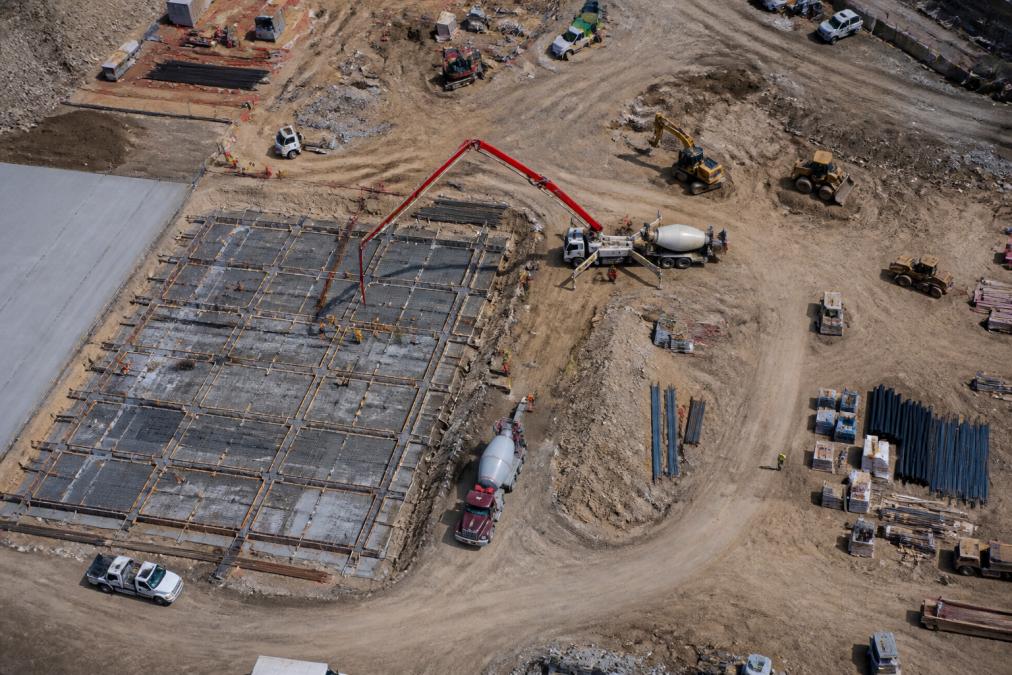
Hourly rates usually range based on pilot certification, equipment sophistication, and geographic location. An operator charges for flight time, ground setup, and mobilization. This model works well for single-visit site inspections or when the exact scope remains unclear at booking. You pay for actual time spent, which can feel transparent but creates budget uncertainty if flights take longer than expected.
Per-project pricing locks in a fixed fee for a defined deliverable: one complete site survey, a month of weekly progress monitoring, or a comprehensive orthomosaic and 3D model. This structure suits ongoing construction monitoring contracts where you need consistent aerial documentation. Fixed-fee arrangements eliminate billing surprises and align the service provider's efficiency with your budget certainty.
Hybrid models blend both approaches. A provider might charge a mobilization fee (travel to site) plus an hourly rate for flight time, or offer a monthly retainer for unlimited site visits within defined parameters. This flexibility appeals to projects with variable monitoring needs.
The right structure depends on your project scope and contract type. Recurring contracts, weekly or bi-weekly progress monitoring over months, favor fixed monthly fees because they simplify budgeting and encourage the operator to develop efficient workflows. One-time site surveys often work better on hourly or per-project bases because scope is clearly defined upfront.
Understanding the Cost of Drone Construction Progress Report Delivery
The drone construction progress report isn't just raw footage. Processing that footage into actionable deliverables drives a significant portion of the total cost. Raw flight data requires substantial post-processing before it becomes useful for project stakeholders.
Orthomosaic imagery, a georeferenced, high-resolution aerial photograph of the entire site, requires stitching hundreds of individual photos together with ground control points and photogrammetry software. This process transforms raw sensor data into a unified image that shows progress and site conditions from a consistent perspective. Processing time depends on site area, resolution requirements, and weather conditions during the flight.
3D modeling and volumetric analysis add another layer of complexity. Photogrammetry software reconstructs the site as a three-dimensional model, allowing engineers to measure stockpiles, excavation depth, and material volumes without sending personnel into potentially hazardous areas (peer-reviewed research). This capability justifies higher processing costs but delivers measurable ROI for projects tracking material movement and earthwork progress.
Cloud storage and data management costs accumulate when projects generate hundreds of gigabytes of high-resolution imagery monthly. Secure cloud storage, backup redundancy, and access management systems protect your project data but require ongoing subscription fees that operators factor into pricing.
Deliverable format also affects cost. Basic PDF reports with annotated photos cost less than interactive web portals where stakeholders can view 3D models, compare time-series imagery, and generate custom reports on demand. The portal approach requires ongoing software maintenance and hosting, justifying premium pricing.
Turnaround time for deliverables directly impacts cost. Standard processing might take five business days. Expedited delivery within 24 hours requires dedicated resources and faster processing pipelines, commanding a substantial markup.
How Often Should You Schedule Construction Site Inspection Drone Visits
Optimal flight frequency depends on project phase, contract requirements, and stakeholder needs. There's no universal answer, but construction managers can calculate the right cadence based on project milestones and monitoring objectives.
Early-stage projects often require baseline documentation: a comprehensive site survey showing existing conditions before mobilization begins. This initial flight establishes ground control points and creates reference imagery for comparison. One baseline flight typically costs less than ongoing monitoring because it's a single, well-defined deliverable.
Active construction phases benefit from weekly or bi-weekly progress monitoring. Regular aerial documentation shows equipment positioning, material stockpile changes, structural progress, and site safety compliance. Weekly flights create a visual record of project advancement and catch potential delays or quality issues early. Bi-weekly monitoring reduces frequency for projects with slower pace or stable conditions.
Critical milestones, foundation completion, structural frame topping out, facade installation, warrant additional flights beyond the regular schedule. These milestone captures document achievement and provide stakeholders with compelling visual proof of progress.
Some projects implement event-triggered flights rather than calendar-based schedules. Weather delays, equipment breakdowns, or safety incidents prompt unscheduled drone documentation. This flexible approach reduces unnecessary flights during slow periods while ensuring documentation when conditions changes.
Monthly contracts typically include two to four scheduled flights, with the flexibility to add additional visits for specific events. This cadence balances documentation needs with budget constraints for most active construction projects.
Post-construction phases often drop to monthly or quarterly documentation for warranty monitoring and long-term asset management. Once active construction ends, the need for frequent updates decreases unless specific issues require tracking.
Calculating ROI of Drone Construction Monitoring for Your Project
Drone construction monitoring delivers measurable return on investment through risk reduction, efficiency gains, and stakeholder communication improvements. Construction managers can quantify these benefits to justify the service cost.
Risk mitigation represents the primary ROI driver. Aerial site inspections identify safety hazards, equipment positioning problems, and compliance issues before they escalate into costly incidents or project delays. Documenting site conditions regularly protects all parties by creating an objective visual record. If disputes arise about workmanship, timeline, or responsibility for damage, orthomosaic imagery and dated flight logs provide irrefutable evidence.
Schedule acceleration generates secondary ROI. Aerial progress documentation reduces the need for ground-based site walks and manual progress tracking. Project managers access current site conditions instantly through cloud-based imagery rather than waiting for field reports. This visibility enables faster decision-making and reduces delays caused by information gaps.
Stakeholder confidence translates to business value. Investors, lenders, and clients gain confidence when they see regular aerial documentation of progress. This visual proof reduces financing delays, accelerates approval cycles, and strengthens client relationships. For projects seeking additional funding or facing stakeholder scrutiny, regular drone progress reports justify their cost through improved capital access.
Quality documentation prevents rework and change orders. Detailed orthomosaic imagery and 3D models show exactly what was constructed versus what was specified. Catching deviations early, before subsequent trades build on incorrect work, prevents expensive rework. The cost of one avoided change order typically exceeds a year of monitoring flights.
Quantifying ROI requires baseline assumptions. A typical mid-sized construction project might budget for drone monitoring. If that monitoring prevents a single week's delay (worth extended overhead, financing costs, and crew idle time), the ROI becomes obvious. Even preventing one costly change order justifies months of aerial documentation.
Recurring contracts with Gods Eye Drone create predictable monthly costs, making ROI calculation straightforward. Fixed fees eliminate billing surprises and allow accurate project budgeting.
Insurance, Licensing, and Hidden Costs in Drone Services
Professional drone construction monitoring involves regulatory, insurance, and operational costs that responsible providers factor into pricing. Understanding these hidden expenses helps you evaluate quotes accurately.
Part 107 certification is mandatory for commercial drone operations. Remote pilots must pass FAA knowledge tests, maintain current certifications, and comply with airspace regulations (faa.gov). This requirement isn't hidden, it's foundational to legal operations. Providers without current Part 107 credentials operate illegally and expose clients to liability.
Liability insurance protects both operator and client. Professional drone services carry general liability coverage for property damage, bodily injury, and errors & omissions (faa.gov). This insurance costs thousands annually and is non-negotiable for legitimate operators. Quotes from uninsured operators appear cheaper but shift risk entirely to your project.
Flight authorization and airspace coordination add operational costs. Many construction sites require FAA airspace authorization, especially near airports or restricted areas. Some sites require coordination with local authorities or property owners. These administrative steps take time and sometimes involve fees that operators pass through.
Mobilization fees cover travel to your site. A provider charging for flight time might add a mobilization fee for equipment transport and setup. This cost is legitimate, it reflects real overhead, but it's sometimes presented as a surprise after the initial quote.
Data storage and cloud management involve ongoing costs. High-resolution imagery consumes significant storage capacity. Secure, redundant cloud storage with backup systems costs money monthly. Some operators include basic storage in their pricing; others charge separately.
Software subscriptions for flight planning, data processing, and project management add to overhead. Flight planning software (like DJI FlightHub or similar platforms) requires active subscriptions. Photogrammetry software for processing orthomosaic imagery and 3D models involves licensing fees. These recurring costs justify higher per-project pricing.
Equipment maintenance and replacement is substantial. Professional drones cost thousands of dollars. Batteries, sensors, and propellers require regular replacement. Insurance deductibles and repair costs accumulate. Responsible operators build equipment costs into pricing rather than operating on razor-thin margins.
Choosing the Right Drone Service Provider for Your Budget
Evaluating drone service providers requires balancing cost, capability, and reliability. Price alone is a poor selection criterion for construction monitoring where quality and consistency matter.
Certification and credentials should be your first filter. Verify that pilots hold current Part 107 certifications. Ask for proof of liability insurance with adequate coverage limits. Legitimate operators provide this documentation without hesitation. Operators who deflect questions about credentials are red flags.
Equipment specifications determine what deliverables are possible. Ask specifically about camera resolution, thermal imaging capabilities (FLIR), software for photogrammetry and 3D modeling, and data processing workflows. Operators with state-of-the-art equipment deliver superior orthomosaic imagery and 3D models. This matters for ongoing monitoring where consistency and precision drive value.
Experience with construction monitoring matters more than general drone videography skills. Ask for references from similar projects. How many construction sites has the operator documented? What was the scope and duration? What deliverables did they provide? Experienced construction monitoring providers understand the specific needs of project managers and engineers.
Turnaround time and reliability affect your project workflow. Can the operator guarantee delivery of processed imagery within your required timeframe? What happens if weather delays the flight? Are backup dates available? Providers with established processes and redundant resources deliver consistently.
Pricing transparency is essential. Request itemized quotes breaking down flight costs, processing fees, mobilization charges, and any other expenses. Compare apples-to-apples across providers. The lowest total cost isn't always the best value if it excludes essential services or uses lower-quality equipment.
Contract flexibility matters for ongoing monitoring. Can you adjust flight frequency mid-contract if project conditions change? What's the cancellation policy? Are there minimum commitments? Gods Eye Drone offers flexible arrangements that adapt to your project's actual needs rather than forcing rigid predetermined schedules.
Conclusion
Drone construction monitoring pricing reflects real costs: certified pilot expertise, professional-grade equipment, comprehensive liability coverage, and sophisticated data processing. The most affordable option rarely delivers the value that construction projects require. Gods Eye Drone combines veteran-owned reliability, certified pilots, and state-of-the-art FLIR equipment to deliver precise aerial intelligence for your construction projects. Book a consultation to discuss your specific monitoring needs and receive a customized quote aligned with your project timeline and budget.
Frequently Asked Questions
Q: What factors influence the price of drone construction progress reports?
A: Drone construction monitoring pricing depends on flight complexity, site size, data processing requirements, and turnaround time. Sites requiring orthomosaic imagery and 3D modeling cost more than simple aerial photos. Equipment needs, thermal imaging, high-resolution cameras, or multispectral sensors, add to the total. Pilot certification level, Part 107 compliance, and liability insurance coverage also affect pricing. Travel distance and mobilization fees vary by location. Most providers charge based on project scope, billable hours, or recurring contract arrangements.
Q: How much does drone construction monitoring cost per site visit?
A: Pricing varies widely based on scope. Fixed-fee pricing for standard site surveys depends on site size and deliverables complexity. Hourly rates cover flight time, data processing, and report generation. Recurring contracts for ongoing progress monitoring often offer better per-visit rates than one-time inspections. Factors like ground control points setup, post-processing time, and cloud storage for geospatial data all factor into the final cost. Request a quote tailored to your specific project needs.
Q: Is drone construction monitoring charged by the hour or by the project?
A: Both models exist. Hourly billing covers pilot time, flight operations, and post-processing labor. Per-project (fixed-fee) pricing works better for well-defined scopes with predictable deliverables like orthomosaic maps or volumetric analysis reports. Recurring contracts for ongoing site monitoring often use a hybrid: a base monthly fee plus per-visit charges for additional services. Choose based on your project timeline and budget predictability. Discuss which model aligns with your construction schedule and reporting frequency.
Q: Why should construction firms invest in recurring drone site monitoring?
A: Recurring drone monitoring improves project accountability, accelerates issue detection, and reduces costly delays. Regular aerial progress reports create a documented timeline of construction phases, protecting all stakeholders. Consistent monitoring identifies safety hazards, equipment placement problems, and scope deviations early. When structured as a recurring contract, per-visit costs drop compared to one-time inspections. Many firms recover the investment through faster project completion, fewer rework cycles, and better resource allocation. The geospatial data and high-resolution imagery also serve as proof of progress for stakeholders and lenders.
This article was written using GrandRanker