 listicle
10 Benefits of Drone Mapping for Small Farms
Table of Contents
- Introduction
- 1. Real-Time Crop Health Monitoring with Multispectral Imaging
- 2. Precise Soil Health and Moisture Analysis
- 3. Automated Field Mapping and Surveying
- 4. Livestock Management and Tracking
- 5. Yield Estimation and Harvest Planning
- Understanding the Cost of Drone Mapping for Small Farms
- 6. Operational Efficiency and Time Savings
- 7. Input Management and Fertilization Optimization
- Regulatory and Legal Compliance for Agricultural Drones
- Small-Farm-Specific ROI: Why Drone Mapping Works at Smaller Scales
- Frequently Asked Questions
Last Updated: August 21, 2026
Introduction
Drone mapping has transformed small-farm operations. What once required expensive consultants and weeks of manual surveying now happens in hours with a single flight. Small-farm economics are different, you can't absorb the cost of inefficiency the way larger operations do.
At Gods Eye Drone, we've worked with agricultural managers who initially questioned whether drone mapping made financial sense for their acreage. This guide walks through the concrete advantages that make drone mapping worth the investment, from real-time crop health monitoring to precise yield forecasting, focusing on practical applications rather than theoretical capabilities.
1. Real-Time Crop Health Monitoring with Multispectral Imaging
Multispectral imaging captures what the human eye cannot see. Drones equipped with multispectral sensors record light across multiple wavelengths, including near-infrared bands that reveal plant stress before visible symptoms appear. This technology generates vegetation indices like NDVI (Normalized Difference Vegetation Index), which quantifies plant health across your entire field. A healthy plant reflects more near-infrared light; a stressed plant reflects less, creating a color-coded map showing exactly where crop vigor is declining.
Traditional scouting requires walking rows, which takes days for even modest acreage (peer-reviewed research). A drone flight takes 20-30 minutes and delivers data within hours. If disease pressure or nutrient deficiency appears in one field section, you address it immediately rather than waiting for a scheduled scout visit. Small farms benefit because you can target treatment to specific zones rather than spraying or fertilizing the entire field uniformly.
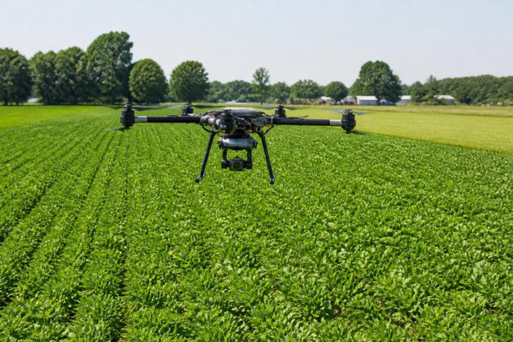
The data integrates with precision agriculture platforms. Software like PIX4Dfields processes multispectral imagery to generate actionable insights automatically. For small farms, this capability levels the playing field against larger operations that can afford dedicated agronomists.
2. Precise Soil Health and Moisture Analysis
Soil moisture drives yield. Drone-based thermal imaging and multispectral analysis reveal moisture patterns across your entire operation. Thermal sensors detect temperature differences that correlate with soil moisture, wet soil holds heat differently than dry soil, creating thermal signatures visible from above. Combined with multispectral data showing plant water stress, you build a complete picture of moisture distribution.
Small farms operating on limited water budgets see immediate value. Targeting irrigation to zones that actually need it conserves resources and lowers input costs. On fields with variable topography or soil types, drone analysis reveals which areas drain faster or retain moisture longer, allowing you to adjust application rates accordingly.
Multispectral data also supports long-term soil health tracking. Comparing imagery across seasons shows how management practices affect soil condition. If cover cropping or reduced tillage improves organic matter, the vegetation response visible in subsequent drone flights confirms the benefit.
3. Automated Field Mapping and Surveying
Accurate field boundaries and topography matter for everything from equipment routing to drainage planning. Traditional surveying requires a professional crew and costs hundreds to thousands per field. Drone photogrammetry delivers the same accuracy in a single flight.
Drones capture overlapping aerial images that software stitches into orthomosaics, geometrically corrected maps where every pixel represents a known ground location. These maps serve as base layers for all other analysis. Field boundaries become precise digital records rather than estimated lines on paper. Topography emerges from the same imagery through photogrammetry, creating digital elevation models that reveal drainage patterns and slope challenges.
For small farms with irregular field shapes or multiple parcels, this automated mapping eliminates guesswork. You know exact acreage, not approximate. The data persists and integrates with farm management software, providing a foundation for variable-rate application maps, yield maps, and field-specific recommendations.
4. Livestock Management and Tracking
For farms with grazing animals or distributed herds, drone imagery provides rapid stock counts and condition assessment without manual labor. Thermal imaging reveals animal location even in dense vegetation, and high-resolution imagery shows herd condition and behavior patterns.
Mustering livestock becomes more efficient. Rather than riding or walking pastures to locate animals, you fly a drone survey that shows where cattle or sheep are concentrated. Thermal imaging detects stressed or sick animals by identifying heat signature anomalies, allowing early intervention before conditions spread.
Pasture use becomes visible. Drone imagery shows grazing patterns and which areas are underutilized, guiding rotational grazing decisions. For operations managing animals across dispersed land, drone surveys replace frequent manual checks, reducing labor while maintaining visibility necessary for good herd management.
5. Yield Estimation and Harvest Planning
Predicting yield before harvest allows you to plan storage, equipment, and labor requirements with confidence. Drone-based yield prediction uses multispectral data and photogrammetry to estimate grain or forage production across entire fields. Software analyzes plant density, canopy development, and stress indicators to generate yield maps showing which field zones will produce more or less grain.
For small farms with limited storage or equipment capacity, knowing yield distribution prevents bottlenecks and allows better use of available resources. Harvest planning becomes more precise, if a field's eastern section will yield significantly more than the western section, you can schedule harvest timing and equipment deployment accordingly.
Yield maps also support post-harvest analysis. Comparing predicted yield to actual harvest results reveals which management practices worked, improving your decision-making over time.
Understanding the Cost of Drone Mapping for Small Farms
Many small farms partner with professional drone operators rather than purchasing equipment themselves. This approach eliminates capital investment while providing access to certified pilots and current technology. Gods Eye Drone offers per-flight pricing that scales with acreage and analysis complexity.
The financial case strengthens when you calculate avoided costs. Reduced input waste through precision application, prevented crop losses from early disease detection, and labor savings from automated scouting typically exceed the cost of drone services within the first season. Small farms benefit from the flexibility of service-based drone work, you can start with basic monitoring to evaluate ROI, then expand to more intensive analysis if results justify it.
6. Operational Efficiency and Time Savings
Faster Field Scouting and Decision-Making
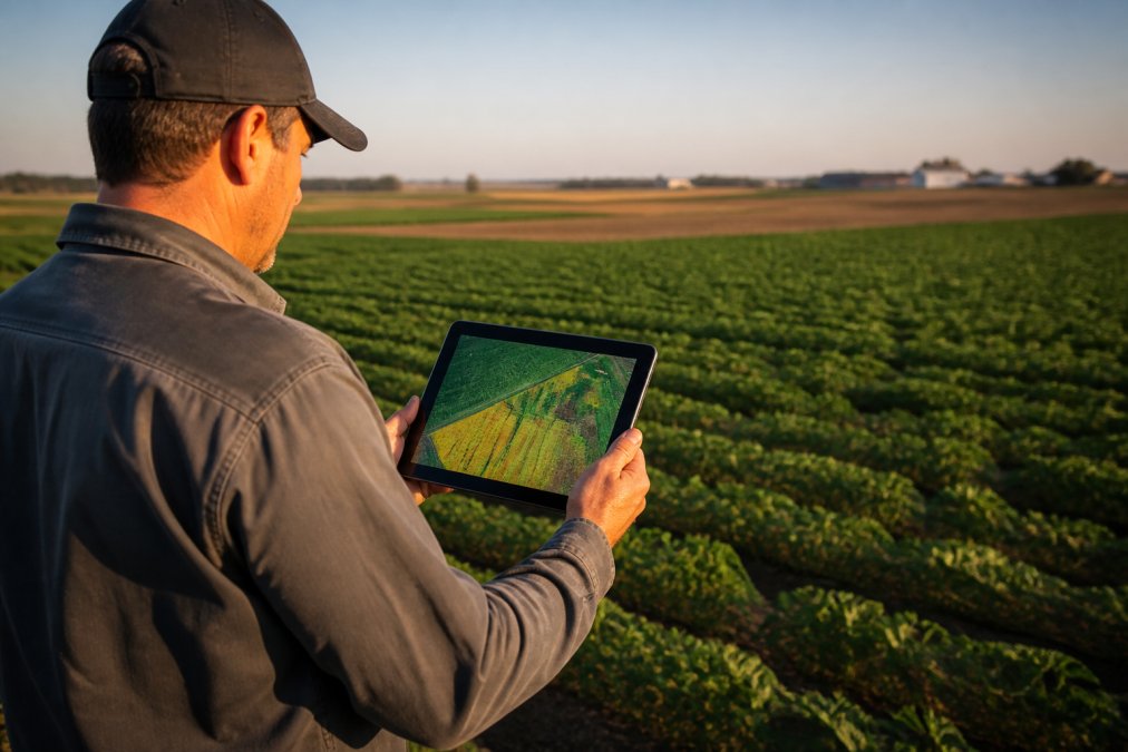
Traditional field scouting consumes 10-15 hours per week during the growing season (usda.gov). Drone flights compress this into 30-45 minutes of flight time plus 1-2 hours of data review. You see the entire field at once, identify problem zones, and prioritize where to conduct ground-truthing.
A morning drone flight delivers analysis by afternoon, allowing same-day decision-making. If you spot disease pressure or nutrient stress, you can source inputs and plan treatment before the problem spreads.
Reduced Manual Labor and Inspection Time
Small farms often operate with minimal staff. Drone-based monitoring reduces labor hours directly by replacing walking surveys with data review. For infrastructure inspection, checking irrigation lines, fence condition, or equipment placement across fields, drones provide rapid visual assessment. Rather than walking miles of irrigation line, you fly the field and identify problem areas from aerial imagery.
Livestock checking becomes faster with drone surveys. Rather than riding pastures daily, you conduct weekly drone flights to verify animal locations and condition. The labor savings compound across the season, freeing staff for other management tasks.
7. Input Management and Fertilization Optimization
Applying fertilizer uniformly across fields wastes money on over-application in low-need zones and under-applies in areas that need more. Drone-based multispectral analysis reveals plant nutrient status across your fields, enabling variable-rate fertilization that matches application to actual need.
NDVI and other vegetation indices correlate with plant nutrient status. Drone analysis generates prescription maps that direct equipment to apply more fertilizer in stressed zones and less in areas with adequate nutrition. For small farms operating on tight input budgets, reducing fertilizer use through variable-rate application based on drone analysis saves money without sacrificing yield.
Drone data also supports fertilization timing decisions. If multispectral imagery shows uniform crop development and adequate nutrition, you can skip a planned application. Conversely, if stress appears in specific zones, you can apply corrective treatments immediately.
Software like PIX4Dfields generates variable-rate maps that export directly to precision application equipment. Weed pressure also appears in drone imagery, allowing you to target herbicide application rather than spraying the entire field.
Regulatory and Legal Compliance for Agricultural Drones
Operating drones for agricultural purposes requires compliance with FAA Part 107 regulations (faa.gov). Any commercial drone operation, including mapping your own fields for business purposes, requires a Part 107 certificate for the pilot. Working with a service provider like Gods Eye Drone ensures compliance without requiring you to obtain certification yourself.
Insurance and liability coverage matter when drones operate over property and equipment. Professional drone operators carry liability insurance that protects you in the unlikely event of equipment damage or injury. Documentation of drone flights supports your record-keeping and can be valuable if questions arise about management practices or yield variations.
Small-Farm-Specific ROI: Why Drone Mapping Works at Smaller Scales
The economics of drone mapping favor small farms more than many realize. Small farms see the same percentage improvement as large operations, but the per-acre impact is often higher because small farms typically operate with tighter margins and less room for waste.
Input savings drive ROI on small farms. Reducing fertilizer use through precision application, preventing disease losses through early detection, and optimizing irrigation all generate direct cost savings. A 50-acre operation saving fuel through efficient field routing, plus reduction in fertilizer, plus prevented disease loss in one field section, easily exceeds the cost of seasonal drone monitoring.
Labor savings matter more on small farms. Every hour of scouting time saved is labor available for other tasks or the ability to operate with smaller crews. Service-based drone work removes the capital barrier, allowing you to pay per flight and scale up monitoring as results justify it.
Drone mapping transforms small-farm management by delivering data that was previously available only to large operations with dedicated resources. Real-time crop health monitoring, precise soil analysis, and optimized input management directly improve profitability and reduce operational risk. Gods Eye Drone brings this capability to small farms with certified pilots, state-of-the-art multispectral technology, and the expertise to translate raw imagery into actionable insights. Book Now to discuss how drone mapping can improve your specific operation.
=== FAQ ANSWERS (audit these too, same rules) ===
[1] Q: What are the primary advantages of using drone mapping on small farms? A: Drone mapping delivers real-time crop health data, precise field measurements, and actionable insights without manual scouting. Small farms benefit from faster decision-making, reduced labor costs, and the ability to spot problems like crop stress or soil moisture issues before they spread. Remote sensing through aerial imagery lets you monitor dozens or hundreds of acres in hours instead of days, freeing up time for other critical farm operations.
[2] Q: How does multispectral imaging for crop health monitoring work? A: Multispectral imaging captures light across multiple spectral bands, including near-infrared and red edge wavelengths, to create vegetation indices like NDVI that reveal plant health invisible to the naked eye. These indices measure chlorophyll content, water stress, and nutrient deficiency, allowing you to apply fertilizer and water precisely where needed. Small farms using multispectral data typically reduce input costs while improving yields by targeting problem areas instead of treating entire fields uniformly.
[3] Q: What FAA Part 107 requirements apply to agricultural drones? A: The FAA Part 107 rules require that commercial drone operations be conducted by certified remote pilots, flights stay below 400 feet, and drones remain within visual line of sight. For small farms using drone services, hiring a certified pilot ensures legal compliance and proper insurance coverage. If you operate your own drone, you must pass the Part 107 knowledge test and maintain current certification, which involves understanding airspace rules and safety protocols specific to agricultural operations.
[4] Q: How much does drone mapping cost for small farms? A: Drone mapping costs depend on farm size, frequency of flights, sensor type, and whether you hire a service or invest in equipment. Professional drone services pricing varies based on acreage and analysis needs, so it's best to request a quote tailored to your operation. Some small farms start with occasional drone flights for critical decisions, while others invest in ongoing multispectral monitoring. Software platforms for processing drone imagery range from subscription models to perpetual licenses, with costs scaling based on acreage and feature access.
[5] Q: Can drone mapping help small farms reduce fertilizer and pesticide costs? A: Yes. Drone mapping identifies areas of crop stress, nutrient deficiency, and pest pressure with spatial precision, enabling variable rate application instead of blanket treatments. By applying inputs only where needed, small farms reduce waste and chemical costs while improving environmental stewardship. Prescription maps generated from drone imagery guide tractors and sprayers to target specific zones, often reducing input spending while maintaining or improving yields.
Frequently Asked Questions
What are the primary advantages of using drone mapping on small farms?
Drone mapping delivers real-time crop health data, precise field measurements, and actionable insights without manual scouting. Small farms benefit from faster decision-making, reduced labor costs, and the ability to spot problems like crop stress or soil moisture issues before they spread. Remote sensing through aerial imagery lets you monitor dozens or hundreds of acres in hours instead of days, freeing up time for other critical farm operations.
How does multispectral imaging for crop health monitoring work?
Multispectral imaging captures light across multiple spectral bands, including near-infrared and red edge wavelengths, to create vegetation indices like NDVI that reveal plant health invisible to the naked eye. These indices measure chlorophyll content, water stress, and nutrient deficiency, allowing you to apply fertilizer and water precisely where needed. Small farms using multispectral data typically reduce input costs while improving yields by targeting problem areas instead of treating entire fields uniformly.
What FAA Part 107 requirements apply to agricultural drones?
The FAA Part 107 rules require that commercial drone operations be conducted by certified remote pilots, flights stay below 400 feet, and drones remain within visual line of sight. For small farms using drone services, hiring a certified pilot ensures legal compliance and proper insurance coverage. If you operate your own drone, you must pass the Part 107 knowledge test and maintain current certification, which involves understanding airspace rules and safety protocols specific to agricultural operations.
How much does drone mapping cost for small farms?
Drone mapping costs depend on farm size, frequency of flights, sensor type, and whether you hire a service or invest in equipment. Professional drone services pricing varies based on acreage and analysis needs, so it's best to request a quote tailored to your operation. Some small farms start with occasional drone flights for critical decisions, while others invest in ongoing multispectral monitoring. Software platforms for processing drone imagery range from subscription models to perpetual licenses, with costs scaling based on acreage and feature access.
Can drone mapping help small farms reduce fertilizer and pesticide costs?
Yes. Drone mapping identifies areas of crop stress, nutrient deficiency, and pest pressure with spatial precision, enabling variable rate application instead of blanket treatments. By applying inputs only where needed, small farms reduce waste and chemical costs while improving environmental stewardship. Prescription maps generated from drone imagery guide tractors and sprayers to target specific zones, often reducing input spending while maintaining or improving yields.
This article was written using GrandRanker