 how-to
Mitigate Drone Site Monitoring Risks: 7-Step Plan
Table of Contents
- Why Drone Site Monitoring Risk Management Matters
- Step 1: Complete Your FAA Part 107 Compliance Checklist
- Step 2: Conduct a Pre-Flight Aerial Inspection Risk Assessment
- Step 3: Establish Flight Protocols for Mitigating Drone Collision Risks
- Step 4: Secure Your Data Management and Privacy Systems
- Step 5: Invest in Operator Training and Certification
- Step 6: Plan for Weather and Environmental Risk Mitigation
- Step 7: Review Insurance and Liability Coverage Options
- Frequently Asked Questions
Last Updated: September 7, 2026
Why Drone Site Monitoring Risk Management Matters
Drones have transformed construction site monitoring, but every flight introduces operational, legal, and data-related hazards that demand structured mitigation. Drone site monitoring risks span mid-air collisions, equipment failure, regulatory noncompliance, data breaches, and liability exposure, and ignoring them can halt a project or trigger costly enforcement action. Managing these risks is not a one-time checklist; it is a continuous discipline that protects workers, assets, and your bottom line.
A proactive risk framework separates smooth operations from costly groundings. The consequences of unmanaged oversight are real: property damage, worker injury, privacy violations, and project delays. Aerial inspections must be governed by the same rigor you apply to any other safety-critical activity on site.
Below, we'll show you exactly how to implement a seven-step plan that addresses the full risk lifecycle. The FAA and industry best practices shape this framework, and the FAA's official guidance on small unmanned aircraft operations serves as the foundational reference for any compliant program.
Step 1: Complete Your FAA Part 107 Compliance Checklist
A compliant drone operation begins with FAA Part 107 certification, which governs all commercial small unmanned aircraft flights. Your FAA Part 107 compliance checklist must confirm that every pilot holds a current Remote Pilot Certificate and that each aircraft is registered and marked with its unique identifier (faa.gov).
The checklist extends beyond paperwork. Verify that the aircraft has undergone a pre-flight inspection, that airspace authorizations are current for the specific site, and that visual line of sight can be maintained throughout the mission. Many operators miss the requirement to check temporary flight restrictions, which can appear suddenly near emergency response zones.
Documentation is your defense. Maintain a flight log for every sortie, recording time, location, weather conditions, and any anomalies. This safety documentation becomes critical evidence if an incident occurs or a regulator requests records. A common mistake is treating compliance as an annual event rather than a per-flight verification.
Step 2: Conduct a Pre-Flight Aerial Inspection Risk Assessment
An aerial inspection risk assessment identifies site-specific hazards before the aircraft leaves the ground. Walk the perimeter, note obstacles like cranes, power lines, and guy wires, and map out exclusion zones where personnel are working. This ground survey directly informs your flight path and altitude choices.
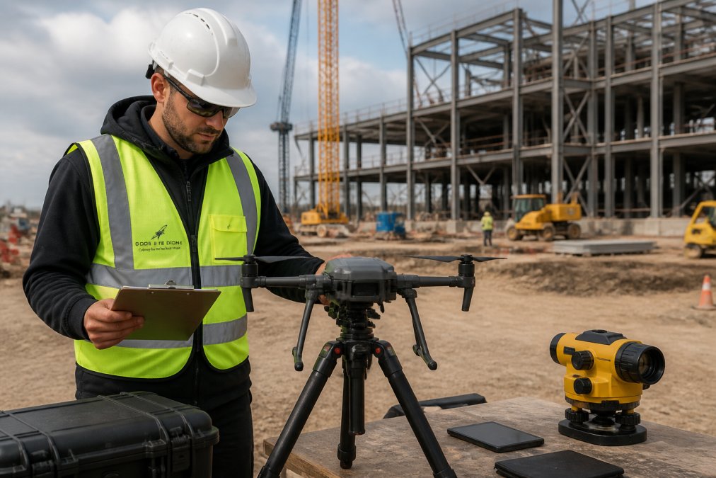
The assessment should evaluate proximity to people, structures, and restricted airspace. Determine whether the mission can be flown safely or whether conditions require postponement. This is also the moment to confirm that the automated flight paths you plan to use avoid known obstacles and that a manual override is available at all times.
A structured risk matrix helps you decide. Score each identified hazard by likelihood and severity, then determine whether mitigation brings the residual risk to an acceptable level. If it does not, the flight does not proceed. This preventive measure is the single most effective way to reduce incident rates.
Step 3: Establish Flight Protocols for Mitigating Drone Collision Risks
Mitigating drone collision risks requires clear, enforced protocols that govern every flight operation. Establish a defined flight zone that excludes workers, vehicles, and bystanders, and communicate it through site signage and a daily safety briefing. The pilot in command retains authority to abort the mission at any moment.
Your protocols should specify minimum altitudes above personnel, maximum speeds near structures, and buffer distances from cranes and scaffolding. Use geofencing and obstacle avoidance systems as backup layers, but never as substitutes for pilot vigilance. Many operators rely on automated functions while losing situational awareness, which is a leading cause of avoidable incidents.
| Risk Protocol | Implementation | Primary Benefit |
|---|---|---|
| Exclusion zones | Marked boundaries, daily briefing | Worker injury prevention |
| Altitude minimums | Set per site, verified pre-flight | Reduced collision exposure |
| Manual override | Pilot maintains control access | Immediate risk mitigation |
| Geofencing | Software limits on flight area | Automated boundary enforcement |
Incident reporting is part of the protocol. Require immediate documentation of any near miss, and review each event to refine procedures. This loop between operations and safety audits builds an increasingly resilient program over time.
Step 4: Secure Your Data Management and Privacy Systems
Site footage is sensitive operational data, and drone site monitoring risks include unauthorized access, theft, and privacy violations. Treat every image and video stream as confidential project information with defined handling procedures. Encrypt data during transmission and at rest, and restrict access to personnel with a verified need.
The unique angle here is the technical depth of the cybersecurity threat model. Most general articles mention 'data security' in a single sentence. A robust mitigation plan requires understanding the specific attack vectors and the mechanisms to counter them.
The Encryption Standard is Non-Negotiable
For data in transit, the industry-standard is AES-256 encryption for the video downlink and telemetry stream (nist.gov). This prevents passive interception of the feed by unauthorized parties on the ground. For data at rest, the microSD card or internal storage on the aircraft and the ground control station (GCS) must also be encrypted. If a drone is lost or stolen, an unencrypted card is a direct data breach. Most enterprise-grade drones now support this natively; verify it is enabled in the settings and not left on the factory default.
Cloud Storage: The Hidden Risk
Many teams automatically upload footage to a cloud service for sharing. This introduces a new set of risks. Before selecting a platform, verify that it offers customer-managed encryption keys (CMEK) and multi-factor authentication (MFA) for all user accounts. A common pattern is a project manager sharing a public link to a video file, which inadvertently exposes the entire site layout to anyone with the link. Mitigation requires a strict policy: no public links, and all sharing must be done through a secure portal with time-limited access and watermarking of the footage to trace leaks.
The Privacy Obligation Beyond the Fence Line
Many programs overlook the privacy dimension of site monitoring. Adjacent properties, public roads, and even workers can appear in footage, creating obligations you must address. Establish retention policies that specify how long raw footage is kept and when it is deleted. This data management discipline reduces liability and builds trust with clients and the surrounding community.
Securing the Ground Control Station (GCS)
The GCS is the most vulnerable point in the system. It is a computer running flight software, and it is often left unattended during battery changes. Mitigation steps include:
- Full Disk Encryption (FDE) on the GCS hard drive.
- Biometric or PIN-based login that locks after 60 seconds of inactivity.
- Disabling USB ports that are not required for the flight controller to prevent 'juice jacking' or malicious firmware uploads.
A compromised feed could expose project details or, worse, provide a vector for interfering with the aircraft. By treating the data pipeline with the same rigor as the flight itself, you close the most significant gap in standard drone safety protocols.
Step 5: Invest in Operator Training and Certification
The pilot is the most critical risk control in any operation, and operator training determines how effectively every other safeguard functions. FAA Part 107 certification is the baseline, but a strong training program extends to site-specific emergency procedures, manual flight proficiency, and decision-making under pressure.
Beyond initial certification, schedule recurring proficiency checks and scenario drills. Practice engine failure responses, lost-link procedures, and emergency landing techniques in a controlled environment. These rehearsals build the muscle memory that prevents a minor malfunction from escalating into a major incident.
Training should also cover reading site conditions and recognizing when environmental factors degrade safe operations. A well-trained operator knows when to decline a mission, and that judgment is worth more than any technical capability. Documentation of training hours and checkrides strengthens your compliance posture and supports your insurance position.
Step 6: Plan for Weather and Environmental Risk Mitigation
Weather is the most unpredictable variable in drone operations, and environmental risk mitigation requires firm go or no-go criteria. Establish specific limits for wind speed, visibility, precipitation, and temperature, and check forecasts immediately before each flight. Conditions can change rapidly on an open construction site, so monitor weather throughout the mission.
Dust, fog, and glare can obscure visual line of sight even when forecasts appear acceptable. Thermal imaging sensors and other payloads have their own environmental tolerances, so verify that equipment ratings match the conditions. A sensor that fails mid-flight due to moisture or extreme cold compromises both the mission and the aircraft.
Site-specific environmental factors matter as much as regional weather. Nearby water bodies, tall structures that create wind shear, and reflective surfaces that confuse sensors all warrant attention. Build these considerations into the pre-flight assessment and adjust flight protocols accordingly.
Step 7: Review Insurance and Liability Coverage Options
A comprehensive risk program acknowledges that incidents can still occur, and insurance and liability coverage provide the financial backstop. Review your policy to confirm it covers hull damage to the aircraft, third-party property damage, and bodily injury. Some policies exclude specific operations like flights over people or beyond visual line of sight.
The gap in the market is the specific liability scenario of a drone crash on a construction site. This is not just about the drone; it is about the cascade of delays and damages that follow.
The 'Cascade' Liability Scenario
A drone crash on an active site rarely just damages the drone. The cascade includes:
- Strike Damage: Impact with a crane or scaffolding can cause structural damage requiring inspection and re-certification, halting work in that zone for days.
- Business Interruption: If the crash forces a shutdown of a critical path activity, the general contractor faces liquidated damages from the owner.
- Subcontractor Claims: If the drone falls on a subcontractor's equipment or materials, the operator may be liable for the subcontractor's downtime and replacement costs.
Most standard aviation liability policies cover the hull and third-party bodily injury/property damage, but they often exclude 'contractual liability', meaning the liability you assume under your contract with the GC. This is a critical gap.
The 'Additional Insured' Endorsement
Before a drone flies on a major project, the GC will often require that they be named as an 'Additional Insured' on your policy. This is not a formality. It extends your coverage to protect the GC against claims arising from your operations. Failure to provide this certificate is a common reason for a drone operator to be barred from a site. Verify that your insurer can issue this endorsement without a significant premium increase; if they cannot, you are underinsured for the commercial reality of the market.
Contractual Clarity: The 'Who Owns the Risk' Matrix
Liability mitigation also involves contractual clarity. Define responsibilities between the drone operator, the general contractor, and the property owner before work begins. Specify who controls the flight plan, who owns the resulting data, and how incidents will be handled. These agreements prevent disputes and clarify coverage obligations.
Ask pointed questions about your coverage limits and exclusions, and confirm that your provider understands the specific risks of construction site monitoring. As your program evolves with new aircraft or payloads, revisit coverage. An annual review aligned with your safety audits keeps protection aligned with actual operations.
Frequently Asked Questions
What are the primary safety risks when using drones for site monitoring?
The main risks fall into four categories: collision with structures, equipment, or people; regulatory violations under FAA Part 107; data breaches from unsecured footage; and equipment failure. A thorough aerial inspection risk assessment before each flight identifies site-specific hazards like cranes, power lines, or workers in the flight path. Pair that with a documented flight plan and you reduce the chance of injury, property damage, or project delays.
How do you ensure FAA Part 107 compliance during site inspections?
Start with a compliance checklist that verifies the pilot holds a current Remote Pilot Certificate, the drone is registered and marked, and the aircraft passes a pre-flight inspection. Check airspace authorization through LAANC for controlled zones and review any temporary flight restrictions (TFRs) for the day. Log each flight with details on location, duration, and weather. This documentation protects you during a safety audit and keeps your drone program in good standing.
How does weather impact drone site monitoring risk levels?
Wind speed, precipitation, and visibility directly affect control and sensor accuracy. High winds strain the motors and reduce battery life, which raises the chance of an uncontrolled landing. Rain can damage unsealed electronics, and fog or glare degrades visual data quality. Set personal minimums for your drone model: for example, no flights above 20 mph sustained winds or in visibility under 3 miles. Check the forecast and on-site conditions right before launch.
What physical security measures protect drone operations on construction sites?
Keep the ground control station within line of sight and use a spotter to keep unauthorized people away from the takeoff and landing zones. Secure the drone in a locked case when not in use to prevent theft or tampering. For the data itself, use encrypted memory cards and transfer footage to a password-protected server immediately after landing. Limit access to the flight logs and visual data to the project manager and the pilot only.