how-to
How to Get Drone Photos for Real Estate Listings
Table of Contents
- Understanding FAA Part 107 Requirements for Real Estate
- Essential Equipment for Capturing Quality Aerial Photography
- Creating a Drone Photography Checklist for Realtors
- Step-by-Step Process for Capturing Drone Photos
- Understanding the Cost of Real Estate Drone Photography
- Hiring a Professional Drone Pilot vs. DIY Approach
- Post-Production and Delivering Final Aerial Imagery
- Maximizing Marketing Impact with Aerial Real Estate Assets
- Frequently Asked Questions
Last Updated: September 3, 2026
Understanding FAA Part 107 Requirements for Real Estate
The FAA Part 107 certificate is the legal foundation for anyone operating drones commercially in the United States (faa.gov). If you're capturing drone photos for real estate listings, you need this credential, there's no workaround. The certification process involves passing a written exam administered by the FAA, demonstrating knowledge of airspace regulations, weather patterns, and safe flight operations. Most people study for 20-30 hours before attempting the test, though prior aviation experience can shorten that timeline (peer-reviewed research).
One critical detail most new operators miss: the Part 107 certificate doesn't grant blanket permission to fly anywhere. You still need to check airspace authorization for each location. The FAA's LAANC (Low Altitude Authorization and Notification Capability) system lets you request airspace approval in real time through approved applications. For real estate properties in urban or semi-urban areas, this step is non-negotiable.
At Gods Eye Drone, our certified remote pilots maintain current Part 107 credentials and understand the regulatory landscape thoroughly. This means every flight we execute for real estate clients operates within legal boundaries and follows FAA guidelines precisely.
Essential Equipment for Capturing Quality Aerial Photography
The equipment you choose directly impacts the quality of drone photos for real estate listings. Professional-grade equipment delivers the image resolution, stability, and reliability that real estate marketing demands.
Drone Selection and Camera Specifications
Your drone's camera sensor determines image quality more than any other single factor. Professional drones feature larger sensors that capture more light and produce sharper detail in varied lighting conditions. Look for drones with at least 20-megapixel cameras and RAW image capture capability, RAW files preserve more data for post-production editing and HDR processing (peer-reviewed research).
Flight time matters significantly. A drone that flies for only 15-20 minutes forces multiple battery swaps, increasing the risk of missed shots. Premium drones offer 25-35 minutes of flight time per battery, allowing comprehensive shot lists without interruption.
Obstacle avoidance technology prevents costly crashes near trees, power lines, or building structures common in residential photography. Multi-directional sensors detect and navigate around obstacles automatically, letting you focus on composition.
Gimbal Stabilization and Lens Options
The gimbal stabilizes your camera during flight, eliminating vibration and drift that would ruin footage and create blurry stills. A three-axis gimbal controls pitch, roll, and yaw movements, ensuring usable images.
Wide-angle lenses (24mm equivalent or wider) are essential for real estate work, capturing expansive property views that showcase lot size and landscaping. Some professional drones offer interchangeable lens systems, providing flexibility for different property sizes and scenarios.
Lens quality affects sharpness, color accuracy, and distortion. Premium drones employ multi-element glass designs that maintain edge-to-edge sharpness across the entire image frame.
Creating a Drone Photography Checklist for Realtors
A structured approach prevents oversights that cost time and money on location. Before every shoot, walk through a comprehensive checklist covering equipment, weather, airspace, and shot planning.
Pre-Flight Planning and Shot List Development
Define exactly what the property requires. Create a shot list capturing the property's strengths: front elevation, aerial views showing lot size, driveway and entry approach, landscaping details, and unique features like pools or outbuildings.
Nadir shots (straight-down perspective) show property footprint and lot boundaries clearly. Oblique angles (45-degree perspective) are more dynamic and show elevation and three-dimensional context. Most effective real estate marketing uses a mix of both.
Scout the property beforehand if possible. Identify power lines, tall trees, and obstacles that might constrain flight paths. Note sun direction during your planned shoot time, morning and late-afternoon light creates dimension and reduces harsh shadows.
Weather and Lighting Considerations
Wind is the primary weather concern for drone operations. Gusts above 20 mph make stable flight difficult and increase battery drain. Check wind forecasts before committing to a shoot date.
Lighting quality transforms drone photos from mediocre to compelling. Shoot during golden hour, the first hour after sunrise or final hour before sunset, when low-angle sunlight creates warm tones and pronounced shadows that reveal architectural detail. Midday sun creates harsh shadows and washes out colors.
Cloud cover affects image tone and exposure. Broken cloud cover creates visual interest in the sky while providing soft, directional light. Plan your shoot around the weather forecast.
Step-by-Step Process for Capturing Drone Photos
Executing the actual flight requires systematic preparation and disciplined technique.
Step 1: Obtain Airspace Authorization and Flight Planning
Before launching, verify that airspace authorization is required. Use the FAA's B4UFLY app or LAANC-approved applications to check for temporary flight restrictions or controlled airspace. If authorization is needed, submit your request at least a few hours before your planned flight time.
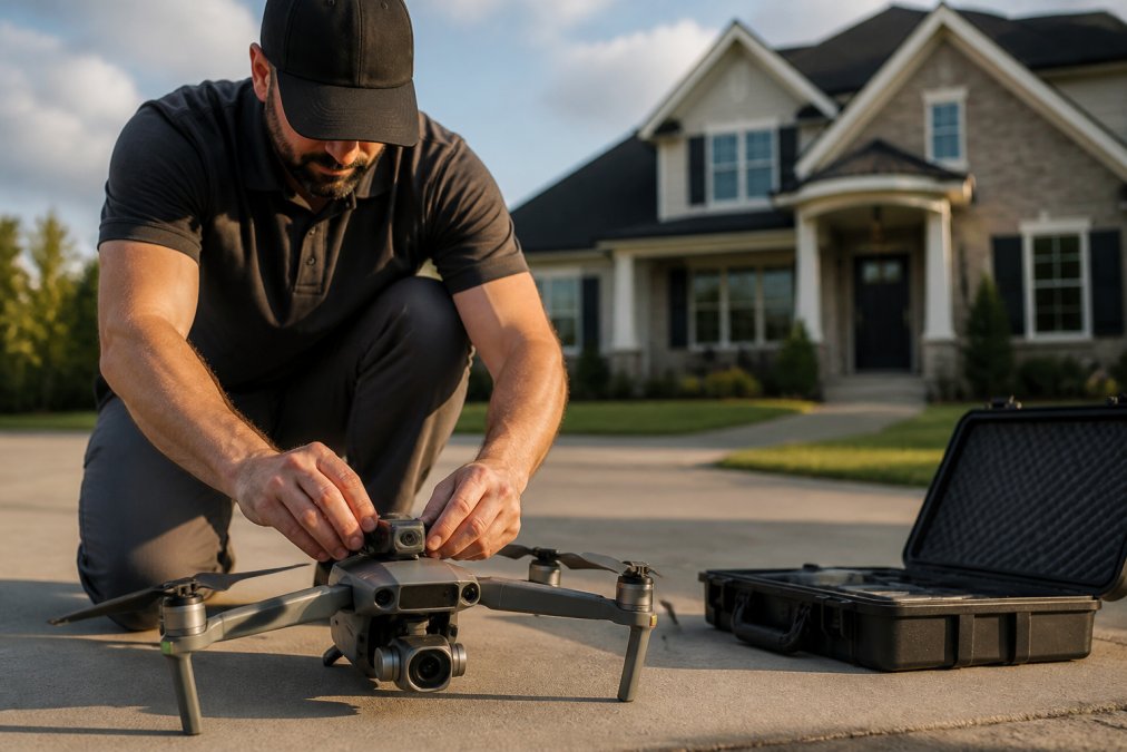
Document your flight plan, recording the property address, GPS coordinates, planned flight altitude, estimated flight duration, and weather conditions. Perform a pre-flight inspection of your aircraft, checking battery health, propeller condition, gimbal alignment, and camera lens for dust or scratches.
Step 2: Execute Nadir and Oblique Angle Shots
Begin with nadir shots directly above the property at 80-120 feet altitude for residential properties. Maintain level flight and steady altitude as you position the camera straight down.
Transition to oblique angles by banking the aircraft to 45 degrees while maintaining altitude. Fly multiple passes from different directions, north, south, east, and west, to capture the property's best angles. Vary altitude during oblique passes: closer approaches (60-80 feet) emphasize architectural detail, while higher shots (150-200 feet) show property context and neighborhood.
Step 3: Capture Multiple Image Resolutions
Shoot in the highest resolution your drone supports. Ensure your camera is set to RAW format when available. Capture multiple exposures of key shots, one at metered exposure, then bracket with overexposed and underexposed versions. This approach enables HDR processing that balances bright skies with properly exposed foregrounds.
Review images on the camera's LCD screen immediately after each pass. Check focus sharpness, exposure, and composition. If a shot missed the mark, fly another pass while on location.
Understanding the Cost of Real Estate Drone Photography
Pricing for drone photography services varies based on property size, location, and deliverables. Flight complexity, number of images required, turnaround time, and whether video is included all influence final cost.
Many real estate professionals wonder whether drone photography justifies the investment. Agents handling premium properties or competing in markets where aerial imagery is expected find drone photography essential. The visual impact typically justifies the service cost through faster sales and higher perceived property value.
When evaluating drone photography services, compare what's included in the package. Some providers deliver raw images with minimal editing; others handle full post-production, including image enhancement, HDR processing, and MLS integration.
Hiring a Professional Drone Pilot vs. DIY Approach
The decision between hiring a professional and purchasing equipment yourself hinges on volume, technical skill, and time investment. If you're a real estate agent with 15-20 listings monthly, outsourcing to a professional drone service often makes more sense than becoming a pilot yourself.
What to Look for in a Certified Remote Pilot
Verify that any drone pilot you hire holds an active FAA Part 107 certificate. Ask to see their certificate, legitimate operators keep current credentials on file.
Experience matters more than certification alone. A pilot with hundreds of real estate projects completed understands property photography requirements and can adapt to different property types and weather conditions. Ask for portfolio examples and references from other real estate professionals.
Communication skills separate good operators from great ones. A professional drone pilot should understand your marketing goals, ask clarifying questions about property features you want to emphasize, and deliver images formatted for your specific needs.
Insurance and Liability Considerations
Professional drone operators carry liability insurance that protects against potential damage or injury. Before hiring, confirm that your service provider maintains adequate coverage.
Ask about their insurance limits and what scenarios are covered. Most commercial drone insurance includes property damage and bodily injury liability.
At Gods Eye Drone, we maintain comprehensive liability coverage and understand the insurance requirements that protect both our clients and our operations. Our certified pilots are trained in risk management and operational safety, ensuring that every real estate photography project proceeds without incident.
Post-Production and Delivering Final Aerial Imagery
Raw drone images require processing to achieve professional marketing quality.
Image Editing and HDR Processing
Basic editing includes color correction, exposure adjustment, and sharpening. Most real estate drone photos benefit from slight saturation enhancement that makes skies more vibrant and landscaping more appealing.
HDR processing combines multiple exposures to preserve detail in both bright sky areas and shadowed foreground elements. This technique is particularly valuable in real estate photography where you want to showcase both the property and surrounding landscape without losing detail in either area.
Straightening horizons and correcting minor perspective distortion ensures professional appearance.
Integration with MLS and Listing Platforms
Most MLS systems now accept aerial photography as part of property listings. Verify the specific image format and resolution requirements for your local MLS before requesting final deliverables.
Organize delivered images logically so real estate agents can easily select the best shots for their listings. Provide images at multiple resolutions: high-resolution files for print marketing, web-optimized versions for online listings, and thumbnail-sized images for quick preview.
Professional photographers include copyright information, shoot date, and property details in image metadata, making it easy to manage large collections of aerial photography across multiple properties.
Maximizing Marketing Impact with Aerial Real Estate Assets
Drone photos and video transform how properties are presented to potential buyers. The elevated perspective showcases features that ground-level photography cannot capture effectively.
Aerial imagery works best when integrated into comprehensive marketing strategies. Feature drone photos prominently on listing websites and real estate portals. Use still images in email marketing campaigns and drone video clips for compelling social media content that drives engagement and property inquiries.
Aerial shots reveal neighborhood context, lot size relationships to surrounding properties, and environmental features that influence property value. This contextual information helps buyers understand the property's position and desirability within the market.
Professional presentation of aerial assets matters as much as the images themselves. High-quality display, strategic placement in listings, and thoughtful selection of which angles to showcase all influence buyer perception and marketing effectiveness.
Getting drone photos for real estate listings requires technical expertise, regulatory compliance, and professional execution. Whether you pursue the DIY path with your own equipment or partner with a professional service depends on your listing volume and technical comfort level. Gods Eye Drone brings certified expertise, state-of-the-art equipment, and a commitment to delivering aerial imagery that genuinely enhances property marketing. Our team understands real estate photography requirements and handles every aspect from flight planning through final image delivery. Book a consultation with Gods Eye Drone to explore how professional aerial photography can elevate your real estate marketing strategy.
Frequently Asked Questions
Do I need a Part 107 certified pilot for real estate drone photos?
Yes. The FAA requires any commercial drone operation, including real estate photography, to be conducted by a remote pilot holding an FAA Part 107 certificate. This certification demonstrates the pilot understands airspace regulations, safety protocols, and operational limits. Hiring a certified professional ensures legal compliance and protects you from liability. Real estate agents cannot legally operate drones for commercial purposes without this certification.
How much does professional drone photography cost for real estate listings?
Pricing for real estate drone photography depends on factors including property size, location complexity, number of images required, turnaround time, and whether additional services like post-production editing are included. Some operators charge per property, others by the hour. Contact professional drone service providers directly for quotes tailored to your specific needs and budget. Many offer tiered packages for agents with multiple monthly listings.
What makes drone photos effective for selling properties?
Drone photos showcase property features that ground-level photography cannot capture: full lot size, roof condition, surrounding landscape, proximity to amenities, and curb appeal from an elevated perspective. Aerial imagery creates emotional connection and gives buyers a complete sense of the property's setting. Studies show listings with aerial imagery receive more online views and inquiries, reducing time on market and potentially increasing final sale price for residential properties.
What equipment do I need to start capturing drone photos?
At minimum, you need a commercial-grade drone with a stabilized gimbal and high-resolution camera capable of capturing at least 20-megapixel images. A wide-angle lens (24mm equivalent or wider) is essential for property photography. You'll also need a remote pilot license (FAA Part 107), liability insurance, airspace authorization tools like LAANC, and post-production software for image editing. Professional operators invest in backup equipment, ND filters for exposure control, and HDR processing capabilities.
This article was written using GrandRanker