 how-to
Aerial Photography for Real Estate: A Complete How-To Guide
Table of Contents
- Why Aerial Photography Matters for Real Estate Listings
- How Aerial Photography Showcases Property Layout and Size
- FAA Part 107 Requirements for Real Estate Drone Operations
- Understanding Average Cost of Drone Photography for Real Estate
- Real Estate Drone Photography Checklist: Pre-Flight to Delivery
- Post-Production and Editing Standards for Professional Results
- Legal and Liability Considerations for Real Estate Agents
- Conclusion
- Frequently Asked Questions
Last Updated: August 11, 2026
Why Aerial Photography Matters for Real Estate Listings
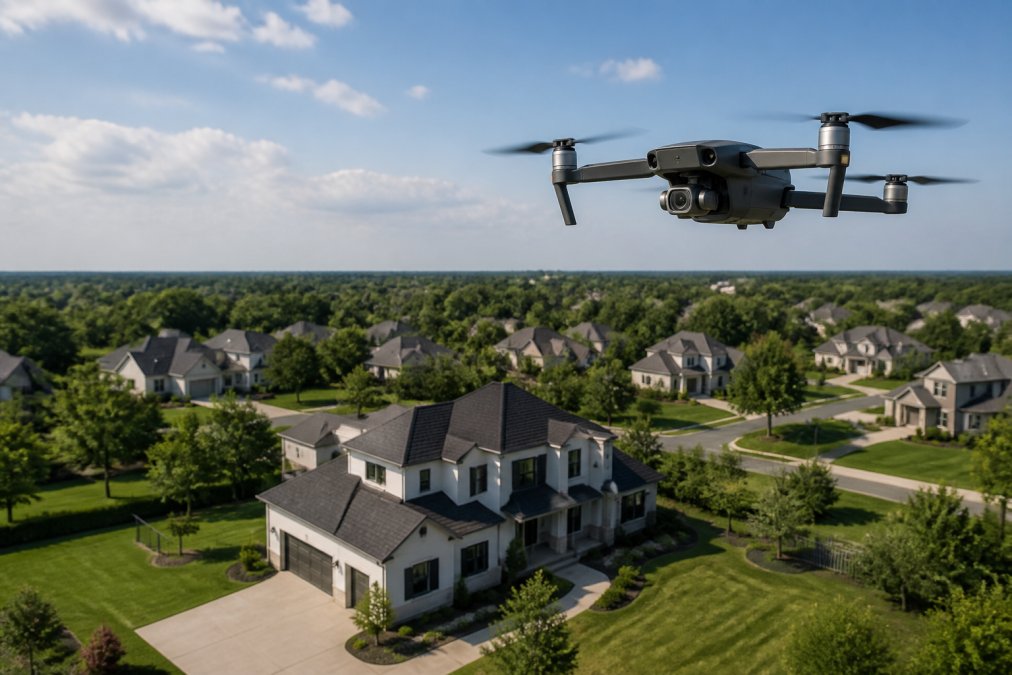
Aerial photography for real estate listings has become essential for agents competing in today's market. The bird's-eye view captures what ground-level photos simply cannot: the complete property layout, lot size, neighboring amenities, and the relationship between the home and its surroundings. This perspective transforms how buyers understand a property before they ever step foot on the land.
At Gods Eye Drone, we've seen firsthand how aerial imagery changes buyer behavior. The reason is straightforward: buyers can now see what they're actually purchasing. They understand the property boundaries, the scale of the land, and how the home sits within the neighborhood context.
The competitive advantage is real. In markets where dozens of homes compete for attention, aerial photography creates immediate visual differentiation. A listing with captivating drone footage stands out in search results and social feeds. It signals professionalism and investment in marketing. Buyers notice.
:::\nAerial photography for real estate listings converts casual browsers into serious buyers by showing the complete property story in seconds. :::
How Aerial Photography Showcases Property Layout and Size
The most powerful aspect of aerial photography is revealing property scale and layout in ways that are impossible from ground level. A two-acre residential lot looks different when you can see the entire perimeter, the driveway approach, the relationship to neighboring properties, and the surrounding landscape. Buyers instantly grasp whether a property is on a busy road, nestled in a quiet neighborhood, or positioned for privacy.
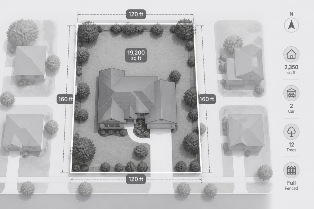
Aerial shots reveal property features that listing descriptions struggle to communicate. The actual size of a backyard, the configuration of multiple buildings, the presence of a pool or outdoor structure, all become immediately obvious from above. A property with mature trees creating a canopy looks completely different in aerial imagery than in photos taken from the ground. Buyers see the environmental context: Is the property on a hillside? Is it surrounded by commercial development or other homes? These details drive decision-making.
For larger properties, estates, commercial land, multi-unit developments, aerial photography becomes almost mandatory. A 10-acre parcel cannot be meaningfully understood from ground-level photos alone. The aerial perspective shows the full scope of the investment. It demonstrates road access, utility infrastructure visibility, and the relationship to surrounding land use. Professional aerial imagery for real estate listings makes these properties market-ready and competitive.
The editing process matters here too. High-resolution aerial shots need to be color-corrected, cropped for composition, and sometimes stitched together for panoramic views. The final images should look polished and professional, not like raw drone footage. This is where post-production separates professional results from amateur work.
FAA Part 107 Requirements for Real Estate Drone Operations
Anyone operating a drone for commercial purposes, including real estate photography, must comply with FAA Part 107 regulations. This is not optional. The rules exist for safety and airspace management. Understanding them protects you, your clients, and your business.
FAA Part 107 requires that commercial drone operators hold a Part 107 certificate. This means passing a written exam administered by the FAA, demonstrating knowledge of airspace rules, weather considerations, and emergency procedures. The certificate is valid for two years and requires renewal. Operators must maintain visual line of sight with the aircraft at all times, fly during daylight hours, and stay below 400 feet above ground level.
The regulations also prohibit flying over people, flying beyond visual line of sight, and operating in certain restricted airspace without clearance. Real estate agents hiring a drone service should always verify that the operator holds a current Part 107 certificate. This is your assurance that the work is being performed legally and safely. Gods Eye Drone's certified pilots hold active Part 107 certifications and maintain current knowledge of all FAA regulations governing commercial drone operations.
Beyond the certificate itself, operators must understand airspace restrictions. Many areas require coordination with local airports or military installations. Some properties sit in restricted zones. A professional operator knows how to check the airspace before scheduling a shoot. They understand the difference between Class B, C, D, and E airspace and know which require prior approval. This knowledge prevents legal complications and ensures the shoot can proceed as planned.
Understanding Average Cost of Drone Photography for Real Estate
Pricing for aerial photography for real estate varies based on property size, complexity, turnaround time, and the deliverables included. Factors that influence cost include the number of photos and video clips requested, whether editing and color correction are included, if a same-day delivery is needed, and whether the operator needs to travel outside their service area.
Most professional drone services price per project rather than per hour, though some offer package deals for agents with multiple monthly listings. The scope of work matters significantly. A simple property with straightforward angles costs less than a complex estate with multiple buildings, water features, and challenging terrain. Properties requiring panoramic stitching, virtual tour integration, or specialized video editing command higher fees.
For specific pricing information, Gods Eye Drone offers customized quotes based on your project requirements. Contact the team directly to discuss your property's needs and receive an accurate estimate. Pricing depends on the specific deliverables, property complexity, and timeline. Rather than guessing at costs, a professional consultation ensures you understand exactly what you're paying for and what you'll receive.
Real Estate Drone Photography Checklist: Pre-Flight to Delivery
Professional aerial photography for real estate requires systematic preparation and execution. A comprehensive checklist ensures nothing is missed and the client receives polished, market-ready content.
Pre-Flight Planning:
- Verify FAA airspace clearance for the property location
- Check weather forecast for wind, clouds, and visibility
- Confirm property access and obtain permission from owner or agent
- Scout the property beforehand to identify optimal angles and flight paths
- Identify obstacles: power lines, trees, structures that might interfere with flight
- Plan shot list: which angles showcase the property best, what story does the imagery tell
Equipment Preparation:
- Inspect drone for damage or wear
- Check battery charge and have backups ready
- Verify camera settings: resolution, white balance, exposure
- Test gimbal stability and camera focus
- Confirm memory cards are formatted and have sufficient space
- Review weather conditions one final time before launch
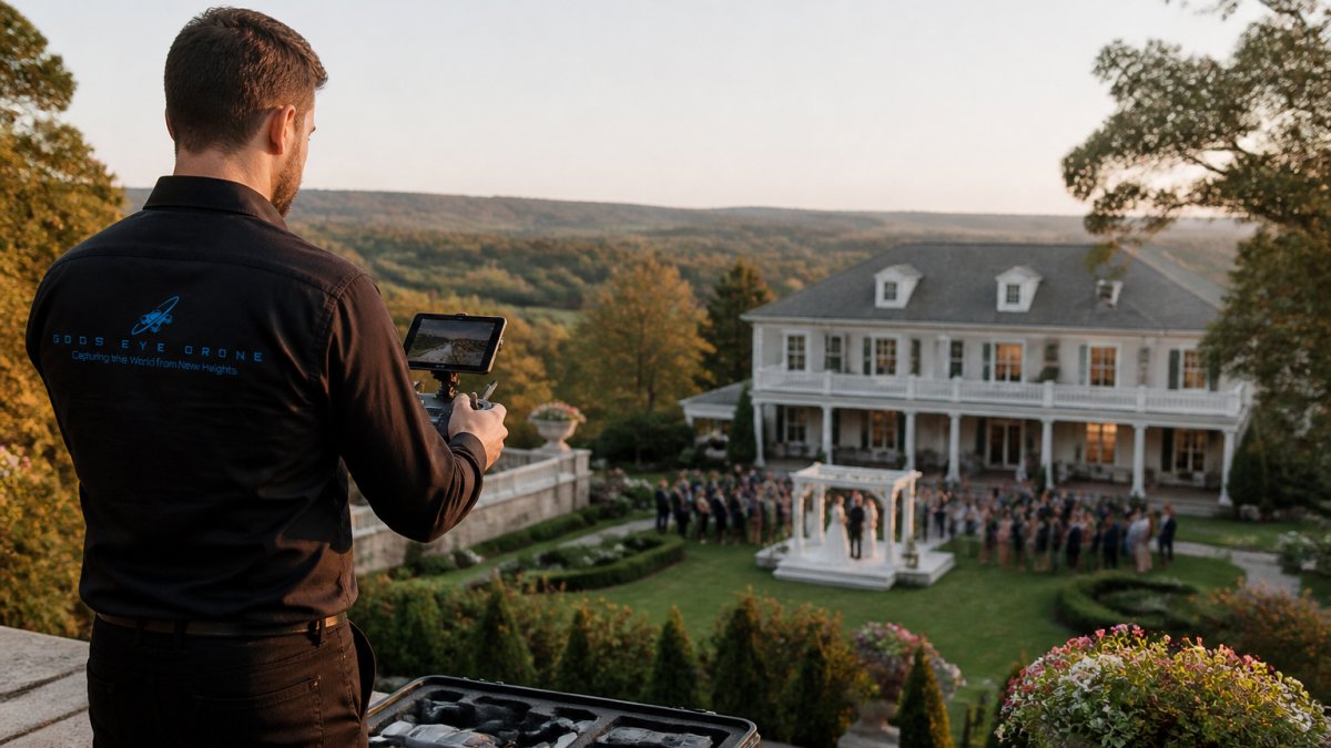
On-Site Execution:
- Establish a safe launch and landing zone away from obstacles
- Confirm airspace is clear and no manned aircraft are nearby
- Document property address, date, and time for records
- Capture multiple angles: establishing shots, detail shots, video clips
- Shoot in various lighting conditions if time permits
- Verify focus and exposure on each shot before moving to the next angle
Post-Production and Delivery:
- Download and back up all raw files immediately
- Review footage for technical quality and composition
- Color-correct images for consistency and professional appearance
- Edit video clips to remove jitter and stabilize footage
- Create final deliverables in requested formats
- Deliver files within promised timeline with organized folder structure
This checklist becomes routine for experienced operators. It ensures consistency, prevents mistakes, and guarantees clients receive professional results every time.
Post-Production and Editing Standards for Professional Results
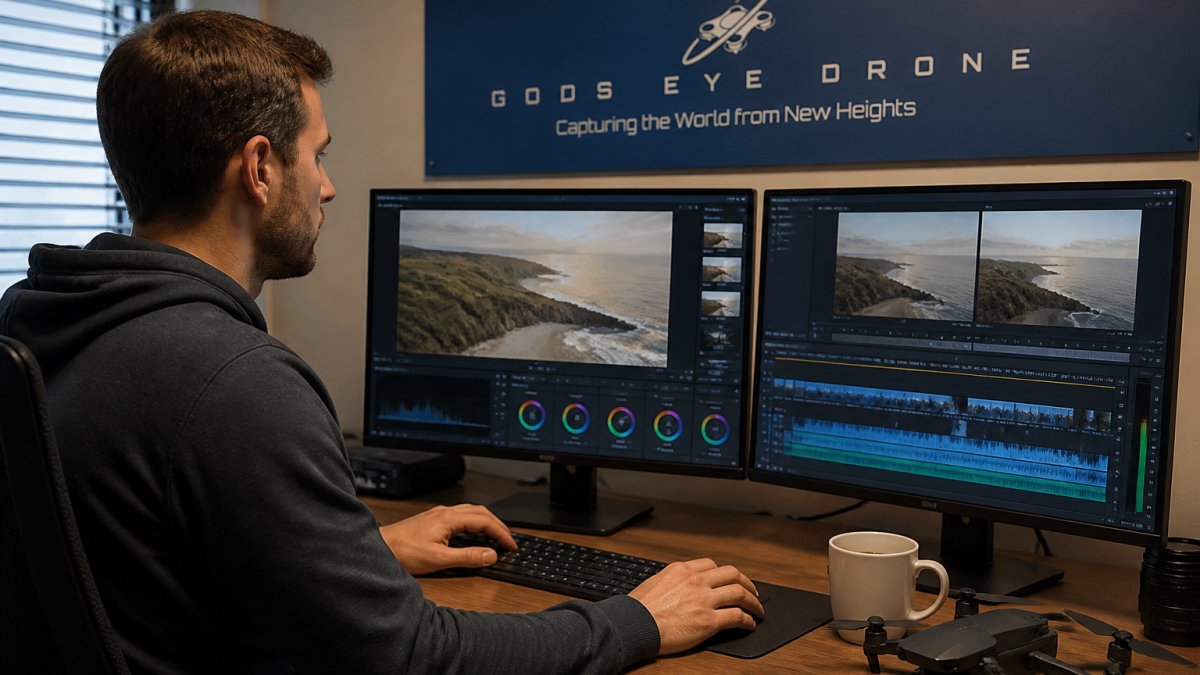
Raw drone footage rarely looks polished enough for marketing. The editing process transforms adequate footage into compelling visual assets that sell properties. Professional standards for aerial photography for real estate include color correction, stabilization, and composition refinement.
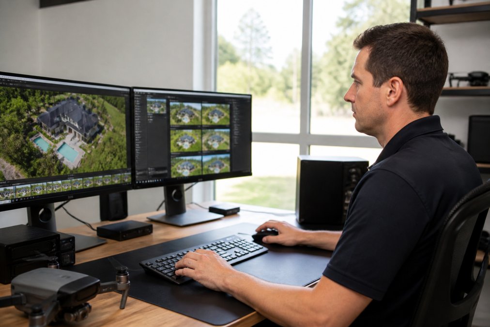
Color correction is non-negotiable. Different times of day, weather conditions, and drone cameras produce varying color temperatures and exposures. Professional editing normalizes these variations so all images look cohesive. The grass should look vibrant but natural. The sky should be blue without blown-out highlights. Shadows should show detail without crushing blacks. This requires skill and experience, not just running a filter.
Video stabilization removes the jitter and micro-movements inherent in drone flight. Even slight wind creates visible motion that distracts from the property. Stabilization software smooths these movements, creating the cinematic quality buyers expect. Advanced operators use gimbal stabilization during capture and digital stabilization during editing for maximum smoothness.
Cropping and composition refinement improve the final images. Raw drone photos often need adjustment to create balanced, visually interesting compositions. Removing distracting elements from frame edges, adjusting horizon lines, and framing the property optimally are all part of professional post-production. Some operators create panoramic images by stitching multiple photos together, a technique that requires technical skill to execute seamlessly.
Editing also includes organizing deliverables. Final files should be clearly labeled, organized by property, and delivered in formats clients can use immediately. Professional operators provide high-resolution images for print marketing, optimized versions for web and social media, and video clips in multiple formats for different platforms.
Legal and Liability Considerations for Real Estate Agents
Real estate agents who hire drone operators need to understand the legal landscape. While the drone operator bears primary responsibility for safe, compliant operations, agents should know what protections are in place and what risks remain.
Insurance and liability coverage are critical. Professional drone operators carry commercial general liability insurance and, often, specialized drone insurance. This coverage protects against damage to property, injury to people, or equipment loss. Before hiring a drone service, ask to see proof of insurance. Verify that coverage limits are adequate for your market and property values. This protects both the operator and the agent if something goes wrong.
Operator certification matters legally. An FAA Part 107 certificate demonstrates that the operator has passed the required exam and maintains compliance with regulations. If an incident occurs and the operator lacks proper certification, liability exposure increases significantly. Always request and verify current Part 107 credentials.
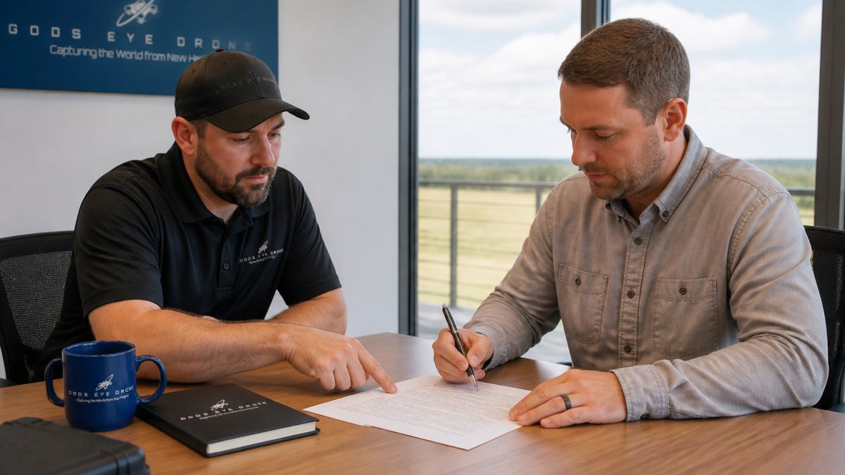
Property rights and permissions create another layer of complexity. Aerial photography captures not just the subject property but surrounding properties and neighborhoods. Ensure the property owner or listing agent has authorized the drone shoot. Some jurisdictions have privacy regulations governing aerial photography. A professional operator understands these nuances and obtains proper permissions before flying.
Consider also what happens if weather prevents the scheduled shoot or if the operator cannot capture usable footage. A professional service agreement should clarify refund or rescheduling policies. If the operator fails to deliver promised results, what recourse does the agent have? Clear contracts prevent disputes and protect both parties.
Conclusion
Aerial photography for real estate listings has moved from a luxury add-on to a competitive necessity. The investment in quality aerial photography for real estate pays dividends in faster sales and better offers.
Gods Eye Drone brings veteran expertise and state-of-the-art equipment to every project. Our certified pilots understand FAA Part 107 requirements, deliver professional post-production results, and handle the legal and liability considerations that protect agents. Whether you're marketing a residential property, an estate, or commercial land, our team provides the aerial intelligence and high-quality imagery your listings need to stand out. Book a consultation with Gods Eye Drone today and discover how professional aerial photography transforms your real estate marketing.
Frequently Asked Questions
Do I need a Part 107 license to use aerial photography for my real estate listings?
Yes. Anyone operating a drone commercially, including for real estate photography, must hold an FAA Part 107 certificate. This requires passing a written exam and demonstrates knowledge of airspace rules, safety, and regulations. When you hire a professional drone operator, verify they hold this certification. It protects you legally and ensures the footage was captured in compliance with federal requirements.
How much does aerial photography cost for a typical residential property?
Pricing depends on property size, complexity, location, turnaround time, and the scope of editing required. Factors like multi-angle shots, video clips, edited stills, and same-day delivery all affect the final cost. Contact a certified operator for a custom quote based on your specific listing needs. Many professionals offer tiered packages to fit different budgets and property types.
What should I include in a real estate drone photography checklist before booking?
Start by confirming the operator is FAA Part 107 certified and carries liability insurance. Provide property address, lot size, key features to highlight, and your deadline. Check weather forecasts and schedule accordingly. Discuss deliverables: how many edited photos, video clips, file formats, and when you'll receive them. Clarify what happens if weather cancels the shoot. Walk the property beforehand to identify angles, obstacles, and no-fly zones. Confirm access to the property on shoot day.
How does aerial photography impact buyer interest and how quickly properties sell?
Aerial imagery gives buyers an immediate sense of property scale, lot boundaries, neighborhood context, and curb appeal, details ground-level photos cannot convey. Listings with drone photography typically receive more clicks, longer viewing times, and faster showings. Properties in competitive markets benefit most because aerial shots differentiate listings and help buyers visualize the full scope before scheduling a tour, reducing wasted appointments and accelerating the sales cycle.
This article was written using GrandRanker